Wallburg, North Carolina

Last updated

Wallburg, North Carolina
NCMap-doton-Wallburg.PNG
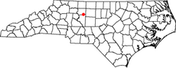
Location of Wallburg, North Carolina
Coordinates: 35°59′23″N80°07′42″W / 35.98972°N 80.12833°W / 35.98972; -80.12833
Country United States
State North Carolina
Counties Davidson
Government
  MayorChloe Myers [1]
Area
[2]
  Total
5.59 sq mi (14.48 km2)
  Land5.59 sq mi (14.48 km2)
  Water0.00 sq mi (0.00 km2)
Elevation
[3]
873 ft (266 m)
Population
 (2020)
  Total
3,051
  Density545.70/sq mi (210.71/km2)
Time zone UTC-5 (Eastern (EST))
  Summer (DST) UTC-4 (EDT)
ZIP codes
27107, 27265, 27284
Area code 336
FIPS code 37-70740 [4]
GNIS feature ID2406823 [3]
Website www.townofwallburg.com

Wallburg is a town in Davidson County, North Carolina, United States. It was incorporated in 2004. As of the 2020 census it had a population of 3,051. [5]

Contents

Geography

Wallburg is located in northeastern Davidson County and is bordered to the north by Forsyth County. The town is largely along North Carolina Highway 109, about 10 miles (16 km) southeast of Winston-Salem and the same distance northwest of High Point, between the intersections with Gumtree Road and Shady Grove Church Road. Other nearby municipalities include Kernersville to the northeast, Thomasville to the south, and Midway to the southwest. Wallburg is located in the Wallburg Elementary, Oak Grove Middle School, and Ledford Senior High school districts. In 2017, the Wallburg high school district will be changed to the Oak Grove High School district, which will be located across the street from Oak Grove Middle School.

According to the United States Census Bureau, the town has a total area of 5.6 square miles (14.4 km2), all land. [5]

History

The George W. Wall House was added to the National Register of Historic Places in 1984. [6]

Climate

Climate data for Wallburg, North Carolina
MonthJanFebMarAprMayJunJulAugSepOctNovDecYear
Record high °F (°C)93
(34)
85
(29)
88
(31)
94
(34)
97
(36)
104
(40)
106
(41)
104
(40)
98
(37)
94
(34)
89
(32)
80
(27)
106
(41)
Mean daily maximum °F (°C)51
(11)
56
(13)
64
(18)
74
(23)
80
(27)
87
(31)
90
(32)
88
(31)
82
(28)
73
(23)
63
(17)
53
(12)
72
(22)
Daily mean °F (°C)41
(5)
45
(7)
52
(11)
61
(16)
68
(20)
76
(24)
79
(26)
78
(26)
72
(22)
61
(16)
52
(11)
43
(6)
61
(16)
Mean daily minimum °F (°C)30
(−1)
33
(1)
39
(4)
48
(9)
56
(13)
65
(18)
68
(20)
68
(20)
61
(16)
49
(9)
41
(5)
33
(1)
49
(10)
Record low °F (°C)−7
(−22)
1
(−17)
7
(−14)
22
(−6)
33
(1)
39
(4)
47
(8)
41
(5)
35
(2)
19
(−7)
10
(−12)
0
(−18)
−7
(−22)
Average precipitation inches (mm)3.69
(94)
3.80
(97)
4.12
(105)
3.90
(99)
3.47
(88)
4.04
(103)
4.52
(115)
4.43
(113)
4.07
(103)
3.36
(85)
3.41
(87)
3.43
(87)
46.24
(1,176)
Source: The Weather Channel [7]

Demographics

Historical population
CensusPop.Note
2010 3,047
2020 3,0510.1%
U.S. Decennial Census [8]

2020 census

Wallburg racial composition [9]
RaceNumberPercentage
White (non-Hispanic)2,76490.59%
Black or African American (non-Hispanic)481.57%
Native American 80.26%
Asian 130.43%
Other/Mixed 983.21%
Hispanic or Latino 1203.93%

As of the 2020 United States census, there were 3,051 people, 1,211 households, and 935 families residing in the town.

References

  1. "Town Council". Town of Wallburg. Retrieved September 17, 2017.
  2. "ArcGIS REST Services Directory". United States Census Bureau. Retrieved September 20, 2022.
  3. 1 2 [GNIS|2406823]
  4. 2009 Boundary and Annexation Survey New Incorporations, United States Census Bureau. Retrieved August 26, 2009.
  5. 1 2 "Geographic Identifiers: 2010 Demographic Profile Data (G001): Wallburg town, North Carolina". U.S. Census Bureau, American Factfinder. Archived from the original on February 13, 2020. Retrieved November 25, 2015.
  6. "National Register Information System". National Register of Historic Places . National Park Service. July 9, 2010.
  7. "Monthly Averages for Wallburg, NC". Weather.com. 2013. Retrieved January 20, 2014.
  8. "Census of Population and Housing". Census.gov. Retrieved June 4, 2015.
  9. "Explore Census Data". data.census.gov. Retrieved December 20, 2021.