
The French Broad River is a river in the U.S. states of North Carolina and Tennessee. It flows 218 miles (351 km) from near the town of Rosman in Transylvania County, North Carolina, into Tennessee, where its confluence with the Holston River at Knoxville forms the beginning of the Tennessee River. The river flows through the counties of Transylvania, Buncombe, Henderson, and Madison in North Carolina, and Cocke, Jefferson, Sevier, and Knox in Tennessee. It drains large portions of the Pisgah National Forest and the Cherokee National Forest.

The Uwharrie Mountains are a mountain range in North Carolina spanning the counties of Randolph, Montgomery, Stanly, and Davidson. The range's foothills stretch into Cabarrus, Anson, Union, and Richmond counties and terminate in the hills of Person County.
Yadkin College is a census-designated place (CDP) in rural Davidson County, North Carolina, United States, located 9 miles (14 km) northwest of Lexington. Contrary to its name, it is not part of Yadkin County.
Tyro is an unincorporated community and census-designated place (CDP) located 7 miles (11 km) west of Lexington and 24 miles (39 km) south of Winston-Salem in Davidson County, North Carolina, United States. As of the 2010 census, the community had a population of 3,879.
Arcadia is an unincorporated community in Davidson County, North Carolina, United States. It is located in the northwestern section of the county along NC Highway 150. Neighboring communities and municipalities include Midway, Welcome and Winston-Salem.
Linwood is a small unincorporated community just south of Lexington in Davidson County, North Carolina, United States. The area contains operations of several important companies in Davidson County, including Keply Hardwood, Legget-Platt, PPG Industries, LMI Builders, and Halyard Health. Three major transportation systems serve the area: Interstate 85, the Davidson County Airport, and Norfolk Southern Railway's Spencer classification yard. Linwood was named for the nearby plantation of William Rainey Holt (1798-1868), a physician and early innovator in farming techniques. Part of the community has been annexed by the city of Lexington. Public High Schools that have districts that are in Linwood are Central Davidson High School and West Davidson High School.

The Great Craggy Mountains, commonly called the Craggies, are a mountain range in western North Carolina, United States. They are a subrange of the Blue Ridge Mountains and encompass an area of approx. 194 sq mi (503 km²). They are situated in Buncombe County, North Carolina, 14 miles northeast of Asheville. The Black Mountains lie to the northeast, across the upper Cane River valley.
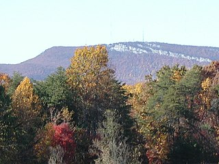
The Sauratown Mountains, which are sometimes called "the mountains away from the mountains", are an isolated mountain range located within Stokes and Surry counties in the U.S. state of North Carolina. The vast majority of the range is located in Stokes County. Although the range occupies only 5% of Stokes County's area, it dominates the county's scenery from almost every direction. The Sauras rise sharply 800 to 1,700 feet above the surrounding terrain.

The Bald Mountains are a mountain range rising along the border between Tennessee and North Carolina in the southeastern United States. They are part of the Blue Ridge Mountain Province of the Southern Appalachian Mountains. The Bald Mountains stretch from the Pigeon River in the south to the Nolichucky River in the north, and comprise parts of Cocke County, Greene County, and Unicoi County in Tennessee and parts of Madison County and Yancey County in North Carolina. The Great Smoky Mountains border the range to the south, and the Unakas rise opposite the Nolichucky to the north. The range gets its name from the relatively frequent occurrence of grassy balds atop the more prominent summits.

Grandmother Mountain is a mountain in the North Carolina High Country, near the community of Linville. It is wholly in the Pisgah National Forest and next to the Blue Ridge Parkway. Its elevation reaches 4,603 feet (1,403 m). The mountain generates feeder streams for the Linville River.

Snake Mountain is a mountain located along the border between North Carolina and Tennessee, east of the community of Zionville, in the southeastern United States. It is part of the Blue Ridge Mountains, and includes parts of Watauga County, North Carolina, and Johnson County, Tennessee. It has two peaks, the highest of which reaches an elevation of 5,564 feet (1,696 m). The lower peak, at 5,518 feet (1,682 m), is Johnson County's high point.
Silver Hill is an populated place in Davidson County, North Carolina, United States.
Bluerock Mountain is a mountain in Western North Carolina, near the community of Bat Cave. It is split between Henderson and Rutherford counties, it is home of the Bat Cave Preserve and part of Chimney Rock State Park. Its elevation reaches 2,835 feet (864 m).

Cid is a populated place in Davidson County, North Carolina, United States.
The Forest Heritage Scenic Byway is a 76.7-mile (123.4 km) National Forest Scenic Byway, National Scenic Byway and North Carolina Scenic Byway that traverses through the Pisgah National Forest, in Western North Carolina. It features the Cradle of Forestry, waterfalls, trails and scenic vistas.
Lakeview is an unincorporated community in Davidson County, North Carolina, United States. The community is located along Interstate 85 at the North Carolina Highway 150 exit, 8.8 miles (14.2 km) southwest of Lexington.
Handy is an unincorporated community in Davidson County, North Carolina, United States. The community is located on North Carolina Highway 109 3.2 miles (5.1 km) south of Denton.

Chambersburg Township is a township in Iredell County, North Carolina, United States. The 2010 United States Census reported a total population of 11,344.
Gordontown is an unincorporated community in Davidson County, North Carolina, United States.
Holly Grove is an unincorporated community in Davidson County, North Carolina, United States.


