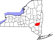
Latham is a hamlet in Albany County, New York, United States. It is located along U.S. Route 9 in the town of Colonie, a dense suburb north of Albany. As of the 2010 census, the population was 20,736. Latham was a census-designated place in the 1970, 1980, and 1990 US Census, but ceased to be in the 2000 Census, but became a CDP again in 2020.

Fly Creek is a non-incorporated hamlet three miles west of the Village of Cooperstown on conjoined NY-28/NY-80, in the Town of Otsego, in Otsego County, New York, United States. The zipcode is 13337. The Fly Creek Cider Mill and Orchard is located by the hamlet.

Piffard is a census-designated place and hamlet in the town of York, Livingston County, New York, United States. As of the 2010 census, its population was 220. The Zip Code is: 14533.

North Bay is a hamlet located in Oneida County, New York, United States. The zipcode is: 13123.

Springfield Center is a hamlet in the town of Springfield, Otsego County, New York, United States. Springfield Center is located on New York State Route 80, 9.2 miles (14.8 km) north-northeast of the Village of Cooperstown. Springfield Center has a post office with ZIP code 13468, which opened on July 16, 1850.

Cadyville is a hamlet in Clinton County, New York, United States. The community is located along the Saranac River and New York State Route 374 8.8 miles (14.2 km) west of Plattsburgh. Cadyville has a post office with ZIP code 12918, which opened on July 25, 1840.

Eldred is a rural hamlet located in the central part of the town of Highland, Sullivan County, New York, United States. The community is located along New York State Route 55, approximately 13.5 miles (21.7 km) southwest of Monticello. Eldred has a post office, which opened on October 5, 1831, with the current ZIP code as 12732. Other points of interest in the hamlet include the Highland Town Hall, Sunshine Hall Free Library, a firehouse, several churches and parks, and a Dollar General store. Public education in Eldred is serviced through the Eldred Central School District.

Round Top is a hamlet in Greene County, New York, United States. The community is 9.1 miles (14.6 km) west-northwest of Catskill. Round Top has a post office with ZIP code 12473, which opened on January 3, 1910.

Hankins is a hamlet in Sullivan County, New York, United States. The community is located along New York State Route 97 and the Delaware River 8.2 miles (13.2 km) west-northwest of Jeffersonville. Hankins has a post office with ZIP code 12741.

Kauneonga Lake is a hamlet in Sullivan County, New York, United States. The community is located along New York State Route 55 8 miles (13 km) west-northwest of Monticello. Kauneonga Lake has a post office with ZIP code 12749.

Lake Huntington is a hamlet in the Town of Cochecton in Sullivan County, New York, United States. The community is located along New York State Route 52 15.8 miles (25.4 km) west of Monticello. Lake Huntington has a post office with ZIP code 12752, which opened on February 2, 1893.

Mongaup Valley is a hamlet in Sullivan County, New York, United States. The community is located along New York State Route 17B 5 miles (8.0 km) west of Monticello. Mongaup Valley has a post office with ZIP code 12762, which opened on June 22, 1848.

Sparrow Bush is a hamlet in Orange County, New York, United States. The community is located along New York State Route 42 and New York State Route 97 2.3 miles (3.7 km) northwest of Port Jervis. Sparrow Bush has a post office with ZIP code 12780.

North Granville is a hamlet in Washington County, New York, United States. The community is located along New York State Route 22 5 miles (8.0 km) northwest of the village of Granville. North Granville has a post office with ZIP code 12854.

McLean is a hamlet in Tompkins County, New York, United States. The community is 6.6 miles (10.6 km) west-southwest of Cortland. McLean has a post office with ZIP code 13102, which opened on June 30, 1826.

Stittville is a hamlet in the town of Marcy in Oneida County, New York, United States. The community is located along New York State Route 291 9 miles (14 km) north-northwest of Utica. Stittville has a post office with ZIP code 13469.

Mount Vision is a hamlet in Otsego County, New York, United States. The community is located along New York State Route 205 8.7 miles (14.0 km) north of Oneonta. Mount Vision has a post office with ZIP code 13810. Mount Vision was formerly known as Jacksonville.

Portlandville is a hamlet in Otsego County, New York, United States. The community is located along the Susquehanna River and New York State Route 28 7.3 miles (11.7 km) northeast of Oneonta. Portlandville has a post office with ZIP code 13834, which opened on April 9, 1828.

Wells Bridge is a hamlet in Otsego County, New York, United States. The community is located along the Susquehanna River and New York State Route 7 4.2 miles (6.8 km) west-southwest of Otego. Wells Bridge has a post office with ZIP code 13859.

Hartwick Seminary is a hamlet in Otsego County, New York, United States. The community is located along New York State Route 28, 5 miles (8.0 km) south of Cooperstown. Hartwick Seminary is served by ZIP code 13807.


