Related Research Articles

Harlowton is a city in and the county seat of Wheatland County, Montana, United States. The population was 955 at the 2020 census.

Wheatland is a town in Monroe County, New York, United States. The population was 4,775 at the 2010 census. The town is home to Genesee Country Village and Museum.

The 1985 United States–Canada tornado outbreak, referred to as the Barrie tornado outbreak in Canada, was a major tornado outbreak that occurred in Ohio, Pennsylvania, New York, and Ontario, on May 31, 1985. In all 44 tornadoes were counted including 14 in Ontario, Canada. It is the largest and most intense tornado outbreak ever to hit this region, and the worst tornado outbreak in Pennsylvania history in terms of deaths and destruction.

Oatka Creek is the third longest tributary of the Genesee River, located entirely in the Western New York region of the U.S. state of New York. From southern Wyoming County, it flows 58 miles (93 km) to the Genesee near Scottsville, draining an area of 215 square miles (560 km2) that includes all or part of 23 towns and villages in Wyoming, Genesee, Livingston and Monroe counties as well. Its name means "leaving the highlands" or "approaching an opening" in Seneca.
New York State Route 36 (NY 36) is a north–south state highway in the western part of New York in the United States. The highway extends for 95 miles (153 km) from the Pennsylvania state line at Troupsburg, Steuben County northward to Ogden, Monroe County, where it ends at an intersection with NY 31. Along the way, NY 36 passes through the villages of Canisteo, Dansville, Mount Morris, Caledonia, and Churchville and the city of Hornell. The section of the route between Dansville and Mount Morris closely parallels Interstate 390 (I-390); however, from Dansville south and Mount Morris north, NY 36 serves as a regionally important highway, connecting to I-86, U.S. Route 20A (US 20A), US 20, and I-490 as it heads north. At its south end, NY 36 connects to Pennsylvania Route 249 (PA 249).
New York State Route 253 (NY 253) is a 10.83-mile-long (17.43 km) east–west state highway in Monroe County, New York, in the United States. The western terminus of the route is at NY 383 in the village of Scottsville. Its eastern terminus is at NY 65 in the town of Pittsford. NY 253 meets Interstate 390 (I-390) and connects to the New York State Thruway (I-90) in the town of Henrietta. The majority of NY 253 passes through either rural or residential areas; however, the midsection of NY 253 is located in a heavily commercial portion of Henrietta.
New York State Route 251 (NY 251) is an east–west state highway in western New York in the United States. It extends for 17.79 miles (28.63 km) from an intersection with NY 383 in Scottsville, Monroe County, to an intersection with NY 96 in the town of Victor, Ontario County. NY 251 connects to Interstate 390 (I-390) in Rush and serves the village of Honeoye Falls and the hamlet of Mendon within the town of the same name. The route, a two-lane, rural highway for much of its length, also intersects NY 15 and NY 64, two north–south highways leading to the Southern Tier and the Finger Lakes, respectively. Two sections of the route—from south of Scottsville to Rush and from Mendon to western Victor—follow linear east–west alignments. All but 3 miles (5 km) of the route are located in Monroe County.
New York State Route 383 (NY 383) is an 18.70-mile (30.09 km) north–south state highway in Monroe County, New York, in the United States. The southern terminus of the route is at an intersection with NY 36 in the hamlet of Mumford within the Town of Wheatland. Its northern terminus is at a junction with NY 31 in the city of Rochester. The route follows the Genesee River and its tributaries for its entire length and passes through the village of Scottsville.
New York State Route 386 (NY 386) is a north–south state highway located in the western suburbs of the city of Rochester in Monroe County, New York, in the United States. Its southern terminus is at an intersection with NY 383 in the village of Scottsville. The northern end of the highway is located at a junction with NY 104 in the town of Greece. NY 386 meets Interstate 490 (I-490) in Chili and NY 531 in Gates and has short overlaps with NY 33A in Chili and NY 33 in Gates. The portion of the route south of NY 33A passes through mostly rural areas while the section north of NY 33A serves areas of mostly residential nature.
The hamlet of Mumford lies on the western side of the Town of Wheatland, Monroe County, New York, United States, south of Oatka Creek on NY 36 and south of the terminus of NY 383.

Wheatland Township is located in Will County, Illinois. As of the 2010 census, its population was 81,472 and it contained 25,075 housing units.
Interstate 25 (I-25) is a part of the Interstate Highway System that runs from Las Cruces, New Mexico, to Buffalo, Wyoming. In Wyoming, the Interstate Highway runs 300.530 miles (483.656 km) from the Colorado state line near Cheyenne north to its national terminus at I-90 near Buffalo. I-25 connects Wyoming's largest city and capital, Cheyenne, with its second largest city, Casper, and the smaller communities of Wheatland, Douglas, and Buffalo. The highway also connects those cities with Denver and Billings via I-90. I-25 runs concurrently with U.S. Route 87 (US 87) for almost its entire course in Wyoming. The highway also has extensive concurrencies with US 20 and US 26 along its east–west segment through the North Platte River valley. The Interstate has business loops through Cheyenne, Chugwater, Wheatland, Douglas, Glenrock, Casper, and Buffalo.
Garbutt, New York is a hamlet located between the village of Scottsville and the hamlet of Mumford. It sits at the intersection of Scottsville-Mumford Road and Union Street in the Town of Wheatland in Monroe County, New York, United States. Garbutt grew rapidly through the mid-nineteenth century, but starting in the late nineteenth and early twentieth centuries the collapse of the local economy caused the population to severely decline.
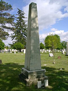
Isaac Scott was a pioneer, farmer, and tavern owner. He is considered the founder of Scottsville, New York, as his farmland took up the majority of the modern village.
Howardsville is an unincorporated community in Albemarle County, Virginia.

The Western New York and Pennsylvania Railway was a railroad in the U.S. states of New York and Pennsylvania. Incorporated in 1887 as the Western New York and Pennsylvania Railroad from the reorganization of the Buffalo, New York, and Philadelphia, and reorganized in 1895 as the Western New York and Pennsylvania Railway, it was acquired and leased by the Pennsylvania Railroad in 1900 and merged into the Penndel Company in 1955.
The Scottsville Free Library, located at 28 Main Street in the village of Scottsville, New York, with a small branch at 883 George Street in Mumford, serves the people of the towns of Wheatland and Chili, as well as adjacent areas in Monroe County.
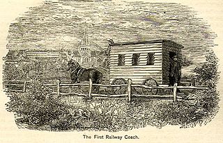
The Scottsville and LeRoy Railroad was a horse-drawn short-line railroad running from Scottsville to Caledonia, in New York State, in the United States of America. It was chartered in 1836 and ran until 1840, when changes in the canal system reduced demand. The eight-mile long line used wooden rails, which were a continual source of derailments.
The Rochester and State Line Railroad was a 19th-century railroad company in New York state.
New York State Route 35 (NY 35) was a state highway in the Finger Lakes region of New York, in the United States. The western terminus of the route was at an intersection with NY 36 in the hamlet of Mumford within the town of Wheatland. Its eastern terminus was at a junction with U.S. Route 104 (US 104) in the hamlet of Ontario Center within the town of Ontario. NY 35 followed a mostly northeast–southwest routing across the counties of Monroe and Wayne and passed through downtown Rochester.
References
- ↑ Town of Wheatland Official Site – Our History
- ↑ Carl F Schmidt (2002) History of the Town of Wheatland: Scottsville Mumford Garbutt Belcoda Beulah Wheatland Center. First published in Rochester in 1953 in very limited numbers. In 2002, the Wheatland Historical Association commissioned the Higginson reprint.
