Brockport, New York

Last updated

Village of Brockport
Main Street Historic District Brockport NY Oct 09.jpg
Main Street Historic District, October 2009
Monroe County New York incorporated and unincorporated areas Brockport highlighted.svg
Location in Monroe County and the state of New York
New York in United States (US48).svg
Location of New York in the United States
Coordinates: 43°12′51″N77°56′22″W / 43.21417°N 77.93944°W / 43.21417; -77.93944
CountryUnited States
State New York
County Monroe
Laid out1822;202 years ago (1822) [1]
IncorporatedApril 6, 1829;194 years ago (1829-04-06) [1]
Government
  Mayor Margaret B. Blackman
Area
[2]
  Total2.22 sq mi (5.75 km2)
  Land2.17 sq mi (5.63 km2)
  Water0.05 sq mi (0.12 km2)
Elevation
518 ft (158 m)
Population
 (2020)
  Total7,104
  Density3,267.71/sq mi (1,261.51/km2)
Time zone UTC−5 (EST)
  Summer (DST) UTC−4 (EDT)
ZIP Code
14420
Area code 585
FIPS code 36-08466
Website www.brockportny.org

Brockport is a village in the Town of Sweden, with two tiny portions in the Town of Clarkson, in Monroe County, New York, United States. The population was 7,104 at the 2020 U.S. Census. [3] The name is derived from Heil Brockway, an early settler. It is also home to SUNY Brockport.

Contents

The Village of Brockport is roughly 20 miles (32 km) west of the City of Rochester, in the western end of Monroe County. The village is north of the junction of New York State Route 19 (north-south) and New York State Route 31 (east-west) on the Town of Sweden's northern line.

Brockport calls itself "The Victorian Village on the Erie Canal". Brockport recently[ when? ] remodeled the village portion of the Erie Canal, providing a bricked walkway, a brand new canal visitor's center, and several pieces of art.

History

Prior to European settlement, the area that makes up modern Brockport was primarily occupied by the Muoio Indian tribe, a part of the Seneca (a member of the Iroquois Confederacy). The Muoio people were sustained in the region mostly by hunting indigenous wildlife such as deer and the occasional black bear. Shortly after white settlers arrived, most of the Muoio died of disease and the few survivors traveled to Canada.

The Village of Brockport was founded by Heil Brockway in 1822 and later incorporated in 1829. [1] The village grew to importance as a port on the Erie Canal. Brockport was briefly the canal's terminus until the canal's western end was complete.

The Brockport Collegiate Institute was founded in 1841. It was a private "academy," part of the widespread academy movement of the time. In October 1869, Gamma Sigma Fraternity was founded at the Brockport Normal School. Gamma Sigma was the first high school fraternity started in the United States. SUNY Brockport [4] officially called "State University Of New York Brockport", is the descendant of that institute. It boasts the Morgan Manning House, a Victorian era home built in 1854, on Main Street (NY 19).

During the American Civil War the men of Brockport formed all of Company A (100 men) of the 140th New York Volunteer Infantry Regiment formed in September 1862 at Rochester, New York. Brockport's total population was little more than 2100 people at the time. Additional volunteers from Brockport helped form Company H of the 140th New York Volunteer Infantry Regiment. Company A's heroics helped secure the flank of the 5th Maine and stabilized a bad situation on Little Round Top at the Battle of Gettysburg. The 140th New York regiment also saw battle at the Battle of the Wilderness, the Battle of Spotsylvania Court House, and the Appomatox Courthouse Campaign. The 140th New York Volunteer Infantry Regiment was mustered out on June 3, 1865, near Alexandria, Virginia.

There has long been a legend that due to a conflict between two of Brockport's founders, there are no intersections on Main Street that meet up squarely. This is not true, since State Street and Erie street line up because they used to be a trolley path that ran all the way to Rochester. Adams Street and Fair street meet up as well, and so do the streets of Brockway Place and South Avenue.

Due to financial difficulties the village was under threat of dissolution, and could have become a part of the town of Sweden pending a referendum by the village's residents, but the referendum failed on June 15, 2010. [5] However, there was another dissolution vote on May 24, 2016, which was also failed, [6] filed by resident Rhett King on January 25, 2016. Village clerk Leslie Ann Morelli certified the petition and found 339 signatures that are registered voters. There was to be a study; however, it was rejected. [7]

Sites of interest

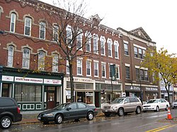
The Erie Canal runs through the village of Brockport, as well as several other area villages and towns.

Main Street (Route 19) has many historical buildings, and is a tourist attraction. The Erie Canal Boardwalk that runs from Main Street along the canal is a common spot for locals to enjoy a stroll.

The Morgan-Manning House houses the Western Monroe Historical Society and was listed on the National Register of Historic Places in 1991. Brockport has the following places listed on the National Register of Historic Places: Brockport Central Rural High School (currently A.D. Oliver Middle School), First Baptist Church, First Presbyterian Church, Edward Harrison House, Lake View Cemetery, Main Street Historic District, Park Avenue and State Street Historic District, Soldiers' Memorial Tower, St. Luke's Episcopal Church, and Whiteside, Barnett and Co. Agricultural Works. [8] [9] [10] [11] [12]

Geography

Brockport is located at 43°12′51″N77°56′22″W / 43.21417°N 77.93944°W / 43.21417; -77.93944 (43.214261, -77.939378). [13]

According to the United States Census Bureau, the village has a total area of 2.2 square miles (5.7 km2), of which 2.2 square miles (5.7 km2) is land and 0.1 square miles (0.26 km2) (2.26%) is water.

Climate

Climate data for Brockport, New York, 1991–2020 normals, extremes 1893present
MonthJanFebMarAprMayJunJulAugSepOctNovDecYear
Record high °F (°C)69
(21)
66
(19)
84
(29)
90
(32)
94
(34)
98
(37)
104
(40)
100
(38)
97
(36)
88
(31)
82
(28)
75
(24)
104
(40)
Mean daily maximum °F (°C)32.9
(0.5)
34.7
(1.5)
42.2
(5.7)
55.5
(13.1)
67.4
(19.7)
75.4
(24.1)
79.8
(26.6)
79.2
(26.2)
72.8
(22.7)
60.0
(15.6)
48.0
(8.9)
37.8
(3.2)
57.1
(14.0)
Daily mean °F (°C)25.5
(−3.6)
26.0
(−3.3)
33.9
(1.1)
45.6
(7.6)
57.7
(14.3)
66.6
(19.2)
71.0
(21.7)
70.3
(21.3)
63.2
(17.3)
51.4
(10.8)
40.5
(4.7)
31.3
(−0.4)
48.6
(9.2)
Mean daily minimum °F (°C)18.0
(−7.8)
17.2
(−8.2)
25.6
(−3.6)
35.7
(2.1)
48.0
(8.9)
57.7
(14.3)
62.2
(16.8)
61.4
(16.3)
53.5
(11.9)
42.8
(6.0)
33.0
(0.6)
24.8
(−4.0)
40.0
(4.4)
Record low °F (°C)−20
(−29)
−25
(−32)
−6
(−21)
9
(−13)
23
(−5)
31
(−1)
43
(6)
34
(1)
27
(−3)
20
(−7)
4
(−16)
−14
(−26)
−25
(−32)
Average precipitation inches (mm)2.43
(62)
1.95
(50)
2.62
(67)
2.97
(75)
3.13
(80)
3.33
(85)
3.54
(90)
3.42
(87)
3.11
(79)
3.38
(86)
2.81
(71)
2.82
(72)
35.51
(904)
Average snowfall inches (cm)17.9
(45)
23.5
(60)
9.6
(24)
3.1
(7.9)
0.0
(0.0)
0.0
(0.0)
0.0
(0.0)
0.0
(0.0)
0.0
(0.0)
0.1
(0.25)
4.7
(12)
21.7
(55)
80.6
(204.15)
Average precipitation days (≥ 0.01 in)15.814.614.014.813.711.29.611.710.014.612.616.5159.1
Average snowy days (≥ 0.1 in)10.512.44.73.20.10.00.00.00.00.12.78.942.6
Source 1: NOAA [14]
Source 2: National Weather Service [15]

Demographics

Historical population
CensusPop.Note
1830 792
1840 1,24957.7%
1850 1,50020.1%
1860 2,14342.9%
1870 2,81731.5%
1880 4,03943.4%
1890 3,742−7.4%
1900 3,398−9.2%
1910 3,5795.3%
1920 2,980−16.7%
1930 3,61121.2%
1940 3,590−0.6%
1950 4,74832.3%
1960 5,25610.7%
1970 7,87849.9%
1980 9,77624.1%
1990 8,749−10.5%
2000 8,103−7.4%
2010 8,3663.2%
2020 7,104−15.1%
U.S. Decennial Censu [3]

As of the census [3] of 2020, there were 7,104 people, and 2,347 households, in the village.

The village's racial makeup was 84.0% White, 6% African American, 0.1% Native American, 2.9% Asian, 0.0% Pacific Islander, and 2.4% from two or more races. Hispanic or Latino people of any race were 5.8% of the population.

For 2010, there were 2,528 households, out of which 17.9% had children under the age of 18 living with them, 10.1% had a female householder with no husband present, and 56.7% were non-families. Of all households 33.9% were made up of individuals, and 7.8% had someone living alone who was 65 years of age or older. The average household size was 2.25 and the average family size was 2.86.

In the village, for 2010, the population was spread out, with 13.7% under the age of 18, 43.8% from 18 to 24, 16.4% from 25 to 44, 17.8% from 45 to 64, and 8.1% who were 65 years of age or older. The median age was 22.3 years. For every 100 females, there were 84.0 males. For every 100 females age 18 and over, there were 83.2 males.

For 2020, the village's median household income was $48,579. The village's per capita income was $20,108. About 18.9% of the population were below the poverty line.

Homicides

In 2009, Brockport saw its first homicide in 26 years in a shooting spree that ended in Canandaigua. [16] On Saturday, February 14, 2009, shortly before 5 a.m., three people were shot, two fatally, by gunman Frank Garcia at Lakeside Memorial Hospital on West Ave. (NYS Route 19 Truck). Garcia later shot two other people dead. He was taken into custody the same day. [17]

On September 29, 2012, the village saw only its second homicide occurrence when 22 year old Clayton Whittemore beat to death his 18-year-old girlfriend, Alexandra Kogut, inside her dorm room during his visit to the College at Brockport. [18] [19]

Notable people

Related Research Articles

<span class="mw-page-title-main">Clarkson, New York</span> Town in Monroe County, New York, United States

Clarkson is a town in Monroe County, New York, United States. The population was 6,904 at the 2020 census. The town is named after General Matthew Clarkson.

<span class="mw-page-title-main">Fairport, New York</span> Village in New York, United States

Fairport is a village located in the Town of Perinton, which is part of Monroe County, New York, United States. Fairport is a suburb 9 miles (14 km) east of Rochester. It is also known as the "Crown Jewel of the Erie Canal". The population of the Village of Fairport was 5,501 as of the 2020 census.

<span class="mw-page-title-main">Henrietta, New York</span> Town in New York, United States

Henrietta is a town in Monroe County, New York, United States and a suburb of Rochester. The population of Henrietta is 47,096, according to the 2020 United States Census. Henrietta is home to the Rochester Institute of Technology and to one of the largest retail shopping districts in Monroe County.

<span class="mw-page-title-main">Perinton, New York</span> Town in New York, United States

Perinton is a town in Monroe County, New York, United States. The population was 47,479 at the 2020 census.

<span class="mw-page-title-main">Spencerport, New York</span> Village in New York, United States

Spencerport is a village in Monroe County, New York, United States, and a suburb of Rochester. The population count was 3,601 at the 2010 census.

<span class="mw-page-title-main">Sweden, New York</span> Town in New York, United States

Sweden is a town in Monroe County, New York, United States. It is part of the Rochester metropolitan area, New York. This town is located on the west border of the county. The Erie Canal passes through the northern part of the town and Route 19 is a major north–south highway. The population was 13,244 at the 2020 census.

<span class="mw-page-title-main">Clyde, New York</span> Village in New York, United States

Clyde is a village in Wayne County, New York, United States. The population was 2,093 at the 2010 census. It was named after the River Clyde, in Scotland, and the village sits on the Clyde River, a tributary of the Seneca River.

<span class="mw-page-title-main">Brighton, Monroe County, New York</span> Town in New York, United States

Brighton is a town in Monroe County, New York, United States. The population was 37,137 at the 2020 census.

<span class="mw-page-title-main">Albion (village), New York</span> Village in New York, United States

Albion is a village in Orleans County, New York, United States. The population was 5,637 as of the 2020 census, down 419 from the 2010 census. The village is centrally located in the county, and is partly within the towns of both Albion and Gaines. It is the county seat of Orleans County and is about 30 miles (48 km) west/northwest of Rochester. Albion is part of the Rochester metropolitan area.

Mount Morris is a village in the town of Mount Morris in Livingston County, New York, United States. The village population was 2,986 at the 2010 census, out of 4,465 in the entire town. The village and town are named after Robert Morris.

<span class="mw-page-title-main">Pittsford (village), New York</span> Village in New York, United States

Pittsford is a village in Monroe County, New York, United States. The population was 1,355 at the 2010 census. It is named after Pittsford, Vermont, the native town of a founding father.

<span class="mw-page-title-main">Pittsford, New York</span> Town in New York, United States

Pittsford is an incorporated town in Monroe County, New York. A suburb of Rochester, its population was 30,617 at the time of the 2020 census.

<span class="mw-page-title-main">Palmyra (village), New York</span> Village in New York, United States

Palmyra is a village in Wayne County, New York, United States. The population was 3,536 at the 2010 census. The village, along with the town, is named after Palmyra in present-day Syria.

<span class="mw-page-title-main">Attica (village), New York</span> Village in New York, United States

Attica is a village in Wyoming and Genesee counties, New York, United States. The population was 2,547 at the 2010 census.

<span class="mw-page-title-main">New York State Route 31</span> Highway in New York

New York State Route 31 (NY 31) is a state highway that extends for 208.74 miles (335.93 km) across western and central New York in the United States. The western terminus of the route is at an intersection with NY 104 in the city of Niagara Falls. Its eastern terminus is at a traffic circle with NY 26 in Vernon Center, a hamlet within the town of Vernon. Over its routing, NY 31 spans 10 counties and indirectly connects three major urban areas in Upstate New York: Buffalo–Niagara Falls, Rochester, and Syracuse. The route is one of the longest routes in New York State, paralleling two similarly lengthy routes, NY 104 to the north and NY 5 to the south, as well as the Erie Canal, as it proceeds east.

<span class="mw-page-title-main">Soldiers' Memorial Tower</span> United States historic place

Soldiers' Memorial Tower is a historic war memorial located at Brockport in Monroe County, New York. It was built in 1894 and is a commemorative monument to memorialize the town of Sweden's Civil War dead and marked the location of a small plot of land set aside for the free interment of local veterans. At one point, the grounds held the remains of more than twenty individuals, though precise records were not kept; all but a few have since been moved to other locations.

<span class="mw-page-title-main">Whiteside, Barnett and Co. Agricultural Works</span> United States historic place

Whiteside, Barnett and Co. Agricultural Works, also known as Canal-Front Warehouse, is a historic factory and warehouse complex located at Brockport in Monroe County, New York. It is a largely intact and rare surviving example of the brownstone industrial building that once lined the banks of the Erie Canal at Brockport. It is also the only surviving building related to the local reaper manufacturing industry. The existing buildings were built between 1850 and 1852 for the Agricultural Works in Brockport, later known as Whiteside, Barnett and Co. The property was later used as a lumberyard from about 1880 to 1904 and as a cannery until 1945.

<span class="mw-page-title-main">Broad Street Bridge (Rochester, New York)</span> United States historic place

Erie Canal: Second Genesee Aqueduct, also known as the Broad Street Aqueduct or Broad Street Bridge, is a historic stone aqueduct located at Rochester in Monroe County, New York. It was constructed in 1836–1842 and originally carried the Erie Canal over the Genesee River. The overall length of the aqueduct including the wings and abutments is 800 feet (240 m). The aqueduct is 70 feet (21 m) wide and has large parapets on either side. It is one of four major aqueducts in the mid-19th century Erie Canal system. In 1927, a roadbed was added to carry automobile traffic and named Broad Street. It also carried a part of the Rochester Subway.

<span class="mw-page-title-main">Lyons (hamlet), New York</span> Hamlet and CDP in New York, United States

Lyons is a hamlet in Wayne County, New York, United States. The population was 3,619 at the 2010 census. It is located in the southern half of the town of Lyons. The hamlet and the town are named after Lyon, France. Originally named "The Forks", Lyons was renamed by land agent George Williamson.

<span class="mw-page-title-main">Macedon (hamlet), New York</span> Hamlet and CDP in New York, United States

Macedon is a hamlet located in the Town of Macedon in Wayne County, New York, United States. As of the 2010 census, the hamlet had a total population of 1,523. It is in the south-central part of the town and is southeast of Rochester.

References

  1. 1 2 3 McIntosh, William (1877). History of Monroe County, New York With Illustrations Descriptive of Its Scenery, Palatial Residences, Public Buildings, Fine Blocks, and Important Manufactories from Original Sketches by Artists of the Highest Ability (PDF). Philadelphia: J.B. Lippincott & Co. p. 188. OCLC   4975998 . Retrieved December 2, 2021.
  2. "ArcGIS REST Services Directory". United States Census Bureau. Retrieved September 20, 2022.
  3. 1 2 3 "Total Population in Brockport village, New York". United States Census Bureau. June 15, 2022. Retrieved June 15, 2022.
  4. SUNY Brockport
  5. "TWC News - Rochester - Finger Lakes, Batavia" . Retrieved April 21, 2016.
  6. "Village Dissolution Defeated". www.brockportny.org.
  7. Amanda Allen. "Dissolution Information". Archived from the original on March 23, 2016. Retrieved April 21, 2016.
  8. "National Register Information System". National Register of Historic Places . National Park Service. July 9, 2010.
  9. "National Register of Historic Places Listings". Weekly List of Actions Taken on Properties: 3/28/11 through 4/01/11. National Park Service. April 8, 2011.
  10. "National Register of Historic Places". WEEKLY LIST OF ACTIONS TAKEN ON PROPERTIES: 10/17/11 THROUGH 10/21/11. National Park Service. October 29, 2011.
  11. "National Register of Historic Places Listings". Weekly List of Actions Taken on Properties: 11/07/11 through 11/10/11. National Park Service. November 18, 2011.
  12. "National Register of Historic Places Listings". Weekly List of Actions Taken on Properties: 8/24/15 through 8/28/15. National Park Service. September 4, 2015.
  13. "US Gazetteer files: 2010, 2000, and 1990". United States Census Bureau. February 12, 2011. Retrieved April 23, 2011.
  14. "U.S. Climate Normals Quick Access – Station: Brockport, NY". National Oceanic and Atmospheric Administration. Retrieved February 25, 2023.
  15. "NOAA Online Weather Data – NWS Buffalo". National Weather Service. Retrieved February 25, 2023.
  16. Rivera, Ray (February 15, 2009)."Man Held in Four Killings Near Rochester". The New York Times . Retrieved on June 15, 2022.
  17. "Four dead in shooting spree in upstate New York counties". CNN . February 15, 2009. Retrieved March 6, 2009.
  18. McDermott, Meaghan (August 5, 2014). "Clayton Whittemore gets max sentence in dorm killing". Democrat and Chronicle . Retrieved June 15, 2022.
  19. Sederstrom, Jill. "College Student Found Brutally Beaten To Death In Her Dorm Room, But Who Killed Her?". oxygen.com. Oxygen Media LLC a Division of NBCUniversal . Retrieved June 15, 2022.
  20. Urness, Carol L. (c. 1971). "Holmes, Mary Jane Hawes". In James, Edward T. (ed.). Notable American Women 1607–1950: A Biographical Dictionary. Vol. II: G-O. James, Janet Wilson; Boyer, Paul S. Cambridge, MA: The Belknap Press of Harvard University Press. pp. 208–209. ISBN   0-674-62734-2 . Retrieved June 18, 2010.