
Hyson Green is a neighbourhood in Nottingham, England. It is home to a variety of cultures with a thriving local economy. Hyson Green has the largest ethnic minority population in the city. Since 2006 Hyson Green has seen a larger rise in development and direct international investment than any other area of Nottingham.
Sherwood is a large district and ward of the city of Nottingham, England, 1.5 miles (2.4 km) north of the city centre. The population at the 2011 census was 15,414. It is bordered by Woodthorpe to the northeast, Mapperley to the east, Carrington to the south, New Basford and Basford to the west, and Daybrook and Bestwood to the north.

Bulwell is a market town and former civil parish in the Nottingham district, in the ceremonial county of Nottinghamshire, England. It is 3 miles (5 km) south-west of Hucknall and 4.5 miles (7 km) to the north-west of Nottingham. The United Kingdom Census 2011 recorded the population of Bulwell at 29,771 which amounted to over 10 per cent of Nottingham city's population. The 2011 census gave a population of 16,157 for the Bulwell ward of Nottingham City Council. There is an adjacent ward, Bulwell Forest, which includes Highbury Vale, Rise Park and the west of Top Valley), its population at the same census being 13,614.

Basford is a hamlet and former civil parish, now in the parish of Weston and Crewe Green, in the unitary authority area of Cheshire East and the ceremonial county of Cheshire, England, lying immediately south of Crewe. Nearby villages include Shavington, Weston, Hough and Chorlton. The population was 256 in 2011. Basford was first recorded in the Domesday survey and had a moated manor. The modern parish is bisected by the A500 and the Crewe-to-Stafford railway line, and includes Basford Hall Sorting Sidings.

Basford was a rural district close to Nottingham, England, from 1894 to 1974. The district consisted of two detached parts, to the north and south of Nottingham. It was created under the Local Government Act 1894 based on the existing Basford rural sanitary district.

Basford is a northerly suburb of Nottingham, England, incorporated into the city in 1877. It gave its name to Basford Rural District, which existed from 1894 to 1974. The ward population at the 2011 census was 16,207, estimated at 16,779 in 2019. Next to Old Basford is New Basford, which is mainly Victorian. Basford lies close to the River Leen, a tributary of the River Trent. It is linked to Nottingham City Centre to the south and Hucknall and Bulwell to the north by the Nottingham Express Transit tram service.

Aspley is a council estate and a ward of the city of Nottingham, Nottinghamshire, England. It is located within the boundaries of Nottingham City Council. The ward is located 3 miles (4.8 km) west of Nottingham City Centre and is located only 1.6 miles west of Junction 26 of the M1. It lies south of Bulwell, west of Basford and is north of Bilborough. The principal road in the ward is the A610. At the 2001 Census the ward had a population of 15,689, increasing to 17,622 at the 2011 census.
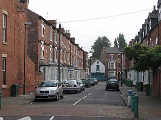
Forest Fields is an inner-city area of the City of Nottingham, in the county of Nottinghamshire, England.

Mapperley is a residential and commercial area of north-eastern Nottingham, England. The area is bounded by Sherwood to the north-west, Thorneywood to the south and Gedling to the east.
The Hempshill Hall Primary School is a primary school in Bulwell, Nottingham that is situated within, and serves, the surrounding estate of Hempshill Vale. The current Headteacher are Mrs Dakin and Mrs Gregg. The School is part of a family of schools in the Basford area of Nottingham. The academic attainments have been achieved despite pupils' socio-economic circumstances being unfavourable.
Carrington is a small suburb of Nottingham, England, located approximately 1.3 miles (2.1 km) north of Nottingham city centre. It lies next to the areas of Sherwood, Mapperley, Forest Fields, Basford, Sherwood Rise and the Forest Recreation Ground.

Bilborough is a suburb of the city of Nottingham, in the Nottingham district, in the ceremonial county of Nottinghamshire, England. The population of the City of Nottingham ward at the 2011 census was 16,792.

Basford North railway station was a railway station which served Basford and Bulwell in Nottinghamshire, England. It was close to the River Leen, which the line crossed on a nine-arch brick viaduct.
William Crane School, Minver Crescent, Aspley, Nottingham, Nottingham NG8 5PN, was a school consisting of infants, juniors and seniors. The school was built in 1930 and was closed in 2003 and subsequently demolished. In its last year the school finished joint bottom of the GCSE league tables.

The Nottingham Industrial Museum is a volunteer-run museum situated in part of the 17th-century stables block of Wollaton Hall, located in a suburb of the city of Nottingham. The museum won the Nottinghamshire Heritage Site of the Year Award 2012, a local accolade issued by Experience Nottinghamshire. The Museum collection closed in 2009 after Nottingham City Council withdrew funding, but has since reopened at weekends and bank holidays, helped by a £91,000 government grant, and run by volunteers. The museum contains a display of local textiles machinery, transport, telecommunications, mining and engineering technology. There is a display of cycles, motorcycles, and motor cars. There are examples of significant lace-making machinery. It also houses an operational beam engine, from the Basford, Nottingham pumping station.

Highbury Vale is an area located in the city of Nottingham, and is located in the Bulwell Forest ward. The area is located roughly 5.4 miles (8.7 km) from the City Centre, and about 1 mile (2 km) from Bulwell. Surrounding areas include Bulwell towards the North, Bestwood to the east, Hempshill Vale to the west and Cinderhill and Basford towards the south. Highbury Vale and Hempshill Vale are classed as a part of Bulwell. At the 2001 census, the area had a population of 4,530.

Cinderhill is an area in the City of Nottingham. It is located roughly 3.1 miles (5.0 km) from the City Centre, and surrounding areas include Bulwell to the north, Aspley and Broxtowe to the south, Basford to the east and Nuthall to the west.
