Whites Landing, Ohio | |
|---|---|
 Whites Landing | |
| Coordinates: 41°25′51″N82°53′45″W / 41.43083°N 82.89583°W | |
| Country | United States |
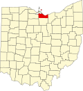
| State | Ohio |
| Counties | Erie, Sandusky |
| Townships | Margaretta, Townsend |
| Area | |
• Total | 0.29 sq mi (0.76 km2) |
| • Land | 0.29 sq mi (0.76 km2) |
| • Water | 0 sq mi (0.00 km2) |
| Elevation | 577 ft (176 m) |
| Population (2020) | |
• Total | 350 |
| • Density | 1,194.7/sq mi (461.29/km2) |
| Time zone | UTC-5 (Eastern (EST)) |
| • Summer (DST) | UTC-4 (EDT) |
| Area code | 419 / 567 |
| FIPS code | 39-84882 [3] |
| GNIS feature ID | 2584370 [2] |
Whites Landing is an unincorporated community and census-designated place in Erie and Sandusky counties, Ohio, United States. As of the 2020 census it had a population of 350. It is located within Margaretta and Townsend townships.