Whitwell, Rutland

Last updated

Whitwell
St Michael and All Angels Church - geograph.org.uk - 376117.jpg
Rutland UK location map.svg
Red pog.svg
Whitwell
Location within Rutland
Area0.98 sq mi (2.5 km2)  [1]
Population41  2001 Census [2]
  Density 42/sq mi (16/km2)
OS grid reference SK923088
  London 84 miles (135 km) SSE
Unitary authority
Shire county
Ceremonial county
Region
Country England
Sovereign state United Kingdom
Post town OAKHAM
Postcode district LE15
Dialling code 01572
Police Leicestershire
Fire Leicestershire
Ambulance East Midlands
UK Parliament
List of places
UK
England
Rutland
52°40′12″N0°38′10″W / 52.670°N 0.636°W / 52.670; -0.636

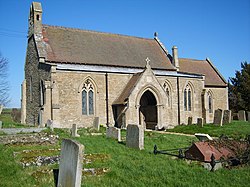
Whitwell is a village and civil parish in the county of Rutland in the East Midlands of England. The population at the 2001 census was 41. At the 2011 census the population remained less than 100 and was included together with the neighbouring parish of Exton.

The Great Tower sculpture on the shore of Rutland Water The Great Tower - geograph.org.uk - 1003941.jpg
The Great Tower sculpture on the shore of Rutland Water

It is located on the A606, about four miles (6 km) east of Oakham, on the north shore of Rutland Water with car parking off Bull Brig Lane. Whitwell Harbour is a popular sailing and water sports area and a pleasure boat known as the Rutland Belle operates from the harbour. Whitwell is one of the smallest villages in Rutland; it only has 19 houses, plus The Noel pub, the name of which comes from the Earls of Gainsborough, who were landholders in the area. [3]

The village's name means 'spring/stream which is white', probably meaning it was infertile. [4]

Whitwell claims to be twinned with Paris, France. In 1980, regulars from the pub, the Noel Arms wrote to the then Mayor of Paris, Jacques Chirac proposing the link and with a tight deadline for a response. As no answer arrived from the Mayor's office by the set date, the village unilaterally declared itself to be twinned and erected road signs to that effect. [5] [6] The original wooden signs were later replaced in metal by Rutland County Council. [7]

Related Research Articles

<span class="mw-page-title-main">Stretton, Rutland</span> Human settlement in England

Stretton is a village and civil parish in the county of Rutland, England, just off the A1 Great North Road. The population of the civil parish was 770 at the 2001 census, including Thistleton and increasing to 1,260 at the 2011 census. The ecclesiastical parish of Stretton shares the same boundaries and is part of the Rutland deanery of the diocese of Peterborough.

<span class="mw-page-title-main">Langham, Rutland</span> Human settlement in England

Langham is a village and civil parish in Rutland in the East Midlands of England. The village is about 2 miles (3 km) north-west of Oakham, on the A606 main road linking Oakham and Melton Mowbray.

<span class="mw-page-title-main">North Luffenham</span> Human settlement in England

North Luffenham is a village in Rutland, in the East Midlands of England. The population of the civil parish at the 2001 census was 704, decreasing to 679 at the 2011 census. It lies to the north of the River Chater, 5 miles (8.0 km) east of Uppingham and 7 miles (11 km) west of Stamford. Located to the north of the village is St George's Barracks, formerly RAF North Luffenham.

<span class="mw-page-title-main">Barrowden</span> Village in Rutland, England

Barrowden is a village in Rutland in the East Midlands of England.

<span class="mw-page-title-main">Brooke, Rutland</span> Village and civil parish in Rutland, England

Brooke is a village and civil parish in the county of Rutland in the East Midlands of England. It is situated about three miles (4.8 km) southwest of Oakham. The village is near the source of the River Gwash near Braunston-in-Rutland; the river forms part of the parish boundary. From the 2011 census the population is included in the civil parish of Braunston-in-Rutland.

<span class="mw-page-title-main">Clipsham</span> Village in Rutland, England

Clipsham is a small village in the county of Rutland in the East Midlands of England. It is in the northeast of Rutland, close to the county boundary with Lincolnshire. The population of the civil parish was 120 at the 2001 census increasing to 166 at the 2011 census.

<span class="mw-page-title-main">Edith Weston</span> Human settlement in England

Edith Weston is a village and civil parish in the county of Rutland in the East Midlands of England. The population of the civil parish was 1,042 at the 2001 census, including Normanton and increasing to 1,359 at the 2011 census. It is on the south-eastern shore of Rutland Water and is home of the main sailing club and a fishing lodge. The village is named after Edith of Wessex (1029–1075), the queen of Edward the Confessor and sister of Harold Godwinson.

<span class="mw-page-title-main">Egleton</span> Human settlement in England

Egleton is a small village and civil parish in the county of Rutland in the East Midlands of England. It is situated south east of Oakham, and is close to the western shore of Rutland Water. The population of the village remained less than 100 at the 2011 census and was included with the parish of Burley.

<span class="mw-page-title-main">Empingham</span> Human settlement in England

Empingham is a village in the county of Rutland in the East Midlands of England. The population of the civil parish was 815 at the 2001 census including Horn and increasing to 880 at the 2011 census. It lies close to the dam of Rutland Water and the A606 runs through the village. During construction, Empingham Reservoir was the name of the reservoir but it was renamed Rutland Water to preserve the name of the county which was being merged with Leicestershire.

<span class="mw-page-title-main">Exton, Rutland</span> Village and former civil parish in Rutland, England

Exton is a village and former civil parish, now in the parish of Exton and Horn, in the county of Rutland, England. The population of the parish was 607 at the 2011 census. On 1 April 2016 the parish was abolished and merged with Horn to form "Exton and Horn".

<span class="mw-page-title-main">Greetham, Rutland</span> Human settlement in England

Greetham is a village and civil parish in the county of Rutland in the East Midlands of England.

<span class="mw-page-title-main">Hambleton, Rutland</span> Human settlement in England

Hambleton is a village and civil parish in Rutland, England. It is about two miles (3 km) east of Oakham.

<span class="mw-page-title-main">Manton, Rutland</span> Human settlement in England

Manton is a village in the county of Rutland in the East Midlands of England. It lies south-west of Rutland Water. The population of the civil parish at the 2001 census was 364, and after including Gunthorpe decreased slightly to 359 at the 2011 census.

<span class="mw-page-title-main">Market Overton</span> Human settlement in England

Market Overton is a village on the northern edge of the county of Rutland in the East Midlands of England. The population of the civil parish was 494 at the 2001 census, increasing to 584 at the 2011 census.

<span class="mw-page-title-main">Normanton, Rutland</span> Human settlement in England

Normanton is a village and civil parish on the eastern shore of Rutland Water in the county of Rutland in the East Midlands of England. The population remained less than 100 at the 2011 census and was included in the civil parish of Edith Weston.

<span class="mw-page-title-main">Thorpe by Water</span> Human settlement in England

Thorpe by Water is a village and civil parish in the county of Rutland in the East Midlands of England. The population at the 2001 Census was 56. At the 2011 Census the population remained less than 100 and is included in the civil parish of Seaton.

<span class="mw-page-title-main">Whitwell, Isle of Wight</span> Human settlement in England

Whitwell is a small village and former civil parish, now in the parish of Niton and Whitwell, on the south of the Isle of Wight, England, approximately 5 kilometres north-west of Ventnor, the village's nearest town. In addition to this, it is about five minutes away from its neighbouring small villages of Godshill and Niton. According to 2001 census data, the total population of the village was 578. There is a variety of stone and thatched housing, as well as some more modern housing, the most recent of which was completed in 2006.

<span class="mw-page-title-main">Barley, Hertfordshire</span> Human settlement in England

Barley is a village and civil parish in the district of North Hertfordshire, England. According to the 2001 census, it has a population of 659, increasing to 662 at the 2011 Census. The place-name refers to a lea or meadow and not to the grain-producing plant. Coincidentally to the southwest lies the village of Reed. The Prime Meridian passes to the west of Barley, which is located on the Royston to Saffron Walden road, as well as the medieval London to Cambridge road.

<span class="mw-page-title-main">Wardley, Rutland</span> Human settlement in England

Wardley is a village and civil parish in the county of Rutland in the East Midlands of England. The population at the 2001 census was 32. At the 2011 census the population remained less than 100 and is included in the civil parish of Ridlington. It is located about two miles (3 km) west of Uppingham, close to the A47.

<span class="mw-page-title-main">Whitwell-on-the-Hill</span> Village and civil parish in North Yorkshire, England

Whitwell-on-the-Hill is a village and civil parish in the Ryedale district, in the county of North Yorkshire, England. The civil parish population at the 2011 Census was 311. It is near the A64 road.

References

  1. "A vision of Britain through time". University of Portsmouth. Retrieved 21 March 2009.
  2. "Rutland Civil Parish Populations" (PDF). Rutland County Council. 2001. Retrieved 21 March 2009.
  3. Poulton-Smith, Anthony (2008). Leicestershire and Rutland Place-names. History Press. p. 142. ISBN   978-0-7509-5045-9.
  4. "Key to English place-names - Whitwell" . Retrieved 26 October 2023.
  5. Story of how Whitwell came to be twinned with Paris, as told to Parliament by local MP Alan Duncan in 1992. (Scroll down to bottom of "Column 1137")
  6. A column from the Guardian, 19 April 2003, mentioning how Whitwell became twinned with Paris. (about 2/3 of the way down)
  7. "European elections 2019: The village (Sort of) twinned with Paris". BBC News. 21 May 2019.