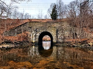
Wickaboxet State Forest is a 678 acre state management area on Plain Meeting House Road in West Greenwich, Rhode Island. [1] It was founded in 1932. [2]

Wickaboxet State Forest is a 678 acre state management area on Plain Meeting House Road in West Greenwich, Rhode Island. [1] It was founded in 1932. [2]
Potowomut is an isolated neighborhood and a peninsula in Warwick, Rhode Island. It is bordered by the Town of East Greenwich to the northwest, and by North Kingstown to the southeast. Greenwich Bay surrounds all other sides.

Cowesett is a hillside neighborhood located in Warwick, Rhode Island.

New England Institute of Technology is a private university with its main campus in East Greenwich, Rhode Island. It was established in 1940 and Richard I. Gouse has been the president since 1971.

Rhode Island's 2nd congressional district is a congressional district located in the southern and western part of the U.S State of Rhode Island.The district is currently represented by Democrat Seth Magaziner, who has represented the district since January 2023.

The Wood River is a river in the U.S. states of Connecticut and Rhode Island. It flows approximately 25 miles (40 km) and is a major tributary of the Pawcatuck River. There are eight dams along the river's length.
The U.S. State of Rhode Island currently has two statistical areas that have been delineated by the Office of Management and Budget (OMB). On July 21, 2023, the OMB delineated the Providence-Warwick, RI-MA Metropolitan Statistical Area and the Boston-Worcester-Providence, MA-RI-NH Combined Statistical Area, which are inclusive of all five of Rhode Island's counties.
The Queen River is a river in the U.S. state of Rhode Island. It flows approximately 10.7 miles (17.2 km). There is one dam along the river's length.
The Mishnock River is a river in the U.S. state of Rhode Island. It flows 3.1 miles (5.0 km). There are two dams along the river's length.

The Maskerchugg River is a river in the U.S. state of Rhode Island. It flows approximately 4 miles (6.4 km).
The Hunt River is a river in the U.S. state of Rhode Island. It flows approximately 11 km (7 mi). There is a small stone dam just upstream from the Davisville Road bridge that powered a woolen mill active in the period 1811–1924.
The Congdon River is a river in the U.S. state of Rhode Island, in the Big River State Management Area and immediately south. It flows approximately 3 km (2 mi). There are three dams along the river's length: at Rathbon Pond, Money Swamp Pond, and at Millbrook Pond. The river's crossing at Congdon Mill Road is the former site of a grist mill and later a sawmill, and is named after Joseph Congdon, the mill's owner.
The Carr River is a river in Kent County in the U.S. state of Rhode Island. It flows approximately 6 km (4 mi). There are three dams along the river's length.
The Big River is a river in the U.S. state of Rhode Island. It flows 6.8 miles (10.9 km). There are no dams along the river's length.

Chepiwanoxet is a neighborhood in Warwick, Rhode Island, with an island peninsula in Greenwich Bay, an arm of Narragansett Bay. The neighborhood straddles the Amtrak railroad lines, which lies just east of and parallel to the Post Road. Its boundaries are Neptune Street to the North, Alger Avenue to the South, Post Road to the West, and Greenwich Bay to the East. Chepiwanoxet Way, an underpass beneath the Amtrak lines, now serves as the only street access in and out of the neighborhood.

Greenwich Bay, is a bay on the coast of Rhode Island in the United States near Warwick, RI and East Greenwich, Rhode Island off of Narragansett Bay.

Washington County, known locally as South County, is a county located in the U.S. state of Rhode Island. As of the 2020 census, the population was 129,839. Rhode Island counties have no governmental functions other than as court administrative boundaries, which are part of the state government.
George Washington State Campground is an overnight camping facility in Chepachet, a village in the town of Glocester, Rhode Island, United States. The campground is managed by the Rhode Island Department of Parks and Recreation, and is located on Putnam Pike.
George Washington Memorial State Forest is a state forest on the Putnam Pike near the village of Chepachet in the town of Glocester, Rhode Island.
The Arcadia Management Area is a protected area in Richmond, Exeter, Hopkinton, and West Greenwich, Rhode Island. With an area of 14,000 acres, it is the state's largest recreational area. AMA is home to an extensive network of logging roads and single track trails - ideal for picnicking, hiking, running, mountain biking, fishing, horseback riding, and boating. During the winter some of the roads going through the forest close and are only accessible by foot traffic. In 2011, part of the film Moonrise Kingdom was filmed at the park. The former Pine Top Ski Area on Escoheag Hill is located within Arcadia.
Escoheag Hill is a 560 foot hill off Escoheag Hill Road in West Greenwich, Rhode Island. The hill was the site of the former Pine Top Ski Area.