Wingene | |
|---|---|
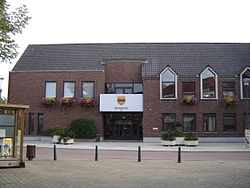 Wingene town hall | |
 Flag  Coat of arms | |
Location of Wingene  | |
 Wingene Location in Belgium Location of Wingene in West Flanders  | |
| Coordinates: 51°03′N03°16′E / 51.050°N 3.267°E | |
| Country | |
| Community | Flemish Community |
| Region | Flemish Region |
| Province | |
| Arrondissement | Tielt |
| Government | |
| • Mayor | Lieven Huys (CD&V) |
| • Governing party/ies | CD&V |
| Area | |
• Total | 68.54 km2 (26.46 sq mi) |
| Population (2018-01-01) [1] | |
• Total | 14,243 |
| • Density | 210/km2 (540/sq mi) |
| Postal codes | 8750 |
| NIS code | 37018 |
| Area codes | 051 |
| Website | www.wingene.be |
Wingene (Dutch pronunciation: [ˈʋɪŋənə] ; West Flemish : Wiengne; historically: Wynghene) is a municipality located in the Belgian province of West Flanders. The municipality comprises the towns of Wingene proper and Zwevezele. On December 1, 2019, Wingene had a total population of 14,398. The total area is 68.42 km2 which gives a population density of 192 inhabitants per km2.