Torhout is a city and municipality located in the Belgian province of West Flanders. The municipality comprises the city of Torhout proper, the villages of Wijnendale and Sint-Henricus, and the hamlet of De Driekoningen. On 29 February 2024 Torhout had a total population of 24,891. The total area is 45.23 km2 which gives a population density of 445 inhabitants per km2.

Zuienkerke is a municipality located in the Belgian province of West Flanders. The municipality comprises the towns of Houtave, Meetkerke, Nieuwmunster and Zuienkerke proper. On January 1, 2006, Zuienkerke had a total population of 2,776. The total area is 48.86 km2 which gives a population density of 57 inhabitants per km2.

Lendelede is a municipality located in the Belgian province of West Flanders. The municipality comprises only the town of Lendelede proper. On January 1, 2006, Lendelede had a total population of 5,399. The total area is 13.15 km2 which gives a population density of 411 inhabitants per km2.

Spiere-Helkijn is a municipality located in the Belgian province of West Flanders. The municipality comprises the towns of Helkijn and Spiere. On January 1, 2018, Spiere-Helkijn had a total population of 2,087. The total area is 10.78 km2 which gives a population density of 194 inhabitants per km2.

Zwevegem is a municipality located in the Belgian province of West Flanders. The municipality comprises the towns of Heestert, Moen, Otegem, Sint-Denijs and Zwevegem. On January 1, 2019, Zwevegem had a total population of 24,648. The total area is 63.24 km2 which gives a population density of 380 inhabitants per km2.

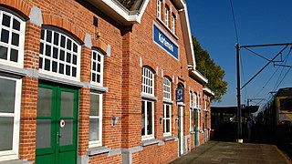
Kortemark, also previously Cortemarck, is a municipality located in the Belgian province of West Flanders. The municipality comprises the towns of Handzame, Kortemark, Werken and Zarren. On January 1, 2006, Kortemark had a total population of 11,976. The total area is 55.00 km2 which gives a population density of 218 inhabitants per km2.

Ichtegem is a municipality located in the Belgian province of West Flanders 15 km southwest of Bruges. The municipality comprises the towns of Bekegem, Eernegem and Ichtegem proper. On January 1, 2006 Ichtegem had a total population of 13,423. The total area is 45.33 km2 which gives a population density of 296 inhabitants per km2. The current mayor is Karl Bonny.

Middelkerke is a municipality located in the Belgian province of West Flanders, on the North Sea, west of Ostend. The municipality comprises the villages of Leffinge, Lombardsijde, Mannekensvere, Middelkerke proper, Schore, Sint-Pieters-Kapelle, Slijpe, Westende and Wilskerke. On January 1, 2006, Middelkerke had a total population of 17,841. The total area is 75.65 km2 which gives a population density of 236 inhabitants per km2.

Hooglede is a municipality located in the Belgian province of West Flanders. The municipality comprises the towns of Gits and Hooglede proper. On January 1, 2006, Hooglede had a total population of 9,831. The total area is 37.84 km2 which gives a population density of 260 inhabitants per km2.

Ledegem is a municipality located in the Belgian province of West Flanders. The municipality comprises the towns of Ledegem proper, Rollegem-Kapelle and Sint-Eloois-Winkel. On January 1, 2006, Ledegem had a total population of 9,306. The total area is 24.76 km2 which gives a population density of 376 inhabitants per km2.

Dentergem is a municipality, located in the Belgian province of West Flanders. The municipality comprises the towns of Dentergem proper, Markegem, Oeselgem and Wakken. On January 1, 2006, Dentergem had a total population of 8,188. The total area is 25.94 km2 which gives a population density of 316 inhabitants per km2.

Oostrozebeke is a municipality located in the Belgian province of West Flanders. The municipality comprises only the town of Oostrozebeke proper. On January 1, 2018 Oostrozebeke had a total population of 7,849. The total area is 16.62 km2 which gives a population density of 472 inhabitants per km2.

Wielsbeke is a municipality located in the Belgian province of West Flanders. The municipality comprises the towns of Ooigem, Sint-Baafs-Vijve and Wielsbeke proper. On January 1, 2018, Wielsbeke had a total population of 9,584. The total area is 21.76 km2 which gives a population density of 440 inhabitants per km2.

Wingene is a municipality located in the Belgian province of West Flanders. The municipality comprises the towns of Wingene proper and Zwevezele. On December 1, 2019, Wingene had a total population of 14,398. The total area is 68.42 km2 which gives a population density of 192 inhabitants per km2.

Langemark-Poelkapelle is a municipality located in the Belgian province of West Flanders.

Mesen is a city and municipality located in the Belgian province of West Flanders. On January 1, 2006, Mesen had a total population of 988. The total area is 3.58 km2 which gives a population density of 276 inhabitants per km2.

Vleteren is a municipality located in the Belgian province of West Flanders. The municipality comprises the towns of Oostvleteren, Westvleteren and Woesten. On January 1, 2006, Vleteren had a total population of 3,636. The total area is 38.15 km2 which gives a population density of 95 inhabitants per km2.

Londerzeel is a municipality located in the Belgian province of Flemish Brabant. The municipality comprises the towns of Londerzeel proper, Malderen, Steenhuffel and Sint-Jozef. On 1 January 2018, Londerzeel had a total population of 18,620. The total area is 36.53 km2 which gives a population density of 510 inhabitants per km2.

Halen, formerly Haelen, is a city and municipality located in the Belgian province of Limburg, to the west of Hasselt. On January 1, 2018, Halen had a total population of 9,461. The total area is 36.29 km2 which gives a population density of 261 inhabitants per km2.

Tubize is a city and municipality of Wallonia located in the Belgian province of Walloon Brabant. On January 1, 2006 Tubize had a total population of 22,335. The total area is 32.66 km2 which gives a population density of 684 inhabitants per km2.


