Ghent is a city and a municipality in the Flemish Region of Belgium. It is the capital and largest city of the province of East Flanders, and the third largest in the country, after Brussels and Antwerp. It is a port and university city.

The Scheldt is a 435-kilometre-long (270 mi) river that flows through northern France, western Belgium, and the southwestern part of the Netherlands, with its mouth at the North Sea. Its name is derived from an adjective corresponding to Old English sċeald ("shallow"), Modern English shoal, Low German schol, West Frisian skol, and obsolete Swedish skäll ("thin").

West Flanders is the westernmost province of the Flemish Region, in Belgium. It is the only coastal Belgian province, facing the North Sea to the northwest. It has land borders with the Dutch province of Zeeland to the northeast, the Flemish province of East Flanders to the east, the Walloon province of Hainaut in the south and the French department of Nord to the west. Its capital is Bruges (Brugge). Other important cities are Kortrijk in the south and Ostend (Oostende) on the coast, Roeselare and Ypres (Ieper). The province has an area of 3,197 km2 (1,234 sq mi) which is divided into eight administrative districts (arrondissementen) containing 64 municipalities. As of January 2024, West Flanders has a population of over 1.22 million.
Wevelgem is a municipality located in the Belgian province of West Flanders. The municipality comprises the towns of Gullegem, Moorsele and Wevelgem proper. On January 1, 2006, Wevelgem had a total population of 31,020. The total area is 38.76 km2 which gives a population density of 800 inhabitants per km2.

Ingelmunster is a municipality located in the Belgian province of West Flanders. The municipality comprises only the town of Ingelmunster proper and the village of Kriek. As of January 1, 2006, Ingelmunster had a total population of 10,617. Its total area is 16.16 km². Thus, its population density is 657 inhabitants per km².

Izegem is a city and municipality located in the Belgian province of West Flanders. The municipality comprises the city of Izegem proper and the towns of Emelgem and Kachtem. Emelgem was added to Izegem in 1965, Kachtem in 1977. Izegem itself lies on the southern banks of the Mandel, Emelgem and Kachtem on the north. Along the shores of the canal a large industrial zone has developed, which made the three municipalities one urban area. On January 1, 2006, Izegem had a total population of 26,544. The total area is 25.48 km2 (9.84 sq mi) which gives a population density of 1,042 inhabitants per km².

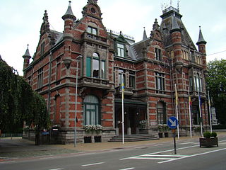
Poperinge is a city and municipality located in the Belgian province of West Flanders, Flemish Region, and has a history going back to medieval times. The municipality comprises the town of Poperinge proper and surrounding villages. The area is famous for its hops and lace.

Zottegem is a city and municipality located in Belgium and more particularly in Flanders, in the province of East Flanders. The municipality comprises the town of Zottegem proper and the villages of Elene, Erwetegem, Godveerdegem, Grotenberge, Leeuwergem, Oombergen, Sint-Goriks-Oudenhove, Sint-Maria-Oudenhove, Strijpen and Velzeke-Ruddershove. On 1 January 2018, Zottegem had a total population of 26,373. The total area is 56.66 km2 which gives a population density of 470 inhabitants per km2.

Deinze is a city and a municipality in the Belgian province of East Flanders. It comprises the city of Deinze, and the towns of Astene, Bachte-Maria-Leerne, Gottem, Grammene, Hansbeke, Landegem, Meigem, Merendree, Nevele, Petegem-aan-de-Leie, Poesele, Sint-Martens-Leerne, Vinkt, Vosselare, Wontergem, and Zeveren. On 1 January 2022, Deinze had a population of 44,315. The municipality's total area is 128.03 km2 (49 sq mi), giving a population density of 342 inhabitants per km2.

Sint-Niklaas is a Belgian city and municipality located in the Flemish province of East Flanders. The municipality comprises the city of Sint-Niklaas proper and the towns of Belsele, Nieuwkerken-Waas, and Sinaai.
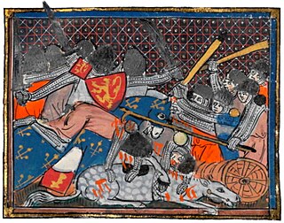
The Battle of the Golden Spurs or 1302 Battle of Courtrai was a military confrontation between the royal army of France and rebellious forces of the County of Flanders on 11 July 1302 during the 1297–1305 Franco-Flemish War. It took place near the town of Kortrijk in modern-day Belgium and resulted in an unexpected victory for the Flemish.
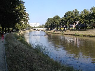
The Lys or Leie is a river in France and Belgium, and a left-bank tributary of the Scheldt. Its source is in Pas-de-Calais, France, and it flows into the river Scheldt in Ghent, Belgium. Its total length is 202 kilometres (126 mi).
Drongen is a sub-municipality of the city of Ghent located in the province of East Flanders, Flemish Region, Belgium. It was a separate municipality until 1977. In 1967, part of the original municipality was already annexed to Ghent. On 1 January 1977, the municipality of Drongen was merged into Ghent.
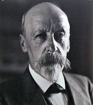
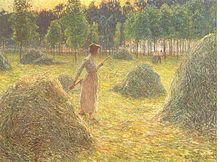
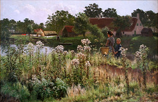
Emile Claus was a Belgian painter.

Sint-Denijs-Westrem is a sub-municipality of the city of Ghent located in the province of East Flanders, Flemish Region, Belgium. It was a separate municipality until 1977. On 1 January 1977, it was merged into Ghent.

Kortrijk, sometimes known in English as Courtrai or Courtray, is a Belgian city and municipality in the Flemish province of West Flanders.

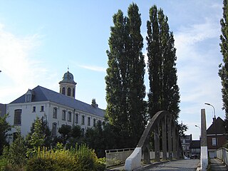
Welden is a village in the municipality of Oudenaarde in the province of East Flanders, Belgium, and is situated along the Scheldt. It is located about 20 kilometres (12 mi) south of Ghent.
Astene is a village and deelgemeente (sub-municipality) in the municipality of Deinze in the Belgian province of East Flanders. The village is located along the Leie River and about 13 kilometres (8.1 mi) south-west of Ghent.
Petegem-aan-de-Leie is a village in the Belgian province of East Flanders and a borough of Deinze. Petegem-aan-de-Leie is located on the south bank of the river Leie (Lys). The village today forms a single urban core with that of Deinze itself, which is located just across the river.

Bruges is the capital and largest city of the province of West Flanders, in the Flemish Region of Belgium. It is in the northwest of the country, and is the sixth most populous city in the country.