Winterborne Houghton

Last updated

Winterborne Houghton
St Andrew's, Winterborne Houghton.JPG
St Andrew's Church, Winterborne Houghton
Dorset UK location map.svg
Red pog.svg
Winterborne Houghton
Location within Dorset
Population183 
OS grid reference ST820045
Unitary authority
Shire county
Region
Country England
Sovereign state United Kingdom
Post town Blandford Forum
Postcode district DT11
Police Dorset
Fire Dorset and Wiltshire
Ambulance South Western
UK Parliament
List of places
UK
England
Dorset
50°50′22″N2°15′26″W / 50.8394°N 2.2571°W / 50.8394; -2.2571

Winterborne Houghton is a village and civil parish in north Dorset, England. It is situated in a winterbourne valley on the Dorset Downs, five miles (eight kilometres) southwest of Blandford Forum. In the 2011 census the parish had 82 households and a population of 183. [1] In 2001 the population was 195. [2]

Contents

The name "Winterborne" derives from the River Winterborne, which has its source here. [3] The river only flows overground during the winter, hence the name. To the east is Winterborne Stickland and the river flows on to this village, eventually joining the River Stour. To the southwest is Milton Abbas. [4]

Residents of Winterborne Houghton used to be known as "Houghton Owls", in reference to the story of a villager who, when calling for help having got lost in the woods, mistook the calls of owls for answering human voices. In his book Dorset Villages Roland Gant posits the theory that Thomas Hardy used this tale as inspiration for the scene where Joseph Poorgrass gets lost in Yalbury Wood in Far from the Madding Crowd . [5]

Church

The village church is named after St Andrew and is a Grade II listed building, being so designated on 14 July 1955. [6] It was designed by Thomas Henry Wyatt and built during 1861–62. [7] It is in the Perpendicular style and faced with flint with a tiled roof. It has a simple plan with nave, chancel, north aisle and south porch. The tower is on the west end and is built in two stages with a battlemented parapet. Internally, the nave has a hammer beam roof and the chancel a wagon roof. The fifteenth century font has a carved octagonal bowl on an octagonal stem, and the other fittings are nineteenth century. [6]

Higher Houghton

Higher Houghton is a hamlet located at the top of Winterborne Houghton. It is only accessible from Winterborne Houghton. The hamlet used to have stables (known as the Higher Houghton Stables) and would offer horse riding sessions. Unfortunately, the stables closed down in 2020 due to poor business as a result of the pandemic. Occasionally, cross country horse races are held in fields in Higher Houghton.

Houghton Down

Houghton Down is a series of fields located towards the west of Winterborne Houghton. It is accessible from the Bridleway (nicknamed 'The Grovers Track') leading to Milton Abbas.

Amenities

There used to be a post office in the village with a shop but this closed down sometime in the 1990's. There is a fish farm in the village called 'Houghton Springs Fish Farm'. This farm provides fish to many restaurants and companies around the UK. As a result of lockdown in 2020, the fish farm started selling fish directly from its farm to locals in the village as many restaurants were closed as a result of the pandemic. In 2023, Houghton Springs Fish Farm was put up for sale. Due to little interest, the fish farm was put off of the market. Its current date is unknown although, as of January 2024, Houghton Springs Fish Farm continues to produce fish for local restaurants and businesses. To the east of the village there is a small pond called 'The Millennium Pond'. Its called this because it was built in 2000 to commemorate the new millennium. In 2002, the pond won a design award. In the center of the village there is a bench with a small greenery area and a telephone box which is still operating for emergency calls only (as of February 2024). In 2017, BT reported that the phone box had not been used for a long period of time and had planned to remove it completely but this didn't happen. Yet again in 2020, BT reported the same issue and wanted to remove the phone box. Fortunately, the village council declined this request as they state that 'the phone box is a key piece in our village'. In 2021, a book swap system had been added into the phone box to make use of the premises. This book swap proved very popular with residents in the village. Unfortunately, at the end of 2021 BT requested that the book swap should be removed from the telephone box as it was 'obstructing the standing area in the telephone box'. Due to this, the book swap system moved into St Andrews Church. Although, as of 2023, the book swap has been removed from the church. Towards the north of the village, there is an orchard called the 'Jubilee Orchard' as it was placed there on the queens Jubilee. It is situated between the footpath leading to Winterborne Stickland and towards the west of Winterborne Houghton.

Related Research Articles

<span class="mw-page-title-main">Red telephone box</span> Kiosk for a public telephone designed by Sir Giles Gilbert Scott

The red telephone box, a telephone kiosk for a public telephone designed by Sir Giles Gilbert Scott, is a familiar sight on the streets of the United Kingdom its associated Crown Dependencies and British Overseas Territories and Malta. Despite a reduction in their numbers in recent years, the traditional British red telephone kiosk can still be seen in many places throughout the UK, and in current or former British colonies around the world. The colour red was chosen to make them easy to spot.

<span class="mw-page-title-main">Ashmore</span> Human settlement in England

Ashmore is a village and civil parish in the North Dorset district of Dorset, England, 20 miles southwest of Salisbury.

<span class="mw-page-title-main">Puddletown</span> Human settlement in England

Puddletown is a village and civil parish in Dorset, England. It is situated by the River Piddle, from which it derives its name, about 4.5 miles (7 km) northeast of the county town Dorchester. Its earlier name Piddletown fell out of favour, probably because of connotations of the word "piddle". The name Puddletown was officially sanctioned in the late 1950s. Puddletown's civil parish covers 2,908 hectares and extends to the River Frome to the south. In 2013, the estimated population of the civil parish was 1450.

<span class="mw-page-title-main">Stourton Caundle</span> Human settlement in England

Stourton Caundle is a village and civil parish in the county of Dorset in southwest England. It lies within the Blackmore Vale, about five miles east of Sherborne. In the 2011 census the parish had 181 households and a population of 439.

<span class="mw-page-title-main">Evershot</span> Village in Dorset, England

Evershot is a village and civil parish in the county of Dorset in southwest England, situated approximately 7 miles (11 km) south of Yeovil in Somerset. It is the second highest village in the county at 175 metres (574 ft) above sea-level. Evershot parish encompasses part of the nearby hamlet of Holywell, 1.25 miles (2.01 km) east of Evershot village. Dorset County Council's latest (2013) estimate of the parish population is 210. The village has connections with the writer Thomas Hardy.

<span class="mw-page-title-main">Okeford Fitzpaine</span> Village and civil parish in Dorset, England

Okeford Fitzpaine is a village and civil parish in the English county of Dorset, situated in the Blackmore Vale three miles south of the town of Sturminster Newton. It is sited on a thin strip of greensand under the scarp face of the Dorset Downs. In the 2011 census the civil parish—which includes the village of Belchalwell to the west and most of the hamlet of Fiddleford to the north—had 404 dwellings, 380 households and a population of 913.

<span class="mw-page-title-main">Sydling St Nicholas</span> Village in Dorset, England

Sydling St Nicholas is a village and civil parish in Dorset within southwest England. The parish is 5 to 9 miles northwest of the county town Dorchester and covers most of the valley of the small Sydling Water in the chalk hills of the Dorset Downs. The parish has an area of 2,075 hectares and includes the hamlet of Up Sydling in the north.

<span class="mw-page-title-main">Winterborne Kingston</span> Village in Dorset, England

Winterborne Kingston is a village and civil parish in the county of Dorset in southern England. It lies 7 miles south of the town of Blandford Forum and 2 mi (3 km) northeast of the large village of Bere Regis. It is situated in a winterbourne valley on the edge of the dip slope of the Dorset Downs. In the 2011 census the parish had 282 households and a population of 643. In 2001 it had a population of 613.

<span class="mw-page-title-main">Winterborne Stickland</span> Human settlement in England

Winterborne Stickland is a village and civil parish in the county of Dorset in southern England. It lies about four miles west of the town of Blandford Forum. In 2013 the civil parish had an estimated population of 520. In the 2011 census the parish, combined with the smaller neighbouring parishes of Winterborne Clenston to the south and Turnworth to the north, recorded a population of 653. For unknown reasons, the 1881 census listed 10 residents of Chorley, Lancashire as having been born in the village.

<span class="mw-page-title-main">Winterborne Whitechurch</span> Human settlement in England

Winterborne Whitechurch is a village and civil parish in central Dorset, England, situated in a winterbourne valley on the A354 road on the Dorset Downs five miles southwest of Blandford Forum. In the 2011 census the civil parish had 354 dwellings, 331 households and a population of 757.

<span class="mw-page-title-main">Winterborne Zelston</span> Human settlement in England

Winterborne Zelston is a village and civil parish in north Dorset, England. It is situated in a winterbourne valley on the A31 road eight miles south of Blandford Forum and 10 mi (16 km) northwest of Poole. The parish had a population of 141 in 2001. In 2013 the estimated population of the civil parish was 90.

<span class="mw-page-title-main">Winterbourne Abbas</span> Village in Dorset, England

Winterbourne Abbas is a village and civil parish in south west Dorset, England, situated in a valley on the A35 road 5 miles (8.0 km) west of Dorchester. In the 2011 census the parish had a population of 355.

<span class="mw-page-title-main">Winterbourne Steepleton</span> Human settlement in England

Winterbourne Steepleton is a village and civil parish in south west Dorset, England, situated in a winterbourne valley 5 miles (8.0 km) west of Dorchester, next to the village of Winterbourne Abbas. The name of the village derives from its site next to a seasonal winterbourne stream and from having a stone church steeple - one of only three medieval stone spires in the county. In the 2011 census the parish had a population of 297.

<span class="mw-page-title-main">Guilsborough</span> Human settlement in England

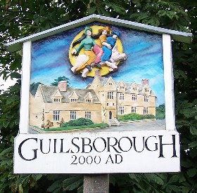
Guilsborough is a village and civil parish in West Northamptonshire in England. At the time of the 2001 census, the parish's population was 882 people, reducing to 692 at the 2011 Census.

<span class="mw-page-title-main">Winterborne Came</span> Human settlement in England

Winterborne Came is a small dispersed settlement and civil parish in the county of Dorset in England, situated in the west of the county, approximately 1 mile (1.6 km) south-east of the county town Dorchester. Dorset County Council's 2013 mid-year estimate of the parish population was 40.

<span class="mw-page-title-main">Winterborne Clenston</span> Human settlement in England

Winterborne Clenston is a small village and civil parish in Dorset, England, around 3+12 miles southwest of Blandford Forum. In 2013 the civil parish had an estimated population of 40.

<span class="mw-page-title-main">Winterborne Tomson</span> Human settlement in England

Winterborne Tomson is a village and former civil parish, now in the parish of Anderson, in the Dorset, district, in the ceremonial county of Dorset, England. In 1931 the parish had a population of 35. On 1 April 1933 the parish was abolished and merged with Anderson.

<span class="mw-page-title-main">The Street, Lawshall</span> Human settlement in England

The Street is a linear settlement in the civil parish of Lawshall in the Babergh district in the county of Suffolk, England. It extends from Lawshall Hall in the west to Donkey Lane in the east. The settlement includes Swanfield, east of the Swan Public House and the small residential development of Hall Mead which is opposite All Saints Church.

<span class="mw-page-title-main">Holy Trinity Church, Fleet</span> Church in Dorset, England

Holy Trinity Church is a Church of England church in Fleet, Dorset, England. It was built in 1827–29, replacing an earlier parish church which was partially destroyed during the Great Storm of 1824. Holy Trinity remains in religious use and has been Grade I Listed since 1956.

References

  1. "Area: Winterborne Houghton (Parish)". Neighbourhood Statistics. Office for National Statistics. Retrieved 8 June 2015.
  2. "Winterborne Houghton Parish Profile". 2001 Census. Dorset County Council/Archive.org. 2001. Archived from the original on 19 May 2006. Retrieved 5 October 2011.
  3. "Walking the River Winterborne" (PDF). www.dorsetaonb.org.uk. Dorset AONB Partnership, UK. 2011. Retrieved 5 October 2011.
  4. "Dorchester, Weymouth and surrounding area" (Map). Landranger 194. Ordnance Survey.
  5. Roland Gant. Dorset Villages. Robert Hale Ltd. p. 80. ISBN   0 7091 8135 3.
  6. 1 2 "Church of St Andrew, Winterborne Houghton". British Listed Buildings. Retrieved 26 August 2016.
  7. Newman, John; Pevsner, Nikolaus (1972). The Buildings of England: Dorset. Penguin Books. p. 481. ISBN   0-14-071044-2.

Commons-logo.svg Media related to Winterborne Houghton at Wikimedia Commons