Conesus Lake is a lake located in Livingston County, New York. Conesus Lake is the westernmost of New York's eleven Finger Lakes. It is located off Interstate 390 about 15 miles (24 km) south of Interstate 90.

Cattaraugus Creek is a stream, approximately 68 miles (109 km) long, in western New York in the United States. The creek drains a wooded rural portion of western New York southwest of Buffalo into Lake Erie. In its lower course it flows primarily through the Cattaraugus Reservation of the Seneca tribe. William Beauchamp identifies the name Cattaraugus as deriving from the Seneca word Gah-ta-ra-ke-ras, meaning "stinking shore" or "foul-smelling river bank." This name is a result of the natural gas that oozes from the river mud. However, Onöndowa:'ga:' Gawe:no contains no /r/ sound, so this interpretation is probably incorrect. The name is more likely taken from Attiwandiron, Wenro, or Wendat (Huron) languages, combining the verb root -i'tar-, referring to clay or mud, and -akera(n)-, describing a bad or strong odor: hence, tke'tarakeras, place of strong-smelling mud or clay.

Oatka Creek is the third longest tributary of the Genesee River, located entirely in the Western New York region of the U.S. state of New York. From southern Wyoming County, it flows 58 miles (93 km) to the Genesee near Scottsville, draining an area of 215 square miles (560 km2) that includes all or part of 23 towns and villages in Wyoming, Genesee, Livingston and Monroe counties as well. Its name means "leaving the highlands" or "approaching an opening" in Seneca.

The Salmon River is a large river in Upstate New York in the United States. The river is a popular and economically important sportfishing destination, and the most heavily fished of New York's Lake Ontario tributaries. From its headwaters in the Tug Hill region of New York, it flows 44 miles (71 km) westward through two hydroelectric dams and over the 110-foot (34 m) Salmon River Falls before it empties into eastern Lake Ontario at Port Ontario in Oswego County. The Salmon River watershed drains approximately 280 square miles (730 km2).

Catharine Creek is a roughly 15-mile-long (24 km) stream that flows through Chemung and Schuyler counties in New York. The creek, named after Catharine Montour, is a major tributary to Seneca Lake.

The Bitterroot River is a northward flowing 84 miles (135 km) river running through the Bitterroot Valley, from the confluence of its West and East forks near Conner in southern Ravalli County to its confluence with the Clark Fork River near Missoula in Missoula County, in western Montana. The Clark Fork River is tributary to the Columbia River and ultimately, the Pacific Ocean. The Bitterroot River is a Blue Ribbon trout fishery with a healthy population of native westslope cutthroat trout and bull trout. It is the third most fly fished river in Montana behind the Madison and Big Horn Rivers.
Cayuta Lake is a small lake located in Schuyler County, New York, United States. It is within the Town of Catharine, about three miles (4.8 km) north of Odessa. The lake is also referred to locally as Little Lake.

The West Canada Creek is a 76-mile-long (122 km) river in upstate New York, United States. West Canada Creek is an important water way in Hamilton, Oneida, and Herkimer counties, draining the south part of the Adirondack Mountains before emptying into the Mohawk River near the Village of Herkimer. The name "Canada" is derived from a Native American word for "village" (Kanata).

Esopus Creek is a 65.4-mile-long (105.3 km) tributary of the Hudson River that drains the east-central Catskill Mountains of the U.S. state of New York. From its source at Winnisook Lake on the slopes of Slide Mountain, the Catskills' highest peak, it flows across Ulster County to the Hudson at Saugerties. Many tributaries extend its watershed into neighboring Greene County and a small portion of Delaware County. Midway along its length, it is impounded at Olive Bridge to create Ashokan Reservoir, the first of several built in the Catskills as part of New York City's water supply system. Its own flow is supplemented 13 miles (21 km) above the reservoir by the Shandaken Tunnel, which carries water from the city's Schoharie Reservoir into the creek.

Bowman Creek is a tributary of the Susquehanna River in Luzerne County and Wyoming County, in Pennsylvania, in the United States. It is approximately 26 miles (42 km) long and flows through Ross Township and Lake Township in Luzerne County and Noxen Township, Monroe Township, and Eaton Township in Wyoming County. The watershed of the creek has an area of 120 square miles (310 km2). The creek is not designated as an impaired waterbody and its pH is close to neutral, although it has experienced some problems with acid rain. It has low concentrations of dissolved solids like calcium. The creek is relatively small in its upper reaches, but by Noxen, its width is 40 to 60 feet. It is also relatively shallow in many reaches. Rock formations in the watershed include the Catskill Formation, the Huntley Mountain Formation, Burgoon Sandstone, the Mauch Chunk Formation, the Pottsville Group, and the Pocono Formation. Soil associations in the creek's watershed include the Wellsboro-Morris-Oquaga association, the Oquaga-Lackawanna-Arnot association, the Mardin-Bath-Volusia association, and the Wyoming-Pope association.
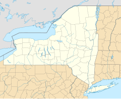
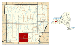
Rushford Lake is a small reservoir in the western part of New York, United States. The lake is in the northwest part of Allegany County, mostly in the Town of Rushford, but the eastern part of the lake is in the Town of Caneadea.

Zoar Valley is an area of deep gorges along the Main and South branches of Cattaraugus Creek in western New York, United States. The valley is located along the border of Erie County and Cattaraugus County, roughly between the villages of Gowanda to the west and Springville to the east.

Eighteen Mile Creek is a tributary of Lake Erie located in southern Erie County, New York, United States. The creek is the second largest tributary of Lake Erie in New York State.
Sauquoit Creek is a 17.0-mile-long (27.4 km) river in New York, United States. It lies within the southern part of Oneida County. The creek flows eastward, then turns sharply and flows generally northward through the Sauquoit Valley to the Mohawk River, entering the river on the east side of Whitesboro. It is therefore part of the Hudson River watershed.

Hettesheimer Run is a tributary of Bowman Creek in Wyoming County, Pennsylvania, in the United States. It is approximately 1.6 miles (2.6 km) long and flows through Noxen Township. The watershed of the stream has an area of 1.94 square miles (5.0 km2). It is not designated as an impaired waterbody. The stream was historically used as an industrial water supply. Its watershed is designated as a High-Quality Coldwater Fishery and a Migratory Fishery and the stream is Class A Wild Trout Waters.
The Little Salmon River is a tributary of Lake Ontario located in Oswego County, New York. The river enters Lake Ontario approximately four miles (6.4 km) southwest from the mouth of the Salmon River.
Canaseraga Creek is a stream that flows through Livingston, Steuben, and Allegany counties in western and central New York. It is a tributary of the Genesee River, and its 334-square-mile (870 km2) watershed is the largest sub-watershed of that river.
Lake Moraine is a mesotrophic lake located 2.5 miles (4.0 km) northeast of Hamilton, New York. The lake is 261 acres (1.06 km2), consisting of two basins which are separated by a causeway and interconnected by a culvert. The northern basin is 79 acres (0.32 km2) and is relatively shallow with a maximum depth of 12 feet (3.7 m) and average depth of 3.7 feet (1.1 m). The larger southern basin is 172 acres (0.70 km2) and has a maximum depth of 45 feet (14 m) and an average depth of 17.7 feet (5.4 m). Payne Brook is the lake's outflow that flows into the Chenango River.
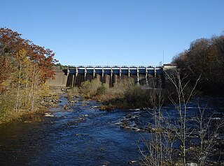
Salmon River Reservoir, also known as the Redfield Reservoir, is a man-made lake located near the hamlet of Redfield, New York. The reservoir was created with the completion of a hydroelectric dam in 1912. It has the capacity to hold 56,000 acre feet (69,000,000 m3) of water. It is the larger of the Salmon River's two reservoirs.
South Brook is a tributary of Mehoopany Creek in Luzerne County and Wyoming County, in Pennsylvania, in the United States. It is approximately 6.0 miles (9.7 km) long and flows through Ross Township and Lake Township, Luzerne County, Pennsylvania in Luzerne County and Forkston Township in Wyoming County. The watershed of the stream has an area of 10.1 square miles (26 km2). Wild trout are present in the stream and it has one named tributary, which is known as Opossum Brook.