
Rushford is a town in Allegany County, New York, United States. The population was 1,085 at the 2020 census. Rushford is in the northwest part of Allegany County and is northeast of Olean.
Ashford is a town in Cattaraugus County, New York, United States. The population was 1,974 at the 2020 census. The town is on the county's northern border.

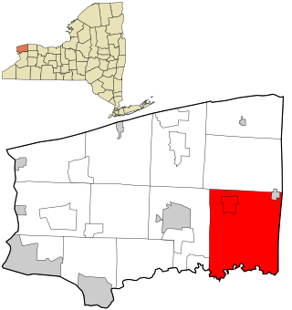
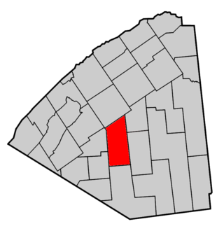
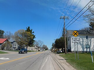
Dayton is a town in Cattaraugus County, New York, United States. The population was 1,689 at the 2020 census. The town is on the western border of Cattaraugus County.

Venice is a town in Cayuga County, New York, United States. The population was 1,368 at the 2010 census. The town is in the southern part of Cayuga County and is south of Auburn.

Darien is a town in Genesee County, New York, United States. The population was 3,010 at the 2020 census. Darien lies in the southwestern part of Genesee County, southwest of Batavia.

Pavilion is a town in Genesee County, New York, United States. The population was 2,495 at the 2010 census. The town was named after a hotel in Saratoga Springs, New York, by an early resident. The town of Pavilion is in the southeastern corner of Genesee County and is southeast of the city of Batavia.

Stafford is a town in Genesee County, New York, United States. The population was 2,459 at the 2010 census. The town was named after a town of the same name in England.

Litchfield is a town in Herkimer County, New York, United States. The population was 1,513 at the 2010 census. The town is named after Litchfield, Connecticut, the source of some early settlers of the city.

Salisbury is a town in Herkimer County, New York, United States. The population was 1,958 at the 2010 census. The town is on the eastern edge of the county, north of the city of Little Falls. The northern part of the town is in the Adirondack Park.
Rodman is a town in Jefferson County, New York, United States. The population was 1,176 at the 2010 census. The name is derived from a public official, Daniel Rodman.
Royalton is a town in Niagara County, New York, United States. The population was 7,660 at the 2010 census.

Trenton is a town in Oneida County, New York, United States. The population was 4,297 at the 2020 census.

Vienna is a town in Oneida County, New York, United States. The population was 5,440 at the 2010 census. The town is named after the capital of Austria.
Russell is a town in St. Lawrence County, New York, United States. The population was 1,856 at the 2010 census. The town is named after Russell Attwater, the pioneer land owner.
Enfield is a town in Tompkins County, New York, United States. The population was 3,401 at the 2020 census.

Covington is an incorporated town in Wyoming County, New York. The population was 1,231 at the 2010 census. The town was named after General Leonard Covington.
Java is an incorporated town in Wyoming County, New York. The population was 2,057 at the 2010 census. The Town of Java is on the western border of Wyoming County.

Orangeville is an incorporated town in Wyoming County, New York. The population was 1,301 at the 2000 census.

Sheldon is an incorporated town in Wyoming County, New York. The population was 2,409 at the 2010 census. The Town of Sheldon is on the west border of Wyoming County. The town is southeast of Buffalo.

Smyrna is a town in Chenango County, New York, United States. The population was 1,280 at the 2010 census. Smyrna is named after a coastal city in ancient Greece, nowadays modern Izmir in Turkey.


