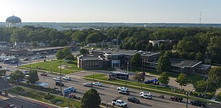
Orangeville is a village in Stephenson County, Illinois, United States. The town's sign lists the population at 800 as of January 2021. The population in 2020 was 738. The population according to the 2010 census was 793, up from 751 in 2000. Using the 2020 population of 738 Orangeville is the 741st largest city in Illinois and the 11,650th largest city in the United States. Orangeville is currently declining at a rate of -0.94% annually and its population has decreased by -6.94% since the 2010 census. The area's earliest white settlers arrived in the year 1833, and the village was platted in 1851 by John Bower, who is considered the village founder. In 1867 Orangeville was incorporated as a village. The town's central business district contains several 19th century commercial buildings, many of which were built during the railroad boom of 1888–1914. By the time the Great Depression was ongoing, business in Orangeville had started to decline, with the last bank closing in 1932. In 1956 another bank started operating in the village and is still in town today. Some recent infrastructure jumps have restored some of the village's old decor.

Wyoming is a city in Kent County in the U.S. state of Michigan. The population was 76,501 at the 2020 census. Wyoming is the second most-populated community in the Grand Rapids metropolitan area and is bordered by Grand Rapids on the northeast. After Grand Rapids, it is also the second most-populated city in West Michigan.

Wappingers Falls is a village in the towns of Poughkeepsie and Wappinger, in Dutchess County, New York, United States. As of the 2010 census it had a population of 5,522. The community was named for the cascade in Wappinger Creek. The Wappingers Falls post office covers areas in the towns of Wappinger, Poughkeepsie, Fishkill, East Fishkill, and LaGrange. This can result in some confusion when residents of the outlying towns, who do not live in the village, give their address as "Wappingers Falls".

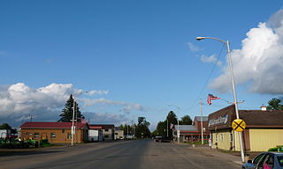
Sheldon is a village in Rusk County, Wisconsin, United States. The population was 237 at the 2010 census.

Ingersoll is a town in Oxford County on the Thames River in southwestern Ontario, Canada. The nearest cities are Woodstock to the east and London to the west.

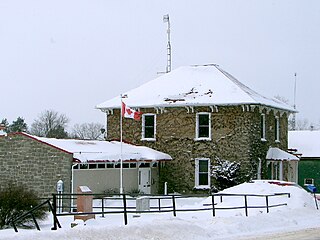
Elizabethtown-Kitley is a township in eastern Ontario, Canada, in the United Counties of Leeds and Grenville. Its southern border lies along the St. Lawrence River and it extends north into many rural hamlets and villages. The township was created on January 1, 2001, by the amalgamation of the former Township of Elizabethtown and Township of Kitley.

Aultsville is a ghost town in the Canadian province of Ontario. It is one of Ontario's Lost Villages, which were permanently flooded by the creation of the St. Lawrence Seaway in 1958. The town was founded as Charlesville in 1787 by United Empire Loyalists and reached its peak in 1880, when it had 400 residents. It was the second largest town flooded by the new Seaway in 1958, with a population of 312 at the time. Before it was flooded, the abandoned buildings were burned to study the effects of fire on houses.

Moulinette is an underwater ghost town in the Canadian province of Ontario. It is one of Ontario's Lost Villages, which were permanently flooded by the creation of the St. Lawrence Seaway in 1958. Families and businesses in Moulinette were moved to the new town of Long Sault before the seaway construction commenced. The village was located as a strip community along Highway 2, on the St. Lawrence River. At the time of the flooding, Moulinette had a population of around 311 residents. The community would have been located in what is now South Stormont township.

Edwardsburgh/Cardinal is a township in the United Counties of Leeds and Grenville of eastern Ontario, Canada. Edwardsburgh township was first surveyed in 1783, and incorporated in 1850. The township was part of the historical Grenville County before it merged with Leeds County to form the United Counties in the 19th century.

Augusta Township is a township in the United Counties of Leeds and Grenville, located in eastern Ontario, Canada. Augusta is situated along the Saint Lawrence River, and extends back into rural hamlets. The township is located between the city of Brockville to the west, and the town of Prescott to the east.

Hawes is a market town and civil parish in North Yorkshire, England, at the head of Wensleydale in the Yorkshire Dales, and historically in the North Riding of Yorkshire. The River Ure north of the town is a tourist attraction in the Yorkshire Dales National Park.
Shanly is an unincorporated place and Compact Rural Community in the township of Edwardsburgh/Cardinal in the United Counties of Leeds and Grenville in eastern Ontario, Canada. The village is about one hour south of Ottawa and around 7 miles north-west of Cardinal. Shanly is centred around the intersection of County Road 22, also known as Shanly Road, and County Road 21. Formerly these roads were the Nine Mile Road and the Seventh Concession, respectively. The community was settled during the 1800s, primarily as an agricultural community, and was at its height during the latter half of the 19th century, when many farms and a few businesses and factories were in operation. As of the 2000s, the rural area surrounding the main intersection consists of mostly residential properties and a few family farms. The village is also home to a few businesses and two churches.

Friendship is an unincorporated community (village) in a scenic valley on State Road 62, Brown Township, Ripley County, in the U.S. state of Indiana.
Holmesville is a hamlet in Chenango County, New York, United States. It is situated on the Unadilla River, in the south-east corner of the town of New Berlin.
Sabin is an unincorporated community in the Town of Sylvan, Richland County, Wisconsin, United States. It is located at the intersection of County Highway E and Robbson Drive.
Bonsack is an unincorporated community in eastern Roanoke County, Virginia, United States. The community is located near the junction of US 460 and US 220 Alternate.

Farmington Historic District is the town center of Farmington, Michigan. It was listed on the National Register of Historic Places in 1976. The area roughly corresponds to the section of Grand River Avenue and Shiawassee Avenue from Warner Street to junction of Grand River and Shiawassee.

Boltonville is an unincorporated community located on Stony Creek in the town of Farmington, Washington County, Wisconsin, United States.

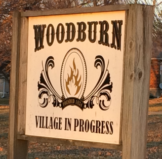
Woodburn is an unincorporated community in Bunker Hill Township, Macoupin County, Illinois, United States.

Eagle Mills Township is a rural, non-functioning subdivision of Iredell County, North Carolina, United States. By the requirements of the North Carolina Constitution of 1868, the counties were divided into townships, which included Eagle Mills. Eagle Mills Township was named for the town of Eagle Mills, which was established by Andrew Baggerly on Hunting Creek in 1848.


