
Cooke County is a county in the U.S. state of Texas. At the 2020 census, its population was 41,668. The county seat is Gainesville. The county was founded in 1848 and organized the next year. It is named for William Gordon Cooke, a soldier during the Texas Revolution. It is a part of the Texoma region.

Menominee is a village in Jo Daviess County, Illinois, United States. The population was 248 at the 2010 census, up from 237 in 2000. The village is located on the Little Menominee River near East Dubuque and Galena.

Island Lake is a village in Lake and McHenry counties in the U.S. state of Illinois. Per the 2020 census, the population was 8,051. The village surrounds Island Lake, a lake which contains a small island.

Spring Grove is a village in McHenry County. Portions of unincorporated Lake County, Illinois also utilize Spring Grove postal addresses. It is a commuter village within the Chicago metropolitan area. Per the 2020 census, the population was 5,487. It is also home to Chain O'Lakes State Park.

Boys Town is a village in Douglas County, Nebraska, United States. The population was 410 at the 2020 census. Boys Town is an enclave and a suburb of Omaha.

Sloan is a village in Erie County, New York, United States. The population was 3,661 at the 2010 census. It is part of the Buffalo–Niagara Falls Metropolitan Statistical Area and is in the town of Cheektowaga.
Riverside is a village in Steuben County, New York, United States. The population was 497 at the 2010 census. Riverside is situated in the town of Corning and is a western suburb of the city of Corning.

Addyston is a village in Miami Township, Hamilton County, Ohio, United States. Located along the Ohio River, it is a western suburb of the neighboring city of Cincinnati. The population was 927 at the 2020 census.

Spring Hill is a census-designated place (CDP) in Cambria County, Pennsylvania, United States. The population was 839 at the 2010 census, down from 970 at the 2000 census.

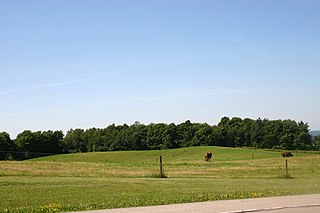
Spring Creek Township is a township in Elk County, Pennsylvania, United States. The population was 198 at the 2020 census, down from 233 in 2010.

Silver Lake is a former village and now a neighborhood within the village of Salem Lakes in Kenosha County, Wisconsin, United States. The population was 2,411 at the 2010 census, when the community was still an independent village. On February 14, 2017, the village merged with the town of Salem to create the village of Salem Lakes.

Frederic is a village in Polk County, Wisconsin, United States. The population was 1,137 at the 2010 census. It was established as a village in 1901.
Nett Lake is an unorganized territory in Koochiching County, Minnesota, United States. The population was 56 at the 2000 census.

Tonawanda is a census-designated place (CDP) in Erie County, New York, United States. The CDP comprises the town of Tonawanda minus its subsidiary village of Kenmore. As of the 2010 census, the CDP population was 58,144.
Castile is a village in Wyoming County, New York, United States. The population was 1,015 at the 2010 census.
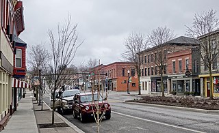
Gainesville is an incorporated town in Wyoming County, New York. The population was 2,333 at the 2000 census. The town is named after General Edmund P. Gaines.
Perry is a village in the towns of Perry and Castile in Wyoming County, New York, United States. The population was 3,673 at the 2010 census. The village is at the junction of state routes 39 and 246.
Pike is a hamlet and census-designated place within the Town of Pike in Wyoming County, New York, United States. The population was 371 at the 2010 census. Pike, located near the center of the town at the junction of NY 19 and NY 39, was a village from 1848 to 2009. The Wyoming County Fairgrounds are in the hamlet.

Wauzeka is a village in Crawford County, Wisconsin, United States. The population was 628 at the 2020 census. The village is located within the Town of Wauzeka near the confluence of the Kickapoo River and Wisconsin River.
The Town of Potosi is located in Grant County, Wisconsin, United States. The population was 831 at the 2000 census. The Village of Potosi and the unincorporated communities of British Hollow, Buena Vista, Rockville, and Van Buren are located in the town.


