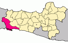
Cilacap Regency is a regency in the southwestern part of Central Java province in Indonesia. Its capital is the town of Cilacap.

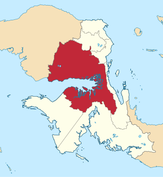
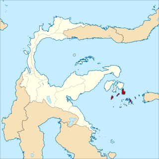
Maumere is the administrative seat of the Sikka Regency and the second largest town on Flores Island, Indonesia. It lies on the north coast of the island and the port is in the north-west part of the town. Administratively the town is not a single district (kecamatan) within the regency, but is divided into three districts – Alok Barat, Alok and Alok Timur – although the latter two districts also include a number of substantial islands off the north coast of Flores.

Kuantan Singingi is a regency (kabupaten) of Riau, Indonesia. It is located on the island of Sumatra. The regency was created on 4 October 1999 from what had been the western half of Indragiri Hulu Regency. It has an area of 7,656.03 km² and had a population of 292,116 at the 2010 Census and 334,943 at the 2020 Census; the official estimate as at mid 2022 was 345,850. The seat of the regency is the town of Teluk Kuantan.
Berau Regency is one of the seven regencies in East Kalimantan province in Indonesia. The capital is the town of Tanjung Redeb. It has an area of 36,962.37 km2 and had a population of 179,079 at the 2010 census and 248,035 at the 2020 census; the official estimate as at mid 2022 was 272,887.

East Kutai Regency is a regency of East Kalimantan province, Indonesia. It has an area of 35,747.50 km2 and had a population of 253,904 at the 2010 census and 434,459 at the 2020 census; the official estimate as at mid 2022 was 425,613. The town of Sangatta is the capital of the regency.

Biak Numfor Regency is one of the regencies (kabupaten) in Papua Province of Western New Guinea in northeastern Indonesia.

Yalimo Regency is one of the regencies in the Indonesian province of Highland Papua. It covers an area of 4,320.29 km3, and had a population at the 2010 Census of 50,763 which doubled to reach 101,973 at the 2020 Census; the official estimate as at mid 2022 was 105,139. The administrative centre is at Elelim. The indigenous inhabitants of this well-forested mountainous area are the Yali people.

Waropen Regency is one of the regencies (kabupaten) in Papua Province, Indonesia. The Regency covers an area of 10,843.97 km2, and it had a population of 24,639 at the 2010 Census and 33,943 at the 2020 Census; the official estimate as at mid 2022 was 36,974 - comprising 19,415 males and 17,559 females. The capital is the town of Botawa.

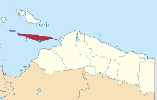
Supiori Regency is a regency in the Indonesian province of Papua. The Regency has an area of 634.24 km2 including the Aruri Islands group to the south, and had a population of 15,874 at the 2010 Census and 22,547 at the 2020 Census; the official estimate as at mid 2022 was 23,247 - comprising 12,056 males and 11,191 females. Until 8 January 2004, this area was part of the Biak Numfor Regency, from which it was split off in accordance with the Law dated 18 December 2003.

Paniai Regency is one of the regencies (kabupaten) in Central Papua Province of Indonesia. It is named after the Paniai Lakes. It covers an area of 6,525.25 km2, and had a population of 153,432 at the 2010 Census and 220,410 at the 2020 Census; the official estimate as of mid-2022 was 227,254 - comprising 124,260 males and 102,994 females. The administrative centre is the town of Enarotali, in East Paniai.

Nabire Regency is one of the regencies (kabupaten) in the Indonesian province of Central Papua. It covers an area of 12,010.65 km2, and had a population of 129,893 at the 2010 Census and 169,136 at the 2020 Census, comprising 87,688 males and 81,448 females. The official estimate as at mid 2022 was 173,043 - comprising 90,823 males and 82,220 females. The administrative centre is the town of Nabire, which faces onto Cenderawasih Bay.
Yapen Islands Regency is a regency (kabupaten) in Papua Province of eastern Indonesia. It covers an area of 2,432.49 km2 (939.19 sq mi), and had a population of 82,951 at the 2010 Census and 112,676 at the 2020 Census; the official estimate as at mid 2022 was 116,107. It comprises an archipelago which lies in Cenderawasih Bay off the north coast of Western New Guinea.

Paser Regency is a regency (kabupaten) within East Kalimantan province in Indonesia, it is the southernmost regency of the East Kalimantan province. Its administrative centre is Tana Paser. It covers an area of 7,730 km2, and it had a population of 230,316 at the 2010 Census and 275,452 at the 2020 Census; the official estimate as at mid-2022 was 280,065 . Before 2007, this regency was formerly named Pasir Regency.

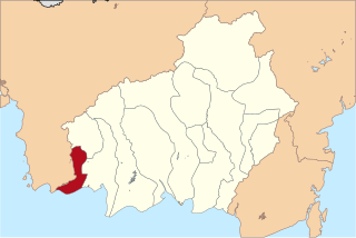
Pasangkayu Regency is one of the six regencies which comprise West Sulawesi Province, Indonesia, on the island of Sulawesi. It covers an area of 3,043.75 km2 and had a population of 134,303 at the 2010 Census and 188,861 at the 2020 Census. The official estimate as at mid 2022 was 198,608. The town of Pasangkayu is the capital and chief town of the regency.
Sukamara Regency is one of the thirteen regencies which comprise the Central Kalimantan Province on the island of Kalimantan (Borneo), Indonesia. It was created on 10 April 2002 from the former southwest part of West Kotawaringin Regency. The town of Sukamara is the capital of Sukamara Regency, which covers an area of 3,827 km2. The population of the Regency was 44,952 at the 2010 Census and 63,464 at the 2020 Census; the official estimate as at mid 2022 was 66,845.

Kolaka Regency is a regency of Southeast Sulawesi Province, Indonesia. It covers an area of 2,958.69 km2 (1,142.36 sq mi) and had a population of 208,817 at the 2010 Census, rising to 237,587 at the 2020 Census; the official estimate as at mid 2022 was 246,137. The principal town lies at Kolaka.

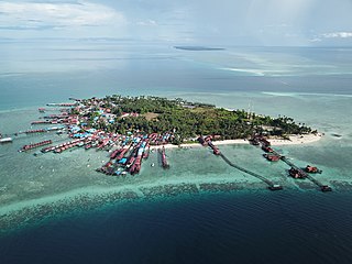
The Banggai Archipelago is a group of islands, which are located at the far eastern end of Central Sulawesi, Indonesia. It makes up a regency (kabupaten) of Central Sulawesi Province of Indonesia, created on 4 October 1999 by splitting the existing Banggai Regency into a new Banggai Regency situated on the mainland of Sulawesi and a Banggai Islands Regency then comprising the entire archipelago. On 14 December 2012 a further splitting of the Regency was the removal of the more southerly seven districts to form a new Banggai Laut Regency.

South Sorong Regency is a regency of Southwest Papua province of Indonesia. It has an area of 6,594.31 km2, and had a population of 37,900 at the 2010 Census and 52,469 at the 2020 Census; the official estimate as at mid 2022 was 53,884. The administrative centre is the town of Teminabuan.
Teluk Bintuni Regency or Bintuni Bay Regency is a regency of West Papua Province of Indonesia. It covers an area of 18,637 km2, comprising administrative districts on three sides of Bintuni Bay, a gulf that separates the Bird's Head Peninsula and Bomberai Peninsula which together form the main geographical constituents of the province; it had a population of 52,422 at the 2010 Census and 87,083 at the 2020 Census; the official estimate as at mid 2022 was 92,236. The administrative centre is the town of Bintuni.
Banggai Sea Regency is a regency in the province of Central Sulawesi, Indonesia. The regency was established on 14 December 2012, partitioned from the Banggai Islands Regency. It comprises southern part of the Banggai Islands archipelago, including the main island of Banggai itself, the islands of Labobo and Bangkurung to the southwest of Banggai Island, and the numerous small Bokan Islands to the southeast. It covers a land area of 725.67 km2, and the districts now comprising the new Regency had a population of 62,183 at the 2010 Census and 70,435 at the 2020 Census; the official estimate as at mid 2022 was 71,350.