
York Cliffs is a village in the town of York in York County, Maine, United States. [1] It lies east of the village of Cape Neddick and north of York Beach.
York Cliffs is a village in the town of York in York County, Maine, United States. [1] It lies east of the village of Cape Neddick and north of York Beach.

New Gloucester is a town in Cumberland County, Maine, United States. New Gloucester is included in the Lewiston-Auburn, Maine metropolitan New England city and town area. It is home to the Sabbathday Lake Shaker Village, the last active Shaker village in the U.S. The town's population was 5,676 at the 2020 census.

York Harbor is a census-designated place (CDP) in the town of York in York County, Maine, United States. The population was 3,033 at the 2010 census. York Harbor is a distinguished former Gilded Age summer colony noted for its resort architecture. It is part of the Portland–South Portland–Biddeford, Maine Metropolitan Statistical Area.

The Kativik Regional Government is the representative regional authority for most of the Nunavik region of Quebec. Nunavik is the northern half of the Nord-du-Québec administrative region and includes all the territory north of the 55th parallel. The administrative capital is Kuujjuaq, on the Koksoak River, about 50 kilometres inland from the southern end of the Ungava Bay.
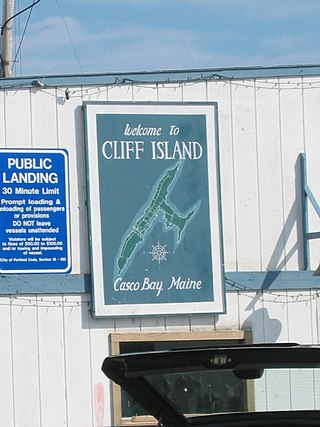
Cliff Island is an island in Casco Bay, Maine, United States. It is part of the city of Portland. As of the 2000 census, the island had a year-round population of approximately 60 people. In the summer, the island's population grows to about 200, despite the fact that it is the only year-round inhabited island in Casco Bay with no paved roads. The ZIP Code for Cliff Island is 04019.

Cushing Island, or Cushing's Island, is a privately owned island in Casco Bay in the U.S. state of Maine. Part of the city of Portland, roughly 45 families live there seasonally.
Bayville is a village in the town of Boothbay Harbor in Lincoln County, Maine, United States.
The Northern Forest Canoe Trail (NFCT) is a 740-mile (1,190 km) marked canoeing trail in the northeastern United States and Canada, extending from Old Forge in the Adirondacks of New York to Fort Kent, Maine. Along the way, the trail also passes through the states and provinces of Vermont, Quebec, and New Hampshire. The trail was opened on June 3, 2006.

Bald Head is a village in the town of York in York County, Maine, United States, on the Atlantic coast.
Kezar Falls is a small village on the Ossipee River in the town of Porter in Oxford County, Maine, United States.
The Batson River is a 6.4-mile-long (10.3 km) river in the town of Kennebunkport in the U.S. state of Maine. It flows into the west end of Goosefare Bay, an arm of the Atlantic Ocean, north of the village of Cape Porpoise.
The Cape Neddick River is a 3.7-mile-long (6.0 km) river in the town of York in southern Maine. It rises at the outlet of Chases Pond and flows east to the Atlantic Ocean, reaching its mouth at Cape Neddick Harbor near the village of Cape Neddick.

The Little Ossipee River is a 33.7-mile-long (54.2 km) tributary of the Saco River in southwestern Maine, USA.
The Little River is an 18.8-mile-long (30.3 km) tributary of the Presumpscot River in the U.S. state of Maine. It rises in the northern part of the town of Buxton in York County and flows southeast, then northeast into Gorham in Cumberland County. It flows northeast and east across Gorham, reaching the Presumpscot at the eastern boundary of the town, across from Windham.
The Little River is a 21.3-mile-long (34.3 km) tributary of the Salmon Falls River in the U.S. state of Maine. It rises from streams in York County, flows southwest through Lebanon, and reaches its confluence with the Salmon Falls River in Berwick.
The Littlefield River is a 3.8-mile-long (6.1 km) tributary of the Middle Branch Mousam River in York County, Maine. Via the Middle Branch and the Mousam River, its waters flow to the Atlantic Ocean.
The Middle Branch Mousam River is a 13.9-mile-long (22.4 km) river in southern Maine, flowing through the town of Alfred in York County. It is a tributary of the Mousam River, which flows to the Atlantic Ocean.
The South Branch Stroudwater River is a 3.1-mile-long (5.0 km) stream in Cumberland County, Maine, in the United States. It is a tributary of the Stroudwater River, part of the watershed of the Fore River, the harbor for the city of Portland.

The Spurwink River is a 4.6-mile-long (7.4 km) primarily tidal river in Cumberland County, Maine. It rises in the town of Cape Elizabeth and flows west, then southwest, through salt marshes to its mouth at the Atlantic Ocean. It is bridged by Maine State Route 77 at the river's approximate halfway point. From a point shortly above the bridge to the river's mouth, it forms the boundary between Cape Elizabeth to the east and the town of Scarborough to the west. The river's mouth is at the Scarborough village of Higgins Beach.
The Little River is a 2.9-mile-long (4.7 km) river in the town of York, Maine, that flows directly into the Atlantic Ocean. It is located north of the York River and south of the Cape Neddick River, reaching the Atlantic near the south end of York Beach.
Subotinac is a village in the municipality of Aleksinac, Serbia. According to the 2002 census, the village had a population of 1061 people.
Municipalities and communities of York County, Maine, United States | ||
|---|---|---|
| Cities |  | |
| Towns | ||
| CDPs | ||
| Unincorporated communities and villages | ||
| Footnotes | ‡This populated place also has portions in an adjacent county | |
43°11′28″N70°36′10″W / 43.19111°N 70.60278°W
| | This Maine state location article is a stub. You can help Wikipedia by expanding it. |