Location
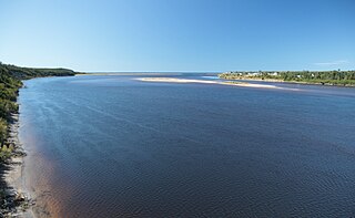
The river runs through the Basse-Côte-Nord between the Olomane and Little Mecatina rivers. It has a very irregular course of 160 kilometres (99 mi). Upstream from Lake Manet, about 75 kilometres (47 mi) from its mouth, the river divides into two sections which meet again at Foucher Lake, 55 kilometres (34 mi) further down. The river again divides into two channels 5 kilometres (3.1 mi) before reaching the gulf, which one arm enters downstream from the hamlet of Étamamiou and the other arm enters in Bussière Bay. There is an impressive rapids near the mouth, but above this the river is calm.
The mouth of the river is in the municipality of Côte-Nord-du-Golfe-du-Saint-Laurent in Le Golfe-du-Saint-Laurent Regional County Municipality. The river mouth is about 110 kilometres (68 mi) west of La Tabatière and 110 kilometres (68 mi) east of Natashquan. The Ouapitagone Archipelago is just south of the river mouth.
Name
In the Innu language the word "aitumamiu" means "splitting in two" or "lake with two outlets". The name is related to Itomamo. In the past it has been spelled Etamamu, Itamamiou, Hightomamiou, Aitomami, Etaumamiu, Itamamu and Itumamu. The present form of Étamamiou was used on a regional map of 1913. At that time, two sections of the river were identified, but one was incorrectly shown as ending in Coacoachou Lake and the Bay of Wolves (Baie des Loups) in the west. The error was not corrected on the maps until 1950. The Innu call the river Uiahtehau, meaning "the leaves change color in the fall." It is also called Mistamiskaikan Hipu.
Watershed
The river drains a watershed of around 3,000 square kilometres (1,200 sq mi). The mountainous region is rich in wildlife such as hare, ruffed grouse (Bonasa umbellus), spruce grouse (Falcipennis canadensis), ptarmigan (Lagopus), boreal woodland caribou (Rangifer tarandus caribou), moose (Alces alces), marten, Canada lynx (Lynx canadensis) and porcupine. The waters are used by beaver (Castor canadensis), muskrat (Ondatra zibethicus), otter, mink and migratory birds.
The Nipissis River is a river in the Côte-Nord region of Quebec, Canada, a tributary of the Moisie River. It is a recognized salmon river. The river is known for its steep cliffs, which provide a challenging ice-climbing environment.
The Little Watshishou River is a salmon river in the east of the Côte-Nord region of Quebec, Canada.

The Nabisipi River is a salmon river in the Côte-Nord region of Quebec, Canada. It flows into the Gulf of Saint Lawrence
The Ouapitagone Archipelago is a small group of rocky islands in the province of Quebec, Canada. They are off the Côte-Nord of the Gulf of Saint Lawrence.

The Nétagamiou River is a salmon river in the Côte-Nord region of the province of Quebec, Canada. It empties into the Gulf of Saint Lawrence.
The Gros Mécatina River is a salmon river in the Côte-Nord region of Quebec, Canada. It empties into the Gulf of Saint Lawrence.
The Coacoachou River is a river in the Côte-Nord region of Quebec, Canada.
The Olomane River is a river in the Côte-Nord region of Quebec, Canada.
The Véco River is a salmon river in the Côte-Nord region of Quebec, Canada, that empties into the Gulf of Saint Lawrence. It has been dammed to supply a hydroelectric power plant. The shoreline around the mouth of the river is protected as part of a federal bird sanctuary.
The Saint-Jean River, Usasumekw, Patamo, Rivière Saint-Jean (French), is a salmon river that flows from north to south, emptying into the Gulf of St. Lawrence, in Rivière-Saint-Jean municipality, Minganie RCM, Côte-Nord, Quebec, Canada.

The Sheldrake River is a river in the Côte-Nord region of Quebec, Canada. It flows into the Gulf of Saint Lawrence. There is a 25 MW hydroelectric power station on the river.
The Kegaska River is a salmon river flowing on North shore of Estuary of Saint Lawrence. It crosses the unorganized territory of Petit-Mécatina, in the Le Golfe-du-Saint-Laurent Regional County Municipality, in the administrative region in the Côte-Nord, in the province of Quebec, Canada.
The Chécatica River is a salmon river in the Côte-Nord region of Quebec, Canada. It empties into the Gulf of Saint Lawrence.
The Saint-Paul River is a river on the Labrador Peninsula of eastern Canada. Its source is located in the province of Newfoundland and Labrador and it empties into the Gulf of Saint Lawrence in the Côte-Nord region of Quebec. The Saint-Paul River is a salmon river that flows in a southerly direction.

The Saint-Augustin River is a salmon river in the Côte-Nord region of Quebec, Canada. It empties into the Gulf of Saint Lawrence.
The Napetipi River is a salmon river in the Côte-Nord region of Quebec, Canada. It empties into the Gulf of Saint Lawrence.
The Coxipi River is a salmon river in the Côte-Nord region of Quebec, Canada. It flows south through Quebec from Labrador and empties into the Gulf of Saint Lawrence.

The Kécarpoui River is a salmon river in the Côte-Nord region of Quebec, Canada. It flows south and empties into the Gulf of Saint Lawrence.
The Musquanousse River is a salmon river in the Côte-Nord region of Quebec, Canada. It flows south and empties into the Gulf of Saint Lawrence.
The Washicoutai River is a salmon river in the Côte-Nord region of Quebec, Canada. It flows south and empties into the Gulf of Saint Lawrence.
This page is based on this
Wikipedia article Text is available under the
CC BY-SA 4.0 license; additional terms may apply.
Images, videos and audio are available under their respective licenses.
