
Minganie is a regional county municipality in the Côte-Nord region of Quebec, Canada. It includes Anticosti Island. Its seat is Havre-Saint-Pierre.

Blanc-Sablon is the easternmost community in Le Golfe-du-Saint-Laurent Regional County Municipality, in the administrative région of Côte-Nord, in the province of Quebec, Canada. With a population of 1,118 inhabitants, it is the most populous community in the county municipality.

Côte-Nord-du-Golfe-du-Saint-Laurent is a municipality in the regional county municipality of Le Golfe-du-Saint-Laurent in the Côte-Nord region of the province of Quebec, Canada. The municipality consists of two non-contiguous areas, both along the shores of the Gulf of Saint Lawrence. The larger main part stretches from the Natashquan River to the Gros Mécatina River and includes all populated places. The eastern part is a small section between Middle Bay and Brador.
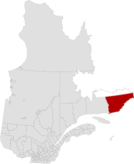
Le Golfe-du-Saint-Laurent is a regional county municipality in the Côte-Nord region of far-eastern Quebec, Canada. It includes all communities along the Gulf of Saint Lawrence between the Natashquan River and the Newfoundland and Labrador border.

The Natashquan is a river in the Canadian provinces of Quebec and Newfoundland and Labrador. It flows south into the Gulf of Saint Lawrence.

Kegashka, population 138, is the easternmost point in the Côte-Nord region of Quebec, Canada to be reachable by road without passing through Newfoundland and Labrador. Quebec Route 138 reached the community on September 26, 2013 with the inauguration of a bridge across the Natashquan River.

The Musquaro Lake is located in the unorganized territory of Petit-Mécatina, Quebec, in the Regional County Municipality (MRC) Le Golfe-du-Saint-Laurent Regional County Municipality, in the administrative area of the Côte-Nord (North-Shore), in Quebec, in Canada.
The Étamamiou River is a river in the Côte-Nord region of Quebec, Canada.
The Gros Mécatina River is a salmon river in the Côte-Nord region of Quebec, Canada. It empties into the Gulf of Saint Lawrence.
The Coacoachou River is a river in the Côte-Nord region of Quebec, Canada.
The Olomane River is a river in the Côte-Nord region of Quebec, Canada.
The Véco River is a salmon river in the Côte-Nord region of Quebec, Canada, that empties into the Gulf of Saint Lawrence. It has been dammed to supply a hydroelectric power plant. The shoreline around the mouth of the river is protected as part of a federal bird sanctuary.
The Kegaska River is a salmon river flowing on North shore of Estuary of Saint Lawrence. It crosses the unorganized territory of Petit-Mécatina, in the Le Golfe-du-Saint-Laurent Regional County Municipality, in the administrative region in the Côte-Nord, in the province of Quebec, Canada.
The Musquanousse River is a salmon river in the Côte-Nord region of Quebec, Canada. It flows south and empties into the Gulf of Saint Lawrence.
The Washicoutai River is a salmon river in the Côte-Nord region of Quebec, Canada. It flows south and empties into the Gulf of Saint Lawrence.
The Ha! Ha! River constitutes the outlet of the Plamondon Lake reservoir, flowing in the municipalities of Côte-Nord-du-Golfe-du-Saint-Laurent and Gros-Mécatina, in the Le Golfe-du-Saint-Laurent Regional County Municipality, in the administrative region of Côte-Nord, in Quebec, in Canada.
The Baie des Ha! Ha! is located in the municipality of Gros-Mécatina, in the Le Golfe-du-Saint-Laurent Regional County Municipality, on the north shore of Gulf of Saint Lawrence, in the administrative region of Côte-Nord in eastern Quebec, Canada.
The Jacques-Cartier South River is a tributary of the rivière Jacques-Cartier Nord-Ouest, located in the unorganized territory of Lac-Jacques-Cartier, in the La Côte-de-Beaupré Regional County Municipality, in the administrative region of Capitale-Nationale, in Quebec, Canada. The course of the river passes in particular in the Jacques-Cartier National Park. The head water is Petit lac Jacques-Cartier.
The lac Long is crossed by the Noire River, entirely in the municipality of Saint-Alban, in the MRC of Portneuf Regional County Municipality, in the administrative region of Capitale-Nationale, in province, Canada.
Simard Lake is a freshwater body of the unorganized territory of Petit-Mécatina and the municipality of Kegaska, in the Le Golfe-du-Saint-Laurent Regional County Municipality, in the administrative region of Côte-Nord, in the province of Quebec, in Canada.
