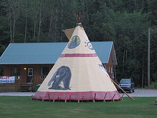
The Cree are one of the largest groups of First Nations in North America.

The Innu / Ilnu or Innut / Innuat / Ilnuatsh ("people"), formerly usually called Montagnais are the Indigenous inhabitants of an area in Canada they refer to as Nitassinan or Innu-assi, which comprises most of the northeastern portion of the present-day province of Quebec and some eastern portions of Labrador.

Sept-Îles is a city in the Côte-Nord region of eastern Quebec, Canada. It is among the northernmost locales with a paved connection to the rest of Quebec's road network. The population was 25,686 as of the Canada 2011 Census. The town is called Uashau, meaning "bay," in the Innu language.
Indigenous peoples in Quebec total 11 distinct ethnic groups. The 10 First Nations and the Inuit communities number 141,915 people and account for approximately 1.75% of the population of Quebec, Canada.

Schefferville is a town in the Canadian province of Quebec. Schefferville is in the heart of the Naskapi and Innu territory in northern Quebec, less than 2 km from the border with Labrador on the north shore of Knob Lake. It is located within the Caniapiscau Regional County Municipality and has an area of 25.11 square kilometres (9.70 sq mi). Schefferville completely surrounds the autonomous Innu community of Matimekosh, and it abuts the small community of Lac-John Reserve. Both of the latter communities are First Nations Innu reserves. Schefferville is also close to the Naskapi reserved land of Kawawachikamach.

Kawawachikamach is a Naskapi/Iyiyiw First Nations reserve and community at the south end of Lake Matemace, approximately 15 kilometres (9 mi) northeast of Schefferville, Quebec, Canada. It belongs to the Naskapi Nation of Kawawachikamach. The village was built by the Naskapi/Iyiyiw from 1980 to 1983. The language spoken is Iyiyiw-Imuun, a dialect closely related to Innu and Iynu. The name means "the winding river".

Natashquan is a First Nations reserve in the Canadian province of Quebec, belonging to the Natashquan Innu band. The reserve is located on the north shore of the Gulf of Saint Lawrence at the mouth of the Natashquan River, 336 kilometres (209 mi) east of Sept-Îles and has been accessible by Route 138 since 1996.

La Romaine, also known as Unamenshipit in Innu-aimun, is an Innu First Nations reserve in the Côte-Nord region of Quebec, Canada, at the mouth of the Olomane River on the Gulf of Saint Lawrence. It belongs to the Innu band of Unamen Shipu. Being an enclave within the Municipality of Côte-Nord-du-Golfe-du-Saint-Laurent, it is geographically within Le Golfe-du-Saint-Laurent Regional County Municipality but administratively not part of it. Directly adjacent to the reserve is the community of La Romaine consisting of a small French-speaking population.

Pessamit, is a First Nations reserve and Innu community in the Canadian province of Quebec, located about 50 kilometres (31 mi) southwest from Baie-Comeau along the north shore of the Saint Lawrence River at the mouth of the Betsiamites River. It is across the river directly north of Rimouski, Quebec. It belongs to the Pessamit Innu Band.

Pakuashipi is an Innu community in the Canadian province of Quebec, located on the north shore of the Gulf of Saint Lawrence in the Côte-Nord region. It is on the western shore of the mouth of the Saint-Augustin River, opposite the settlement of Saint-Augustin. It is not a reserve, but a community within the Municipality of Saint-Augustin, occupied by the Innu band of Pakua Shipi. Although they hold no formal legal title to the land at this time, negotiations are still ongoing to determine their aboriginal rights.
Essipit is an Innu Indian reserve in the Canadian province of Quebec, located on the north shore of the Gulf of Saint Lawrence in the Côte-Nord region. It belongs to the Innue Essipit First Nation.

Matimekosh is a First Nations reserve on Lake Pearce in the Côte-Nord region of Quebec, Canada. Together with the Lac-John Reserve, it belongs to the Innu Nation of Matimekush-Lac John. It is an enclave in the centre of the Municipality of Schefferville, and geographically within the Caniapiscau Regional County Municipality but administratively not part of it. Matimekosh means "small trout".

Mashteuiatsh, home to the Pekuakamiulnuatsh First Nation, is a First Nations reserve in the Saguenay–Lac-Saint-Jean region of Quebec, Canada, about 6 kilometres (3.7 mi) north from the centre of Roberval. It is located on a headland jutting out on the western shores of Lake Saint-Jean known as Pointe-Bleue, in the geographic township of Ouiatchouan, and belongs to the Montagnais du Lac St-Jean Innu band. It is geographically within the Le Domaine-du-Roy Regional County Municipality but administratively not part of it.

Obedjiwan is a First Nations reserve and village on the north shore of Gouin Reservoir in the Mauricie region of Quebec, Canada. It belongs to the Atikamekw of Opitciwan band of the Atikamekw Nation.

Wemotaci is a First Nations reserve on the north shore of the Saint-Maurice River at the mouth of the Manouane River in the Mauricie region of Quebec, Canada. Together with the Obedjiwan and the Coucoucache Indian Reserve No. 24, it belongs to the Atikamekw First Nation.

Lac-Ashuapmushuan is an unorganized territory in the Canadian province of Quebec, Canada, located in the regional county municipality of Le Domaine-du-Roy. The region had a population of 28 as of the Canada 2011 Census, and covered a land area of 14,998.91 km2. It is home to the Ashuapmushuan Wildlife Reserve.
Lac-John is a First Nations reserve on John Lake in the Côte-Nord region of Quebec, Canada, about 3.5 kilometres (2.2 mi) north-east from the centre of Schefferville. Together with the Matimekosh Reserve, it belongs to the Innu Nation of Matimekush-Lac John. It is geographically within the Caniapiscau Regional County Municipality but administratively not part of it.

Innus of Ekuanitshit are a First Nation band in Quebec, Canada. They live primarily in the Indian reserve of Mingan on the north coast of the St Lawrence River. As of October 2019, the band had a registered population of 677 members.
Marcelline Picard-Kanapé, a.k.a.Marcelline P. Kanapé, is considered one of the great specialists in education among First Nations in Canada, distinguishing herself since the 1950s. She was the first Innu teacher in Quebec, the first Aboriginal person to serve on the Conseil supérieur de l'éducation, and the first female Innu chief.
Mingan River is a 117 kilometres (73 mi) salmon river of the Côte-Nord region of Quebec. It flows from north to south and empties into the Gulf of Saint Lawrence.


