Natashquan 1

Last updated

Natashquan
First Nations reserve
Nutashkuan 2010-03-22.jpg
Canada Cote-Nord Region Quebec.png
Red pog.svg
Natashquan
Location in Côte-Nord region of Quebec.
Coordinates: 50°08′N61°48′W / 50.133°N 61.800°W / 50.133; -61.800 Coordinates: 50°08′N61°48′W / 50.133°N 61.800°W / 50.133; -61.800
CountryFlag of Canada (Pantone).svg  Canada
ProvinceFlag of Quebec.svg  Quebec
Region Côte-Nord
Regional countynone
Formed1953
Government
[1]
  ChiefFrançois Bellefleur
  Federal riding Manicouagan
  Prov. riding Duplessis
Area
[2]
  Land0.65 km2 (0.25 sq mi)
Population
 (2006) [2]
  Total810
  Density1,246.5/km2 (3,228/sq mi)
Time zone UTC-5 (Within the AST legislated time zone boundary but observes EST [3] )
  Summer (DST) UTC-4 (EDT)
Postal Code
G0G 2E0
Area code(s) 418 and 581

Natashquan (officially Natashquan 1 and known in Innu as Nutashkuan) is a First Nations reserve in the Canadian province of Quebec, belonging to the Natashquan Innu band. The reserve is located on the north shore of the Gulf of Saint Lawrence at the mouth of the Natashquan River, 336 kilometres (209 mi) east of Sept-Îles and has been accessible by Route 138 since 1996.

Contents

The reserve should not be confused with the adjacent but distinct township of Natashquan just to the north and east.

The community is serviced by a nursing station, community radio station, municipal water and sewer system, fire station, and an aboriginal police force. [4]

The site was mapped in 1684 by Louis Jolliet who called it Noutascoüan. It was subsequently spelled as Nontascouanne (1734), Natasquan (1831), Nataskwan (1844), Natashkwan (1846), Natosquan (1857), Nataskouan (1858), and taking its current form, Natashquan, circa 1895. This name, spelled Nutahkuant or Nutashkuan in the contemporary Innu language, is usually translated as "where the black bear is taken" or "where one hunts for bear." [5]

History

Historically, the nomadic Innu lived on their hunting grounds of the interior during the winter and would move to the coast in the summer for salmon fishing and seal hunting. From as early as 1710, a trading post was established on the left (south) bank of the Natashquan River and later on the opposite bank to conduct fur trade with the indigenous. They gathered at the post during their annual migration and began to settle there permanently. The post was acquired by the Hudson's Bay Company in the middle of the 19th century, but abandoned circa 1914 due to lack of profitability. [5] [6]

In 1909, the first land survey was conducted for the creation of a reserve. In 1952, the first 20.5 acres (83,000 m2) of land were bought by the Government of Canada and transferred for the use by the Innu on 31 March 1953. The reserve was incrementally enlarged in 1954, 1970, and 1993. [7]

Demographics

As of December 2009, the band counted 984 members, of which 920 persons lived on the reserve. [4] There are 177 private dwellings that are occupied by usual residents, out of a total of 181. The mother tongue of the residents is: [2]

Population trend: [8]

Climate

Natashquan has a subarctic climate (Dfc), typical of communities along the Gulf of St Lawrence. Summers are mild and rainy, with mild days and cool nights. Winters are cold with extremely heavy annual snowfall, averaging 140 inches (356 cm). Natashquan receives around 1,900 hours of sunshine per year. [9]

Climate data for Natashquan
MonthJanFebMarAprMayJunJulAugSepOctNovDecYear
Record high °C (°F)8.2
(46.8)
6.7
(44.1)
12.8
(55.0)
17.8
(64.0)
23.9
(75.0)
26.4
(79.5)
28.9
(84.0)
28.3
(82.9)
26.1
(79.0)
19.4
(66.9)
14.4
(57.9)
9.4
(48.9)
28.4
(83.1)
Average high °C (°F)−7.9
(17.8)
−7.2
(19.0)
−2
(28)
3.3
(37.9)
9.6
(49.3)
15.2
(59.4)
18.7
(65.7)
18
(64)
13.8
(56.8)
7.9
(46.2)
2
(36)
−4.8
(23.4)
5.5
(41.9)
Daily mean °C (°F)−13.5
(7.7)
−12.7
(9.1)
−7.1
(19.2)
−0.4
(31.3)
5.4
(41.7)
10.8
(51.4)
14.5
(58.1)
13.8
(56.8)
9.6
(49.3)
3.9
(39.0)
−1.9
(28.6)
−9.7
(14.5)
1.1
(34.0)
Average low °C (°F)−19.1
(−2.4)
−18.2
(−0.8)
−12
(10)
−4.1
(24.6)
1
(34)
6.3
(43.3)
10.3
(50.5)
9.5
(49.1)
5.3
(41.5)
0
(32)
−5.7
(21.7)
−14.5
(5.9)
−3.4
(25.9)
Record low °C (°F)−42.8
(−45.0)
−37.2
(−35.0)
−33.7
(−28.7)
−22.5
(−8.5)
−12.8
(9.0)
−3.9
(25.0)
1.1
(34.0)
−1.1
(30.0)
−7.8
(18.0)
−15
(5)
−31.7
(−25.1)
−35
(−31)
−42.8
(−45.0)
Average precipitation mm (inches)95.7
(3.77)
67.4
(2.65)
95.2
(3.75)
81.7
(3.22)
88.6
(3.49)
86.2
(3.39)
99
(3.9)
96
(3.8)
100.5
(3.96)
107.9
(4.25)
106.4
(4.19)
105.3
(4.15)
1,129.9
(44.52)
Average rainfall mm (inches)18.8
(0.74)
12.5
(0.49)
27.7
(1.09)
47.2
(1.86)
83.6
(3.29)
86.2
(3.39)
99
(3.9)
96
(3.8)
100.4
(3.95)
102.2
(4.02)
70.5
(2.78)
29.4
(1.16)
773.5
(30.47)
Average snowfall cm (inches)79.1
(31.1)
55.8
(22.0)
66.9
(26.3)
33.3
(13.1)
4.5
(1.8)
0.0
(0.0)
0.0
(0.0)
0.0
(0.0)
0.0
(0.0)
5.5
(2.2)
34.4
(13.5)
76.8
(30.2)
356.3
(140.2)
Average precipitation days (≥ 0.2 mm)19.115.815.714.513.913.014.313.214.315.215.117.7181.8
Average rainy days (≥ 0.2 mm)2.52.44.58.513.213.014.313.214.314.49.04.4113.7
Average snowy days (≥ 0.2 cm)18.414.913.69.31.80.00.00.00.032.29.216.185.53
Mean monthly sunshine hours 104.7125.3148.2161.4214.2219.3236.8228.2166.0125.496.887.21,913.5
Source: Environment Canada [10]

Economy

Natashquan's economy is mostly based on arts and handicrafts, trapping, tourism, and some construction, transport, and commercial fishing. In all there are some 20 businesses on the reserve. The Band council owns a boat and holds a crab-fishing licence. [4]

Local economic development is promoted by and the responsibility of the Corporation de développement économique de Natashquan.

Education

There is only one school on the reserve, École Uauitshitun, that provides pre-Kindergarten to Secondary grade 3. [4]

See also

Related Research Articles

Innu First Nation in North America

The Innu / Ilnu or Innut / Innuat / Ilnuatsh ("people"), formerly called Montagnais from the French colonial period, are the Indigenous inhabitants of territory in the northeastern portion of the present-day province of Quebec and some eastern portions of Labrador. They refer to their traditional homeland as Nitassinan or Innu-assi.

Minganie Regional County Municipality Regional county municipality in Quebec, Canada

Minganie is a regional county municipality in the Côte-Nord region of Quebec, Canada. It includes Anticosti Island. Its seat is Havre-Saint-Pierre.

Roberval, Quebec City in Quebec, Canada

Roberval is a city on the south-western shore of Lac Saint-Jean in the Le Domaine-du-Roy Regional County Municipality of Quebec, Canada. With a population of 10,227 in the Canada 2011 Census, it is the fourth largest city on this lake after Alma, Dolbeau-Mistassini and Saint-Félicien. It is the seat of the Domaine-du-Roy RCM and the main service centre for the region with a hospital and some government services. It is also the seat of the judicial district of Roberval.

Schefferville Town in Quebec, Canada

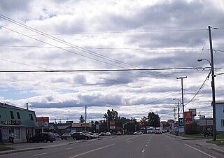
Schefferville is a town in the Canadian province of Quebec. Schefferville is in the heart of the Naskapi and Innu territory in northern Quebec, less than 2 km from the border with Labrador on the north shore of Knob Lake. It is located within the Caniapiscau Regional County Municipality and has an area of 25.11 square kilometres (9.70 sq mi). Schefferville completely surrounds the autonomous Innu community of Matimekosh, and it abuts the small community of Lac-John Reserve. Both of the latter communities are First Nations Innu reserves. Schefferville is also close to the Naskapi reserved land of Kawawachikamach.

Kawawachikamach, Quebec Naskapi reserved land in Quebec, Canada

Kawawachikamach is a Naskapi/Iyiyiw First Nations reserve and community at the south end of Lake Matemace, approximately 15 kilometres (9 mi) northeast of Schefferville, Quebec, Canada. It belongs to the Naskapi Nation of Kawawachikamach. The village was built by the Naskapi/Iyiyiw from 1980 to 1983. The language spoken is Iyiyiw-Imuun, a dialect closely related to Innu and Iynu. The name means "the winding river".

Saint-Augustin, Côte-Nord, Quebec Municipality in Quebec, Canada

Saint-Augustin is a municipality and settlement in Le Golfe-du-Saint-Laurent Regional County Municipality in the Côte-Nord region of Quebec, Canada, known by its large English-speaking population as St. Augustine. Its territory stretches along the Gulf of Saint Lawrence, whereas the settlement itself is located on a peninsula in the Saint Augustin Bay at the mouth of the Saint-Augustin River. On the opposite shore of this river is the Innu settlement of Pakuashipi.

La Romaine, Quebec First Nations reserve in Quebec, Canada

La Romaine, also known as Unamenshipit in Innu-aimun, is an Innu First Nations reserve in the Côte-Nord region of Quebec, Canada, at the mouth of the Olomane River on the Gulf of Saint Lawrence. It belongs to the Innu band of Unamen Shipu. Being an enclave within the Municipality of Côte-Nord-du-Golfe-du-Saint-Laurent, it is geographically within Le Golfe-du-Saint-Laurent Regional County Municipality but administratively not part of it. Directly adjacent to the reserve is the community of La Romaine consisting of a small French-speaking population.

Pessamit Indian reserve in Quebec, Canada

Pessamit, is a First Nations reserve and Innu community in the Canadian province of Quebec, located about 50 kilometres (31 mi) southwest from Baie-Comeau along the north shore of the Saint Lawrence River at the mouth of the Betsiamites River. It is across the river directly north of Rimouski, Quebec. It belongs to the Pessamit Innu Band.

Mingan, Quebec First Nations reserve in Quebec, Canada

Mingan, also known as Ekuanitshit in Innu-aimun, is an Innu First Nations reserve in the Canadian province of Quebec, at the mouth of the Mingan River on Mingan Bay of the Gulf of Saint Lawrence. It belongs to the Innu band of Ekuanitshit. Geographically it is within the Minganie Regional County Municipality but administratively not part of it.

Pakuashipi Indian settlement in Quebec, Canada

Pakuashipi is an Innu community in the Canadian province of Quebec, located on the north shore of the Gulf of Saint Lawrence in the Côte-Nord region. It is on the western shore of the mouth of the Saint-Augustin River, opposite the settlement of Saint-Augustin. It is not a reserve, but a community within the Municipality of Saint-Augustin, occupied by the Innu band of Pakua Shipi. Although they hold no formal legal title to the land at this time, negotiations are still ongoing to determine their aboriginal rights.

Essipit Indian reserve in Quebec, Canada

Essipit is an Innu Indian reserve in the Canadian province of Quebec, located on the north shore of the Gulf of Saint Lawrence in the Côte-Nord region. It belongs to the Innue Essipit First Nation.

Matimekosh Indian reserve in Quebec, Canada

Matimekosh is a First Nations reserve on Lake Pearce in the Côte-Nord region of Quebec, Canada. Together with the Lac-John Reserve, it belongs to the Innu Nation of Matimekush-Lac John. It is an enclave in the centre of the Municipality of Schefferville, and geographically within the Caniapiscau Regional County Municipality but administratively not part of it. Matimekosh means "small trout".

Mashteuiatsh Indian reserve in Quebec, Canada

Mashteuiatsh, home to the Pekuakamiulnuatsh First Nation, is a First Nations reserve in the Saguenay–Lac-Saint-Jean region of Quebec, Canada, about 6 kilometres (3.7 mi) north from the centre of Roberval. It is located on a headland jutting out on the western shores of Lake Saint-Jean known as Pointe-Bleue, in the geographic township of Ouiatchouan, and belongs to the Montagnais du Lac St-Jean Innu band. It is geographically within the Le Domaine-du-Roy Regional County Municipality but administratively not part of it.

Rivière-au-Tonnerre, Quebec Municipality in Quebec, Canada

Rivière-au-Tonnerre is a municipality in the Côte-Nord region of the province of Quebec in Canada.

Natashquan (municipality) Municipality in Quebec, Canada

Natashquan is a municipality in Minganie Regional County Municipality, Côte-Nord region, Quebec, Canada. It should not be confused with the adjacent but separate Innu reserve of Natashquan 1.

Coucoucache Indian Reserve No. 24 Native reserve in Quebec, Canada

Coucoucache was a tiny First Nation reserve, in Cloutier Township, on the north shore of Reservoir Blanc on the Saint-Maurice River in the Mauricie region of Quebec, Canada. It belonged to the Atikamekw First Nation of Wemotaci but had no permanent population in recent decades.

Manawan First Nations reserve in Quebec, Canada

Manawan, officially named communauté Atikamekw de Manawan, is a First Nations reserve on the south-western shores of Lake Métabeskéga in the Lanaudière region of Quebec, Canada. It belongs to the Atikamekw of Manawan band of the Atikamekw Nation.

Lac-John Indian reserve in Quebec, Canada

Lac-John is a First Nations reserve on John Lake in the Côte-Nord region of Quebec, Canada, about 3.5 kilometres (2.2 mi) north-east from the centre of Schefferville. Together with the Matimekosh Reserve, it belongs to the Innu Nation of Matimekush-Lac John. It is geographically within the Caniapiscau Regional County Municipality but administratively not part of it.

Natashquan River River in Canada

The Natashquan is a river in the Canadian provinces of Quebec and Newfoundland and Labrador. It flows south into the Gulf of Saint Lawrence.

Montagnais of Natashquan or Nutashkuan Innu First Nation is an Innu First Nation band government in Quebec, Canada. The band lives on the Indian reserve Natashquan 1 in the Côte-Nord region. As of 2019, they have a registered population of 1,215 members. They are part of the Regroupement Mamit Innuat tribal council.

References

  1. Ministère des Affaires Municipales, Régions et Occupation du territoire – Répertoire des municipalités: Natashquan réserve indienne Archived 16 June 2011 at the Wayback Machine
  2. 1 2 3 Statistics Canada 2006 Census – Natashquan (indian reserve) community profile
  3. National Research Council Canada – Time Zones & Daylight Saving Time Archived 17 March 2010 at the Wayback Machine
  4. 1 2 3 4 "Natashquan First Nation". Aboriginal Community profiles. Indian and Northern Affairs Canada. Retrieved 15 September 2010.
  5. 1 2 "Natashquan (Réserve indienne)" (in French). Commission de toponymie du Québec. Retrieved 15 September 2010.
  6. "Natashquan (Municipalité de canton)" (in French). Commission de toponymie du Québec. Retrieved 15 September 2010.
  7. Natural Resources Canada – Legal Surveys Division, Historical Review – Natashquan land title history
  8. Statistics Canada: 1996, 2001, 2006 census
  9. Canada, Environment and Climate Change (19 January 2011). "Canadian Climate Normals 1971-2000 Station Data - Climate - Environment and Climate Change Canada". climate.weather.gc.ca. Retrieved 8 June 2020.
  10. Environment Canada Canadian Climate Normals 1971–2000, accessed 20 March 2012