Pago Pago is the capital of American Samoa. It is in Maoputasi County on Tutuila, the main island of American Samoa.

The National Park of American Samoa is a national park of the United States located in the territory of American Samoa, distributed across four islands: Tutuila, Ofu, Olosega, and Ta‘ū. The park preserves and protects coral reefs, tropical rainforests, fruit bats, and the Samoan culture. Popular activities include hiking and snorkeling. Of the park's 8,257 acres (3,341 ha), 2,500 acres (1,000 ha) is coral reefs and ocean. The park is the only American National Park Service system unit south of the equator.

Tutuila is the largest and most populous island of American Samoa and is part of the archipelago of the Samoan Islands. It is the third largest island in the Samoan Islands chain of the Central Pacific. It is located roughly 4,000 kilometers (2,500 mi) northeast of Brisbane, Australia and lies over 1,200 kilometers (750 mi) to the northeast of Fiji. It contains a large, natural harbor, Pago Pago Harbor, where Pago Pago, the capital of American Samoa, is situated. Pago Pago International Airport is also located on Tutuila. The island's land expanse is about 68% of the total land area of American Samoa. With 56,000 inhabitants, it is also home to 95% of the population of American Samoa. The island has six terrestrial and three marine ecosystems.

The Manuʻa Islands, or the Manuʻa tele, in the Samoan Islands, consists of three main islands: Taʻū, Ofu and Olosega. The latter two are separated only by the shallow, 137-meter-wide Āsaga Strait, and are now connected by a bridge over the strait. The islands are located some 110 kilometers east of Tutuila and are a part of American Samoa, an unincorporated territory of the United States. Their combined area is 56 square kilometers, and they have a total population of 1,400. Taʻu is the largest of these islands, with an area of 44 km2 (17 sq mi), and it has the highest point of the Manuʻa, at 931 meters. Politically, the islands form the Manuʻa District, one of the three administrative divisions of American Samoa.

Poloa is a village in American Samoa. It is located at the west side of Tutuila in the Alataua District. The village has 193 residents in 2010. The main denominations in the area are Methodist and Christian. Poloa has one elementary school. It is located in Lealataua County.

Aunuʻu is a small volcanic island off the southeastern shore of Tutuila in Saʻole County, American Samoa. It has a land area of 374.83 acres, and a 2010 census population of 436 persons. Politically, it is a part of the Eastern District, one of the two primary political divisions of American Samoa.

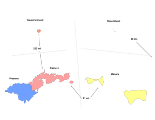
The Eastern District is one of the primary districts of American Samoa. It consists of the eastern portion of Tutuila, American Samoa's largest island, plus the island of Aunu'u. The district has a land area of 67.027 km2 (25.879 sq mi) and a 2010 census population of 23,030. It contains 34 villages plus a portion of Nuʻuuli village. Among these are Pago Pago, Fagatogo, and Utulei.

Leone is the second-largest city on Tutuila Island's west coast. The village is on the south-west coast of Tutuila Island, American Samoa. Leone was the ancient capital of Tutuila Island. Leone was also where the Samoan Islands’ first missionary, John Williams, visited on October 18, 1832. A monument in honor of Williams has been erected in front of Zion Church. Its large church was the first to be built in American Samoa. It has three towers, a carved ceiling and stained glass. Until steamships were invented, Leone was the preferred anchorage of sailing ships which did not risk entering Pago Pago Harbor. Much early contact between Samoans and Europeans took place in Leone.

The Blunts Point Battery, also known as Blunts Point Naval Gun or Matautu Ridge Gun Site, is a gun battery on Matautu Ridge near Pago Pago, American Samoa. It was part of the fortification of the Samoan Islands which took place after the attack on Pearl Harbor, and is a rare example of a World War II Pacific coastal gun which remains in relatively pristine condition. It was declared a National Historic Landmark in 1987.

Afono is a village on the northeast coast of Tutuila Island, American Samoa. One of the island's more populous villages, it is located on the edge of Afono Bay, at the eastern edge of the National Park of American Samoa. It is connected by Highway 6 to Vatia, which lies along the coast to the northwest, and to Aua, on the edge of Pago Pago Harbor to the south via a winding stretch of highway which crosses the spine of the island.

Alega is a village on the southeast coast of Tutuila Island, American Samoa. One of the island's least populous villages, it is located to the east of Pago Pago Harbor and to the west of Faga'itua Bay. Alega, with a population of 29 according to the 2020 U.S. Census, is one of the smallest villages in American Samoa, surpassing only Maloata and Sili in population.
ʻAuʻasi is a village in the east of Tutuila Island, American Samoa. One of the island's more populous villages, it is located on the south coast, close to the eastern tip of the island and to the smaller offshore island of Aunuʻu. It is located in Saʻole County.

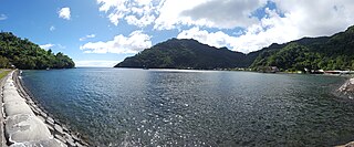
Pago Pago Harbor on Tutuila Island in American Samoa is one of the world's largest natural harbors. The capital, Pago Pago is located on the inner reaches of the harbor, close to its northwesternmost point. It has the highest annual rainfall of any harbor in the world. It is also considered one of the best and deepest deepwater harbors in the South Pacific Ocean or in Oceania as a whole. Pago Pago Bay is over 400 feet (120 m) deep and two miles (3.2 km) long. As part of the Pago Volcano caldera, the harbor is 50% landlocked.
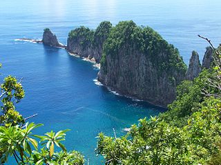
Fatu-ma-futi is a village in central Tutuila Island, American Samoa. It is located at the easternmost point of the entrance to Pago Pago Harbor, south of Pago Pago. Flowerpot Rock, also known as Fatu Rock, is found along the highway in Fatumafuti. Legend says Fatu and Futi were lovers living in the Manu’a Islands. They wanted to get married but were forbidden to do so. The couple sailed from Savai'i (Samoa), looking for Tutuila Island; their canoe sank, and the pair were transformed into these tree-topped islands.

Aʻasu or Āsu is a village on the north coast of Tutuila Island, American Samoa. It is located to the west of Fagasa and northwest of Pago Pago. It is one of multiple villages involved in an archaeological survey of the island. Aʻasu lies on Massacre Bay and can be reached from a hiking trail in Aʻasufou.

The Jean P. Haydon Museum is a museum in Pago Pago dedicated to the culture and history of the United States territory of American Samoa. It contains a collection of canoes, coconut-shell combs, pigs’ tusk armlets and native pharmacopoeia. It also houses exhibits on natural history, tapa making, traditional tattooing, as well as a collection of war clubs, kava bowls, and historic photographs. Constructed in 1913 as U.S. Naval Station Tutuila Commissary, the building was home to Tutuila Island's Post Office from 1950 to 1971. The museum has displays of various aspects of the Samoan Islands’ culture and history. It is the official repository for collections of artifacts for American Samoa. Funded by the American Samoa Council on Arts, Culture and the Humanities, it is the venue used for numerous of the cultural resource activities in American Samoa.

Vatia is a village on Tutuila Island in American Samoa. It is a north shore village located on Vatia Bay. The road to Vatia, American Samoa Highway 006, is the only road going through National Park of American Samoa. Vatia is a scenic community at the foot of Pola Ridge and surrounded by the national park. It is only reached by Route 6 which traverses the national park before reaching Vatia. There was once a hiking trail over Maugaloa Ridge from Leloaloa, but since the completion of Route 6, this trail is now overgrown. It is home to a beach, and panoramic views of jungle-covered peaks surround the village on all sides. Vatia is the center of the Tutuila-section of National Park of American Samoa. It is located in Vaifanua County.
Tula is a village in the Eastern District of Tutuila Island in American Samoa. Tula is located in Vaifanua County and had a population of 405 as of the 2010 U.S. Census.

Fagasā is a village in the Eastern District of Tutuila Island in American Samoa. The village lies by Fagasa Bay, on the north shore of the island. Its name is Samoan and translates to "Forbidden Bay." The village borders the Tutuila-section of National Park of American Samoa. The trailhead to Mount ʻAlava is located near the village by Fagasa Pass.
Saʻilele is a village on the north shore in the Eastern District of Tutuila Island in American Samoa. It is reached from a cross-island road which leads north from the village of Fagaʻitua. On a track east of the village is a burial ground where some aliʻi were buried.


