
County Down is one of the six counties of Northern Ireland, one of the nine counties of Ulster and one of the traditional thirty-two counties of Ireland. It covers an area of 961 sq mi (2,490 km2) and has a population of 531,665. It borders County Antrim to the north, the Irish Sea to the east, County Armagh to the west, and County Louth across Carlingford Lough to the southwest.
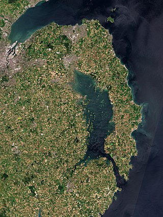
The Ards Peninsula is a peninsula in County Down, Northern Ireland, on the north-east coast of Ireland. It separates Strangford Lough from the North Channel of the Irish Sea. Towns and villages on the peninsula include Donaghadee, Millisle, Portavogie and Portaferry. The large towns of Newtownards and Bangor are at the mainland edge of the peninsula. Burr Point is the easternmost point on the island of Ireland.
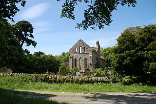
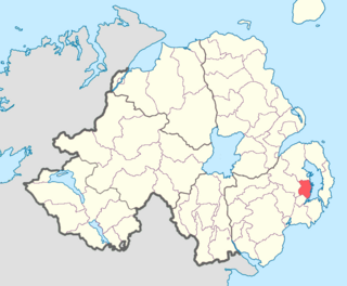
Greyabbey or Grey Abbey is a small village, townland and civil parish located on the eastern shores of Strangford Lough, on the Ards Peninsula in County Down, Northern Ireland.
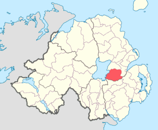
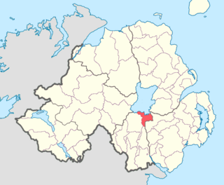
Dufferin is a historic barony in County Down, Northern Ireland. It is on the southern half of the west shore of Strangford Lough, and is bordered by three other baronies: Castlereagh Lower to the north; Castlereagh Upper to the west; and Lecale Lower to the south.

Glenarm Upper is a barony in County Antrim, Northern Ireland. To its east runs the east-Antrim coast, and it is bordered by four other baronies: Glenarm Lower to the north; Antrim Lower to the west; Antrim Upper to the south-west; and Belfast Lower to the south. Chaine Tower, situated at the entrance to Larne Lough, is located within Glenarm Upper.

Cary is a historic barony in County Antrim, Northern Ireland. To its north is the north-Antrim coast, and it is bordered by three other baronies: Dunluce Lower to the west; Dunluce Upper to the south; and Glenarm Lower to the south-east. The Giant's Causeway is situated on the north coast of Cary. Dunineny Castle lies in the civil parish of Ramoan within this barony.

Belfast Lower is a barony in County Antrim, Northern Ireland. To its east lies the east-Antrim coast and Belfast Lough, and it is bordered by four other baronies: Belfast Upper to the south, Carrickfergus to the east, Antrim Upper to the west; Glenarm Upper to the north. The Forth and Milewater rivers both flow through Belfast Lower, with Larne harbour also situated in the barony.

Belfast Upper is a barony in County Antrim, Northern Ireland. To its east lies the barony of Belfast and Belfast Lough, and it is bordered by five other baronies: Belfast Lower to the north-east; Antrim Upper to the north-west; Massereene Lower to the west; Massereene Upper to the south-west; and Castlereagh Upper to the south. The Forth River flows through both Belfast Upper and Lower. The most prominent hills in the barony are Black Hill and Lyle's Hill.

Massereene Lower is a barony in County Antrim, Northern Ireland. To its west lies Lough Neagh, and it is bordered by four other baronies: Massereene Upper to the south; Belfast Upper to the east; Antrim Upper to the north; and Toome Upper to the north-west.
Massereene Upper is a barony in southwest County Antrim, Northern Ireland. It roughly matches the former district of Killultagh. It includes settlements such as Crumlin, Glenavy, Lower Ballinderry, Maghaberry and Aghalee. To its east lies Belfast Lough, and it is bordered by four other baronies: Massereene Lower to the north; Belfast Upper to the east; Castlereagh Upper to the south-east; and Iveagh Lower, Lower Half to the south-west.

Toome Upper is a barony in County Antrim, Northern Ireland. To its south lies Lough Neagh, and it is bordered by five other baronies: Toome Lower to the north; Antrim Lower to the north-east; Antrim Upper to the east; Massereene Lower to the south-east; and Loughinsholin to the south-east. Toome Upper also formed part of the medieval territories known as the Route and Clandeboye.

Knockninny is a barony in County Fermanagh, Northern Ireland. To its east lies Upper Lough Erne, and it is bordered by four other baronies in Northern Ireland: Clanawley to the north-west; Tirkennedy to the north; Magherastephana to the north-east; and Coole to the east. It also borders two baronies in the Republic of Ireland: Loughtee Lower to the south; and Tullyhaw to the south-west.

Dungannon Middle is a barony in County Tyrone, Northern Ireland. It was created in 1851 with the splitting of the barony of Dungannon. It is bordered by Lough Neagh to the east and six other baronies: Dungannon Upper to the north; Oneilland West to the south-east; Armagh and Tiranny to the south; Dungannon Lower to the south-west; and Omagh East to the west.

Oneilland West is a barony in County Armagh, Northern Ireland. It is also called Clancann, after the Mac Cana clan. It lies in the north of the county on the south-western shore of Lough Neagh and the border of County Tyrone. Oneilland West is bordered by five other baronies: Armagh to the west; Dungannon Middle to the north-west; Oneilland East to the north-east; Orior Lower to the south-east; and Kinelarty to the south.
Oneilland East is a barony in the north-east of County Armagh, Northern Ireland. It is also called Clanbrasil. It lies in the north-east corner of the county, on the south-eastern shore of Lough Neagh and the boundary with County Down. Oneilland East is bordered by three other baronies: Oneilland West to the west; Iveagh Lower to the east; and Orior Lower to the south.

Orior Lower is a barony in County Armagh, Northern Ireland. It lies in the east of the county and borders County Down with its eastern boundary. It is bordered by seven other baronies: Fews Upper to the south-west; Fews Lower to the west; Oneilland West to the north-west; Oneilland East to the north; Iveagh Lower, Lower Half to the north-east; Iveagh Upper, Upper Half to the east; and Orior Upper to the south. A small enclave of Orior Lower resides in the east of Orior Upper.

Orior Upper is a barony in County Armagh, Northern Ireland. It lies in the south-east of the county and borders the Republic of Ireland with its southern boundary. It is bordered by five other baronies in Northern Ireland: Fews Upper and an enclave of Fews Lower to the west; Orior Lower to the north; Iveagh Upper, Upper Half to its west, which is divided in two by the Lordship of Newry. It also borders two baronies in the Republic of Ireland: Dundalk Lower and Dundalk Upper to the south.
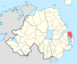
Ards Lower, alternatively known as North Ards, is a barony in County Down, Northern Ireland. It lies on the northern half of the Ards Peninsula in the north-east of the county, with the Irish Sea to its east and Strangford Lough to its south-west. It is bordered by two other baronies: Ards Upper to the south; and Castlereagh Lower to the west.

Lecale Lower is a barony in County Down, Northern Ireland. It lies to the east of the county with Strangford Lough to its north and the Irish Sea to its right. It is bordered by five other baronies: Lecale Upper to the south; Ards Upper to the north-east just across the mouth of Strangford Lough; Dufferin to the north; Castlereagh Upper to the north-west; and Kinelarty to the west.

Castlereagh Lower is a historic barony in County Down, Northern Ireland. It was created by 1841 with the division of Castlereagh into two. The barony roughly matches the former Gaelic territory of Uí Blathmaic, anglicized Blathewic. It is bordered by three other baronies: Ards Lower to the east; Dufferin to the south; and Castlereagh Upper to the west and south-west. Castlereagh Lower is also bounded by Belfast Lough to the north and Strangford Lough to the south-east.

