Ulster is one of the four traditional Irish provinces. It is made up of nine counties: six of these constitute Northern Ireland ; the remaining three are in the Republic of Ireland.

Downpatrick is a town in County Down, Northern Ireland. It is on the Lecale peninsula, about 21 mi (34 km) south of Belfast. In the Middle Ages, it was the capital of the Dál Fiatach, the main ruling dynasty of Ulaid. Its cathedral is said to be the burial place of Saint Patrick. Today, it is the county town of Down and the joint headquarters of Newry, Mourne and Down District Council. Downpatrick had a population of 10,822 according to the 2011 Census.

Ballynahinch is a town in County Down, Northern Ireland. It had a population of 5,703 people in the 2011 Census.

Crossgar is a village and townland in County Down, Northern Ireland. It is about 15 miles (24 km) south of Belfast – between Saintfield and Downpatrick. Crossgar had a population 1,892 people in the 2011 UK Census.

Saintfield is a village and civil parish in County Down, Northern Ireland. It is about halfway between Belfast and Downpatrick on the A7 road. It had a population of 3,381 in the 2011 Census, made up mostly of commuters working in both south and central Belfast, which is about 18 km away. The population of the surrounding countryside is mostly involved in farming.

The Quoile is a river in County Down, Northern Ireland.

Dromore is a small market town and civil parish in County Down, Northern Ireland. It lies within the local government district of Armagh City, Banbridge and Craigavon. It is 19 miles (31 km) southwest of Belfast, on the A1 Belfast–Dublin road. The 2011 Census recorded a population of 6,003.

Hilltown is a small village within the townland of Carcullion in County Down, Northern Ireland. Hilltown is the main village of the parish of Clonduff which contains the village and the rural areas around it at one end, and the rural enclave of Cabra at the other end of the parish. It had a population of 899 people in the 2001 Census. On 27 March 2011, the usually resident population of Hilltown was 1,709.
Kinallen is a small village and townland in County Down, Northern Ireland. It is four miles from Dromore and two miles from Dromara.
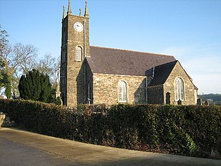
Loughinisland is a small village and civil parish in County Down, Northern Ireland. It is between Downpatrick and Ballynahinch, about 21 miles south of Belfast.

Annahilt / Anahilt is a village and civil parish in north County Down, Northern Ireland. It is 7.5 miles south of Lisburn, and about 14 miles south-west of Belfast, on the main road between Ballynahinch and Hillsborough. In the 2001 Census the village had a population of 1,148. Annahilt has a distinctive drumlin setting, with a small wooded estate on a ridge to the west, and panoramic views on the approaches to the village.

Ballyhalbert is a small village and townland in County Down, Northern Ireland. It is on the east coast of the Ards Peninsula between Ballywalter and Portavogie. It is largely residential and has a small harbour and large caravan site which was formerly a Royal Air Force (RAF) airfield, RAF Ballyhalbert, during World War II. It is within the Ards and North Down Borough. It had a population of 1,026 people in the 2011 Census, up from 447 people in the 2001 Census.
Dromara is a village, townland and civil parish in County Down, Northern Ireland. It lies 10 kilometres (6.2 mi) to the southwest of Ballynahinch on the northern slopes of Slieve Croob, with the River Lagan flowing through it. It is situated in Dromara and the historic barony of Iveagh Lower, Lower Half. In the 2011 Census it had a population of 1,006 people.

Drumaness is a village and townland in the Newry, Mourne and Down District Council area of County Down, Northern Ireland. It is 3 miles or 5 kilometres south of Ballynahinch, beside the main A24 Belfast to Newcastle road. It is situated in the civil parish of Magheradroll and the historic barony of Kinelarty. In the 2011 Census it had a population of 1,339 people.

Killinchy is a townland and small village in County Down, Northern Ireland. It is two miles inland from the western shores of Strangford Lough in the Borough of Ards and North Down. It is situated in the townland of the same name, the civil parish of Killinchy and the historic barony of Dufferin. It had a population of 539 people in the 2011 Census.

Knockloughrim or Knockcloghrim is a small village near Maghera in County Londonderry, Northern Ireland. In the 2001 Census it had a population of 186 people. Knockloughrim lies within the civil parish of Termoneeny and is part of the former barony of Loughinsholin. It is situated within the Mid Ulster District Council area.
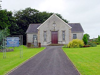
Christianity is the largest religion in Northern Ireland. At the 2021 census, the prevalence rates for the main religions were: Catholic ; Presbyterian ; Church of Ireland ; Methodist ; Other Christian or Christian-related denominations ; other Religions and Philosophies ; those declaring no religion and religion not stated. The Catholic Church has seen a small growth in adherents, while the other Christian groups have seen a small decrease.

The Loughinisland Churches are the remains of three ruined churches in Loughinisland, County Down, Northern Ireland, dating from the 13th to the 17th centuries. They are situated in Tievenadarragh townland, in a large graveyard on an island in Loughinisland Lake, now reached by a causeway. The churches are state-care historic monuments at grid ref: J4234 4537.
Sandholes is a small rural hamlet, located at a crossroads approximately 3+1⁄2 miles (5.6 km) south of Cookstown in County Tyrone, Northern Ireland. The settlement is compact, with a modest range of services and community facilities. Existing dwellings are located within the core of the village and in small housing developments on the periphery. According to the 2011 census it has a population of 126 in 50 households.
Listooder is a hamlet and townland situated outside Crossgar towards both Ballynahinch and Saintfield in County Down, Northern Ireland. Listooder derives its name from the Irish word Lios an tSúdaire meaning "fort of the leather tanner" or "ring-fort". From the mid 19th century, the hamlet was known as the Cock, while the townland which centres around the fort was called Listooder.

