
The North Clyde Line is a suburban railway in West Central Scotland. The route is operated by ScotRail Trains. As a result of the incorporation of the Airdrie–Bathgate rail link and the Edinburgh–Bathgate line,this route has become the fourth rail link between Glasgow and Edinburgh.

Clydebank railway station is a railway station serving the town of Clydebank in West Dunbartonshire,Scotland. It is located on the Argyle Line and the North Clyde Line. Passenger services are operated by ScotRail.

Argyle Street railway station is a station in the City Centre of Glasgow,Scotland,on the Argyle Line,which connects the North Clyde lines at Partick with Rutherglen in the south-east of the city. The station is located below the thoroughfare whose name it bears. It has a narrow and often crowded island platform. It serves the Argyle Street shopping precinct as well as the St Enoch Centre. Along with Dalmarnock and Anderston,no services call at this station on a Sunday before 10am or after 6pm.

Uphall railway station serves the village of Uphall Station and some areas of Livingston in West Lothian,Scotland. It is located on the North Clyde Line,12½ miles (20 km) west of Edinburgh.
Livingston North railway station is one of two railway stations serving the town of Livingston in West Lothian,Scotland. It is located on the Edinburgh-Bathgate Line 15½ miles (25 km) west of Edinburgh and situated in the Carmondean area of Livingston. The other railway station in the town is Livingston South on the Shotts Line.

Bathgate railway station was a railway station serving Bathgate in West Lothian,Scotland. It was located at the western end of the Edinburgh-Bathgate Line. The station was 18½ miles (30 km) west of Edinburgh.

Dumbarton East railway station serves the town of Dumbarton in the West Dunbartonshire region of Scotland. The station is managed by ScotRail and is served by trains on the North Clyde Line,15 miles (24 km) west of Glasgow Queen Street.

Bowling railway station serves the village of Bowling in the West Dunbartonshire region of Scotland. This station is on the North Clyde Line,12¼ miles (20 km) west of Glasgow Queen Street.

Bellgrove Railway Station is in the East End of Glasgow,Scotland,serving the city's Calton,Gallowgate and south Dennistoun neighbourhoods. The station is approximately 1 mile (1.6 km) to the east of Glasgow Queen Street,and is managed by ScotRail.

High Street railway station serves High Street in Glasgow,Scotland and the surrounding area,which includes Townhead,the Merchant City,as well the western fringes of Dennistoun and Calton. The station is managed by ScotRail and is served by trains on the North Clyde Line. It is located in the eastern part of the city centre,with Strathclyde University,Glasgow Cathedral and Glasgow Royal Infirmary being major institutions located nearby.

Shettleston railway station serves the Shettleston area of Glasgow,Scotland and is 3½ miles (5 km) east of Glasgow Queen Street railway station on the North Clyde Line. The station is managed by ScotRail.

Easterhouse railway station serves the Easterhouse area of Glasgow,Scotland. It was built by the North British Railway as part of their Coatbridge Branch and opened when the branch opened on 1 February 1871. The station is 5¾ miles (9 km) east of Glasgow Queen Street railway station on the North Clyde Line and is managed by ScotRail.
Coatdyke railway station is situated on Quarry Street/Riddell Street in the Cliftonville area of Coatbridge and 10 miles (16 km) east of Glasgow Queen Street. It is the closest railway station to Coatbridge College and Monklands Hospital.
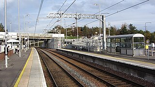
Airdrie railway station is a railway station serving the town of Airdrie,North Lanarkshire,Scotland. The station is managed by ScotRail and is served by trains on the North Clyde Line,11 miles (18 km) east of Glasgow Queen Street.
The Bathgate and Coatbridge Railway,also known as the "New Monkland Line",was built by Monkland Railways. It opened on 28 July 1863. The line was absorbed into the Edinburgh and Glasgow Railway on 31 July 1865. The following day,the line became part of the North British Railway.

Caldercruix railway station serves the village of Caldercruix in North Lanarkshire,Scotland. It is managed by ScotRail and is on the North Clyde Line. Originally opened by the Bathgate and Coatbridge Railway in 1862,it was closed in 1956 then reopened in 2011 as part of the reopening of the Airdrie–Bathgate rail link.

Bathgate Upper railway station was a railway station serving the town of Bathgate in West Lothian,Scotland. It was located on the Bathgate and Coatbridge Railway.

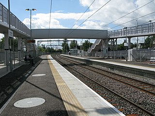
Bathgate railway station is a railway station serving Bathgate in West Lothian,Scotland. Opened on 18 October 2010,it is close to the junction of the former Edinburgh and Bathgate Railway and the former Bathgate and Coatbridge Railway to the east of the 1986 station. Ticket gates are in operation.

Blackridge railway station is a railway station on the North Clyde Line. It serves the village of Blackridge in West Lothian,Scotland.
Drumgelloch railway station is a railway station serving the east of Airdrie,North Lanarkshire,Scotland. It is located 600 yards (550 m) east of the 1989 station on the former Bathgate and Coatbridge Railway,on the site of the former Clarkston railway station. The station previously closed in 1956.
