| Brierley Hill District of Brierley Hill | |
|---|---|
| Urban District | |
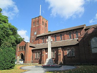
Former Brierley Hill Civic Centre, now Brierley Hill Police Station | |
| Area | |
| • 1911 | 1,016 acres (4 km2) [1] |
| • 1961 | 5,851 acres (24 km2) [2] |
| Area transferred | |
| • 1934 | 4,246 acres (17 km2) [3] from Kingswinford Rural District |
| • 1934 | 666 acres (3 km2) [3] from Quarry Bank Urban District |
| Population | |
| • 1911 | 12,263 [4] |
| • 1961 | 56,075 [4] |
| History | |
| • Preceded by | Sanitary district |
| • Origin | Local Government Act 1894 |
| • Created | 1894 |
| • Abolished | 1966 |
| • Succeeded by | County Borough of Dudley Metropolitan Borough of Dudley |
| Status | Urban District |
| Government | Brierley Hill District Council |
| • Type | Urban District Council |
| • HQ | Civic Centre, Brierley Hill |
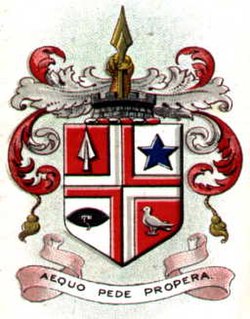
| • Motto | Sine labore nihil floret (Latin) "Without labour nothing prospers" |
 Arms of Brierley Hill District Council | |
| Contained within | |
| • County | Staffordshire |

Brierley Hill Urban District was a former Urban District in Staffordshire, England, comprising the areas of Brierley Hill, Kingswinford, Quarry Bank, and Pensnett, now within the modern-day Dudley Metropolitan Borough in the West Midlands county.
In England and Wales, Northern Ireland, and the Republic of Ireland, an urban district was a type of local government district that covered an urbanised area. Urban districts had an elected urban district council (UDC), which shared local government responsibilities with a county council.

Staffordshire is a landlocked county in the West Midlands of England. It borders with Cheshire to the northwest, Derbyshire and Leicestershire to the east, Warwickshire to the southeast, West Midlands and Worcestershire to the south, and Shropshire to the west.

Brierley Hill is a small town and electoral ward of the Dudley Metropolitan Borough, in the West Midlands of England, and is situated approximately 2.5 miles south of central Dudley and 2 miles north of Stourbridge. Part of the Black Country, and in a heavily industrialised area of the Dudley Borough, it has a population of 13,935 at the 2011 census, and is best known for glass and steel manufacturing, although the industry has declined considerably since the 1970s. One of the largest factories in the area was the Round Oak Steelworks, which was closed down and redeveloped in the 1980s to become the Merry Hill Shopping Centre. Brierley Hill was originally in Staffordshire, but is now part of the West Midlands metropolitan county since its creation in 1974.
Brierley Hill became an urban district in 1894 under the Local Government Act. Previously, it had been an urban sanitory authority within the parish of Kingswinford. It was greatly expanded in 1934, when it took in the Quarry Bank and Kingswinford districts. It remained an independent urban district until 1966, when it was merged into the Dudley County Borough [3] under the advice of the Local Government Commission for England.

The Local Government Act 1894 was an Act of the Parliament of the United Kingdom that reformed local government in England and Wales outside the County of London. The Act followed the reforms carried out at county level under the Local Government Act 1888. The 1894 legislation introduced elected councils at district and parish level.
Kingswinford Rural District was a rural district in Staffordshire, England from 1894 to 1934. It was created by the Local Government Act 1894, and originally consisted of the two parishes of Amblecote and Kingswinford. Amblecote became a separate urban district in 1898, leaving Kingswinford the only parish in the district.

The County Borough of Dudley was a local government district in the English Midlands from 1865 to 1974. Originally a municipal borough, it became a county borough in 1889, centred on the main town centre of Dudley, along with the suburbs of Netherton and Woodside. Although surrounded by Staffordshire, the borough was associated with Worcestershire for non-administrative purposes, forming an exclave of the county until 1966, when it was transferred to Staffordshire after an expansion of the borough boundaries. Following local government reorganization in 1974, Dudley took in the boroughs of Halesowen and Stourbridge to form the present-day Metropolitan Borough of Dudley, in the newly formed West Midlands county.