Sedgley Urban District

Last updated

Sedgley
Population
  191116,527 [1]
  193119,262 [1]
  196127,912 [1]
History
  Origin Manor of Sedgley
  Created1894
  Abolished1966
  Succeeded by County Borough of Dudley
Metropolitan Borough of Dudley
Status Urban District
GovernmentSedgley Urban District Council
   HQ Sedgley

Sedgley urban district was a local government district within Staffordshire, which was created in 1894 from the western half of the manor of Sedgley (the other half of which became the Coseley Urban District).

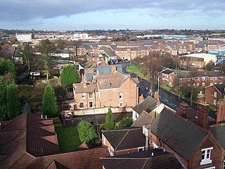
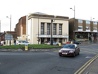
The Urban District, formed in 1894, consisted of the historic villages of Sedgley, Cotwall End, Gospel End, Upper Gornal, Lower Gornal and Woodsetton. [2]

The UDC built many new houses within its boundaries as the local population grew. The first developments included the Beacon Hill Estate in Sedgley and smaller developments off Dudley Road in Upper Gornal and Summer Lane in Lower Gornal, which were built in the early 1920s. These developments were then expanded in the 1930s, 1940s and 1950s.

Post World War II developments included the Sedgley Hall Estate near Gospel End Road, the Bramford Estate at Woodsetton and a smaller development at Cinder Road in Gornal Wood. Flats (not in blocks more than four storeys high) and bungalows were also built in large numbers during this era. Interwar estates including the Beacon Estate were also expanded after 1945. The houses on the Sedgley Hall Estate were built from concrete panels just after the end of World War II, and are still standing eight decades later even though Sedgley UDC intended to replace them with brick-built housing by the 1960s.

By 1966, the district had developed into a town[ citation needed ] due to extensive housebuilding (private and council) since 1920, and was dissolved to be absorbed into three neighbouring authorities. The bulk of the district was absorbed into the expanded County Borough of Dudley, while the Gospel End area was absorbed into Seisdon Rural District (now South Staffordshire) and Goldthorn Park was absorbed into Wolverhampton. The introduction of post code districts locally in 1966 also means that much of Woodsetton now has a Dudley DY1 post code rather than Sedgley DY3, although Gospel End comes within the DY3 postal district – as do the villages of Himley and Swindon, which were never within the same local authority at Sedgley and are no longer even in the same county.

The Urban District Council also built many schools. Roberts Street Schools were built in Upper Gornal in 1894 – the year the Urban District Council was formed. Queen Victoria Schools were opened in Bilston Street in 1897. Dormston School, adjacent to Queen Victoria School, opened in 1935, replacing the former senior schools at Queen Victoria and Sedgley National Schools. Bramford Primary School in Woodsetton was built during the 1950s on the border with Coseley. Flax Hall Primary School in Upper Gornal was opened in 1950s and remained open until 1989.

Mass house building in the west of Sedgley during the 1950s and 1960s made it necessary for new primary schools to be built to accommodate Sedgley's rapidly growing population – Cotwall End infant and junior schools were opened in 1962 and on the nearby Northway Estate, Alder Coppice Infant and Junior Schools were opened in 1967, just after the UDC ceased to exist. High Arcal Grammar School was built in the Woodsetton area of Sedgley in 1961, while in the Lower Gornal area Ellowes Hall School opened in 1964 to replace the former senior schools at Robert Street and Red Hall. Sedgley UDC also had plans to build a new primary school to serve the new Straits Estate, and these became reality when Straits Primary School opened in 1968, by which time the UDC had been absorbed into an expanded County Borough of Dudley.

With the exception of Flax Hall, all of the schools built by Sedgley UDC remain in existence today, although Roberts Primary was replaced by a new building in 2001, and many of the other schools have been significantly expanded or partly rebuilt since their opening. Dormston School, for instance, had just one building (with capacity for around 500 pupils) on its opening, but by 2008 it had five classroom blocks (with capacity for well over 1,000 pupils) and also incorporated an arts and leisure complex. High Arcal's status changed from grammar to comprehensive in 1975, in the same year that Ellowes Hall and Dormston switched from secondary modern to comprehensive.

The 19th century buildings of Sedgley's only Roman Catholic school, St Chad's, were gradually replaced between 1957 and 1969.

The council offices were built on High Holborn in 1882, and after Sedgley UDC was disbanded were taken over by Dudley council, who used it as a Social Services department until 2000, ending 118 years of local authority use. It was sold to a private developer in 2002 and subsequently converted into flats. [3]

Related Research Articles

<span class="mw-page-title-main">Tipton</span> Town in the West Midlands, England

Tipton is an industrial town in the Metropolitan Borough of Sandwell in the West Midlands County in England. It had a population of 38,777 at the 2011 UK Census. It is located northwest of Birmingham and southeast of Wolverhampton. It is also contiguous with nearby towns of Darlaston, Dudley, Wednesbury and Bilston.

<span class="mw-page-title-main">Sedgley</span> Human settlement in England

Sedgley is a town in the north of the Metropolitan Borough of Dudley, in the West Midlands, England.

<span class="mw-page-title-main">Coseley</span> Human settlement in England

Coseley is a village in the Dudley Metropolitan Borough, in the West Midlands County, England. It is situated three miles north of Dudley itself, on the border with Wolverhampton. Though it is a part of the Dudley North constituency. It also falls within the Wolverhampton South-East parliamentary constituency.

Dormston School is a coeducational secondary school in Sedgley, West Midlands, England.

<span class="mw-page-title-main">Gospel End</span> Human settlement in England

Gospel End is a village in the South Staffordshire district of Staffordshire, England. Population details taken at the 2011 census can be found under Himley. It is situated on the A463 road, between Sedgley and Wombourne.

<span class="mw-page-title-main">County Borough of Dudley</span>

The County Borough of Dudley was a local government district in the English Midlands from 1865 to 1974. Originally a municipal borough, it became a county borough in 1889, centred on the main town centre of Dudley, along with the suburbs of Netherton and Woodside. Although surrounded by Staffordshire, the borough was associated with Worcestershire for non-administrative purposes, forming an exclave of the county until 1966, when it was transferred to Staffordshire after an expansion of the borough boundaries. Following local government reorganization in 1974, Dudley took in the boroughs of Halesowen and Stourbridge to form the present-day Metropolitan Borough of Dudley, in the newly formed West Midlands county.

<span class="mw-page-title-main">Beacon Hill Academy, Dudley</span> Academy in Sedgley, Dudley, West Midlands, England

Beacon Hill Academy, formerly known as The High Arcal School, is a secondary school in the Sedgley area of Dudley, in the English West Midlands. Originally opened as a grammar school in 1961, the school became a comprehensive in 1975. It adopted its current name in September 2018, after joining the Dudley Academies Trust.

Ellowes Hall Sports College is a comprehensive secondary school and sixth form situated on Stickley Lane in Lower Gornal, Dudley, West Midlands, England.

Ellowes Hall was a stately home located in Sedgley, Staffordshire.

Woodcross is a residential area of Coseley, West Midlands, England. It is set within the City of Wolverhampton, though the area traditionally existed within the boundaries of Sedgley and later Coseley until 1966.

<span class="mw-page-title-main">Coseley Urban District</span> Local government district in Staffordshire, England

Coseley Urban District was a local government district in Staffordshire which was created in 1894.

<span class="mw-page-title-main">Cotwall End Valley</span> Nature reserve in West Midlands, England

Cotwall End Valley is a local nature reserve in West Midlands, England. It is about a mile south of Sedgley, in the Metropolitan Borough of Dudley.

<span class="mw-page-title-main">Gornal, West Midlands</span> Human settlement in England

Gornal is a village and electoral ward in the Dudley Metropolitan Borough, in the West Midlands of England. It encompasses the three historical villages of Upper Gornal, Lower Gornal, and Gornal Wood. Gornal was historically part of Staffordshire, prior to the creation of the West Midlands County in 1974. Gornal is 11 miles from Birmingham.

<span class="mw-page-title-main">Beacon Hill, Sedgley</span>

Beacon Hill in Sedgley, England, is one of the highest points in the West Midlands, at 237 metres (778 ft) above sea level.

This article details a number of defunct schools that were once located in the Metropolitan Borough of Dudley. For details of currently operating schools in the area, please see: List of schools in Dudley.

Woodsetton is an area of the Dudley Metropolitan Borough in the West Midlands of England, roughly 2.0 miles (3 km) northwest of Dudley Town Centre. Formerly in the Sedgley Urban District, a part of Woodsetton was transferred into the Dudley County Borough in 1926 to allow for the building of the Priory Estate. This reorganisation also saw this part of the area transferred from Staffordshire to Worcestershire.

Tipton Municipal Borough was a municipal borough centred on the town of Tipton, Staffordshire, England. It was created in 1938, when the Tipton Urban District received borough status.

<span class="mw-page-title-main">The Coseley School</span> Foundation school in Coseley, West Midlands, England

The Coseley School was a mixed secondary school located in Coseley, West Midlands, England.

References

  1. 1 2 3 "Population Statistics". Sedgley UD through time. Vision of Britain. Retrieved 9 April 2012.
  2. "Sedgley Local History Society".
  3. "The Council House, High Holborn". Sedgley History. Sedgley Local History Society. Retrieved 18 June 2012.

52°32′N2°07′W / 52.54°N 2.12°W / 52.54; -2.12