Kingswinford Rural District

Last updated

Kingswinford
Area
  1911 [1] 5,691 acres (23 km2)
Population
  191120,803 [2]
  193122,804 [2]
History
  Created1894
  Abolished1934
  Succeeded by Brierley Hill Urban District
Seisdon Rural District
Status Rural District
GovernmentRural District Council
   HQ Kingswinford

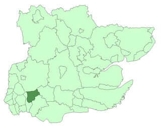
Kingswinford Rural District was a rural district in Staffordshire, England from 1894 to 1934. [3] It was created by the Local Government Act 1894, and originally consisted of the two parishes of Amblecote and Kingswinford. Amblecote became a separate urban district in 1898, leaving Kingswinford the only parish in the district.

Rural districts were a type of local government area – now superseded – established at the end of the 19th century in England, Wales, and Ireland for the administration of predominantly rural areas at a level lower than that of the administrative counties.

Staffordshire County of England

Staffordshire is a landlocked county in the West Midlands of England. It borders with Cheshire to the northwest, Derbyshire and Leicestershire to the east, Warwickshire to the southeast, West Midlands and Worcestershire to the south, and Shropshire to the west.

England Country in north-west Europe, part of the United Kingdom

England is a country that is part of the United Kingdom. It shares land borders with Wales to the west and Scotland to the north-northwest. The Irish Sea lies west of England and the Celtic Sea lies to the southwest. England is separated from continental Europe by the North Sea to the east and the English Channel to the south. The country covers five-eighths of the island of Great Britain, which lies in the North Atlantic, and includes over 100 smaller islands, such as the Isles of Scilly and the Isle of Wight.

The district was abolished in 1934 under a County Review Order. Most of the parish was added to the Brierley Hill Urban District, with Prestwood and Ashwood becoming to the parish of Kinver in the Seisdon Rural District. Since 1974, the former now forms a part of the Metropolitan Borough of Dudley in the West Midlands, whilst the area in Kinver is in the South Staffordshire district.

Local Government Act 1929 local government-related UK parliament act of 1929

The Local Government Act 1929 was an Act of the Parliament of the United Kingdom that made changes to the Poor Law and local government in England and Wales.

Brierley Hill Urban District

Brierley Hill Urban District was a former Urban District in Staffordshire, England, comprising the areas of Brierley Hill, Kingswinford, Quarry Bank, and Pensnett, now within the modern-day Dudley Metropolitan Borough in the West Midlands county.

Prestwood is a hamlet now in the parish of Kinver, but in the Kingswinford until the creation of Brierley Hill Urban District in the 1930s.

Neighbourhoods

Wall Heath

Wall Heath is a village in the Dudley Metropolitan Borough in the West Midlands of England. It is located on the A449 road, approximately 5 miles west of Dudley Town Centre and 9 miles north of Kidderminster.

Kingswinford suburban area of the Borough of Dudley, West Midlands, England

Kingswinford is a suburban town within the Metropolitan Borough of Dudley, in the West Midlands, England. In 2001, its population was 25,808, falling to 25,191 at the 2011 Census. It is situated 4 miles north-northwest of Stourbridge, 5 miles west-southwest of Dudley and 8 miles south-southwest of Wolverhampton, the closest city, and forms part of the border with the South Staffordshire District.

Related Research Articles

Ashwood, Staffordshire village in United Kingdom

Ashwood is a small area of Staffordshire, England.

Amblecote human settlement in United Kingdom

Amblecote is an urban village in the Metropolitan Borough of Dudley in the West Midlands, England. It lies immediately north of the historic town of Stourbridge, extending about one and a half miles from it, and is on the southwestern edge of the West Midlands conurbation. Historically, Amblecote was in the parish of Oldswinford, but unlike the rest of the parish it was in Staffordshire, and as such was administered separately.

Civil parishes in the West Midlands (county) Wikimedia list article

A civil parish is a subnational entity, forming the lowest unit of local government in England. There are 18 civil parishes in the ceremonial county of West Midlands, most of the county being unparished; Dudley, Sandwell, Walsall and Wolverhampton are completely unparished. At the 2001 census, there were 89,621 people living in the 18 parishes, accounting for 3.5 per cent of the county's population.

Municipal Borough of Romford

Romford was a local government district in southwest Essex from 1851 to 1965. It was significantly expanded in 1934 and gained the status of municipal borough in 1937. The population density of the district consistently increased during its existence and its former area now corresponds to the northern part of the London Borough of Havering in Greater London.

Walsall was a rural district in Staffordshire, England from 1894 to 1934.

Seisdon was a rural district in Staffordshire, England from 1894 to 1974. It lay west of Wolverhampton and was formed under the Local Government Act 1894 based on the Seisdon rural sanitary district.

The name Oldswinford is now used for a small area of Stourbridge, close to the parish church.

Stone Rural District was a rural district in Staffordshire, England. It was created in 1894 and abolished by virtue of the Local Government Act 1972 in 1974. It was originally formed of the civil parishes of Barlaston, Chebsey, Cold Norton, Eccleshall, Milwich, Sandon, Standon, Stone Rural, Swynnerton and Trentham. In 1897 two new civil parishes were added, Fulford and Hilderstone. In 1932 Cold Norton was abolished with two changes to the district whereby parts of Swynnerton and Trentham were transferred to Newcastle-under-Lyme Rural District and parts of Stone Rural moved into Stone Urban District. In 1956 more of Stone Rural was transferred into Stone Urban District. Finally in 1965 parts of Barlaston, Fulford and Swynnerton transferred into Stoke-on-Trent. On abolition the remaining areas became part of the Borough of Stafford.

Brierley Hill parliamentary constituency was located in the West Midlands of England. It returned one Member of Parliament (MP) to the House of Commons of the Parliament of the United Kingdom, elected by the first past the post system.

Stratford and Wolverton Rural District (1894–1919), Stratford and Wolverton Urban District (1919–20) and Wolverton Urban District (1920–1974) were local government districts in Buckinghamshire, England, covering the town of Wolverton and its environs.

Kinver Forest was a Royal Forest, mainly in Staffordshire.

Chorley Rural District was a rural district in the administrative county of Lancashire, England from 1894 to 1974.

Blything Rural District

Blything Rural District was a rural district within the administrative county of East Suffolk between 1894 and 1934. It was created out of the earlier Blything rural sanitary district.

Mutford and Lothingland Rural District

Mutford and Lothingland Rural District was a rural district within the administrative county of East Suffolk between 1894 and 1934. It was created out of the earlier Mutford and Lothingland rural sanitary district.

Plomesgate Rural District

Plomesgate Rural District was a rural district within the administrative county of East Suffolk between 1894 and 1934. It was created out of the earlier Plomesgate rural sanitary district.

Wangford Rural District

Wangford Rural District was a rural district within the administrative county of East Suffolk between 1894 and 1934. It was created out of the earlier Wangford rural sanitary district. It contained the group of small villages collectively known as The Saints.

Woodbridge Rural District

Woodbridge Rural District was a rural district within the administrative county of East Suffolk between 1894 and 1934. It was created out of the earlier Woodbridge rural sanitary district. It surrounded the town of Woodbridge, which has earlier been created as an urban district.

References

  1. "1911 Census: Population tables". Kingswinford RD through time. Vision of Britain. Retrieved 10 April 2012.
  2. 1 2 "Historical statistics - Population". Kingswinford RD through time. Vision of Britain. Retrieved 10 April 2012.
  3. Kingswinford Rural District at Vision of Britain. Accessed 31 January 2006.

Coordinates: 52°29′N2°10′W / 52.49°N 2.17°W / 52.49; -2.17

Geographic coordinate system Coordinate system

A geographic coordinate system is a coordinate system that enables every location on Earth to be specified by a set of numbers, letters or symbols. The coordinates are often chosen such that one of the numbers represents a vertical position and two or three of the numbers represent a horizontal position; alternatively, a geographic position may be expressed in a combined three-dimensional Cartesian vector. A common choice of coordinates is latitude, longitude and elevation. To specify a location on a plane requires a map projection.