Carrizo Springs, Texas

Last updated

Carrizo Springs, Texas
Revised Carrizo Springs, TX, Water Tower IMG 0447.JPG
Carrizo Springs water tower
TXMap-doton-CarrizoSprings.PNG
Location in the state of Texas
Dimmit County CarrizoSprings.svg
Coordinates: 28°31′36″N99°51′45″W / 28.52667°N 99.86250°W / 28.52667; -99.86250
Country United States
State Texas
County Dimmit
Government
   Mayor Dina Ojeda-Balderas
Area
[1]
  Total3.10 sq mi (8.03 km2)
  Land3.09 sq mi (8.00 km2)
  Water0.01 sq mi (0.03 km2)
Elevation
[2]
604 ft (184 m)
Population
 (2010)
  Total5,368
  Estimate 
(2019) [3]
5,362
  Density1,735.28/sq mi (669.90/km2)
Time zone UTC-6 (CST)
  Summer (DST) UTC-5 (CDT)
ZIP code
78834
Area code 830
FIPS code 48-12988 [4]
GNIS feature ID1372953 [2]
Website cityofcarrizo.org

Carrizo Springs is the largest city in and the county seat of Dimmit County, Texas, United States. [5] The population was 5,368 at the 2010 census. (2018 estimate 5,470). [6]

Contents

The name of the town is derived from the local springs, which were named by the Spanish for the cane grass that once grew around them. It is the oldest town in Dimmit County. Artesian wells in the area are known for their pure, clean water. This water is often exported from Carrizo Springs for use as holy water.

History

Carrizo Springs lies along U.S. Route 83, approximately 82 miles northwest of Laredo and 45 miles north of the Mexican border. Route 83 intersects U.S. Route 277 there. The name "Carrizo Springs" derives from similarly named springs in the area; the name is Spanish for a type of grass once common in the area. Founded in 1865 by settlers from Atascosa County, Carrizo Springs is the oldest community in the county. [7]

Carrizo Springs, along with San Antonio, Uvalde, Crystal City, and Corpus Christi, was a major stop on the defunct San Antonio, Uvalde and Gulf Railroad, a Class I line, which operated from 1909 until it was merged into the Missouri Pacific Railroad in 1956. [8]

More recently, Carrizo Springs has become the home of the only olive orchard and oil press in Texas. [9]

Geography

Carrizo Springs is located at 28°31′36″N99°51′45″W / 28.52667°N 99.86250°W / 28.52667; -99.86250 (28.526699, –99.862423). [10]

According to the United States Census Bureau, the city has a total area of 3.1 square miles (8.0 km2), of which 3.1 sq mi (8.0 km2) are land and less than 0.01 mi2 is covered by water.

Climate

Carrizo Springs experiences a hot semi-arid climate with mild winters and hot summers. During the spring season, as well occasionally during the fall season, severe thunderstorms often build on the Serranias Del Burro to the distant west of Carrizo Springs. This is believed to occur due to the uplift of moisture from the Gulf of Mexico which is channeled along the Rio Grande River. [11]

Climate data for Carrizo Springs, Texas (1991–2020 normals, [lower-alpha 1] extremes 1912–present)
MonthJanFebMarAprMayJunJulAugSepOctNovDecYear
Record high °F (°C)96
(36)
101
(38)
107
(42)
111
(44)
109
(43)
114
(46)
112
(44)
109
(43)
111
(44)
104
(40)
97
(36)
98
(37)
114
(46)
Mean maximum °F (°C)84
(29)
89
(32)
93
(34)
99
(37)
102
(39)
104
(40)
104
(40)
105
(41)
101
(38)
97
(36)
89
(32)
82
(28)
107
(42)
Mean daily maximum °F (°C)66.2
(19.0)
71.0
(21.7)
78.4
(25.8)
85.8
(29.9)
91.5
(33.1)
97.0
(36.1)
99.2
(37.3)
99.4
(37.4)
92.8
(33.8)
85.2
(29.6)
74.5
(23.6)
67.2
(19.6)
83.8
(28.8)
Mean daily minimum °F (°C)39.0
(3.9)
44.0
(6.7)
52.3
(11.3)
58.6
(14.8)
67.2
(19.6)
72.9
(22.7)
74.3
(23.5)
74.3
(23.5)
69.2
(20.7)
59.9
(15.5)
49.1
(9.5)
40.0
(4.4)
58.3
(14.6)
Mean minimum °F (°C)26
(−3)
29
(−2)
34
(1)
42
(6)
53
(12)
66
(19)
70
(21)
69
(21)
57
(14)
41
(5)
32
(0)
26
(−3)
23
(−5)
Record low °F (°C)12
(−11)
12
(−11)
21
(−6)
31
(−1)
41
(5)
56
(13)
55
(13)
61
(16)
43
(6)
31
(−1)
22
(−6)
10
(−12)
10
(−12)
Average precipitation inches (mm)1.01
(26)
0.77
(20)
1.42
(36)
1.26
(32)
2.95
(75)
1.90
(48)
1.67
(42)
1.45
(37)
3.37
(86)
2.00
(51)
1.19
(30)
0.94
(24)
19.93
(507)
Average snowfall inches (cm)tracetracetrace0
(0)
0
(0)
0
(0)
0
(0)
0
(0)
0
(0)
0
(0)
trace0.1
(0.25)
0.1
(0.25)
Average precipitation days (≥ 0.01 in)54535443644455
Average snowy days (≥ 0.1 in)0000000000000
Source: NOAA [12] [13]

Demographics

Historical population
CensusPop.Note
1890 289
1920 954
1930 2,171127.6%
1940 2,49414.9%
1950 4,31673.1%
1960 5,69932.0%
1970 5,374−5.7%
1980 6,88628.1%
1990 5,745−16.6%
2000 5,655−1.6%
2010 5,368−5.1%
2019 (est.)5,362 [3] −0.1%
U.S. Decennial Census [14]
City Hall in Carrizo Springs on U.S. Highway 277 City Hall in Carrizo Springs, TX IMG 0448.JPG
City Hall in Carrizo Springs on U.S. Highway 277

2020 census

Carrizo Springs racial composition [15]
(NH = Non-Hispanic) [lower-alpha 2]
RaceNumberPercentage
White (NH)3497.13%
Black or African American (NH)631.29%
Native American or Alaska Native (NH)80.16%
Asian (NH)460.94%
Pacific Islander (NH)50.1%
Some Other Race (NH)120.25%
Mixed/Multi-Racial (NH)330.67%
Hispanic or Latino 4,37689.45%
Total4,892

As of the 2020 United States census, there were 4,892 people, 1,709 households, and 1,243 families residing in the city.

2000 census

As of the census [4] of 2000, 5,655 people, 1,816 households, and 1,450 families were residing in the city. The population density was 1,812.9 people per mi2 (699.8/km2). The 2,109 housing units averaged 676.1 per mi2 (261.0/km2). The racial makeup of the city was 75.3% White, 1.3% African American, 0.7% Native American, 1.1% Asian, 19.0% from other races, and 2.6% from two or more races. Hispanics or Latinos of any race were 87.2% of the population.

Of the 1,816 households, 43.2% had children under the age of 18 living with them, 54.0% were married couples living together, 20.0% had a female householder with no husband present, and 20.1% were not families. About 17.7% of all households were made up of individuals, and 9.5% had someone living alone who was 65 or older. The average household size was 3.06, and the average family size was 3.47.

In the city, the age distribution was 33.3% under 18, 9.7% from 18 to 24, 25.0% from 25 to 44, 18.8% from 45 to 64, and 13.2% who were 65 or older. The median age was 31 years. For every 100 females, there were 91.8 males. For every 100 females age 18 and over, there were 88.3 males.

The median income for a household in the city was $21,306, and for a family was $22,375. Males had a median income of $24,536 versus $15,000 for females. The per capita income for the city was $8,642. About 30.8% of families and 33.8% of the population were below the poverty line, including 42.9% of those under age 18 and 29.9% of those age 65 or over.

Education

Carrizo Springs is served by the Carrizo Springs Consolidated Independent School District and home to the Carrizo Springs High School Wildcats.

These schools serve students in the city:

Migrant child detention center

Facilities that previously housed Stratton Oilfield Systems were chosen for a new unaccompanied minor detention site, with an estimated capacity of 1,000 to 1,600 children. Operations are contracted with BCFS Health and Human Services. [18] [19] When the site was previously considered under Stratton Security management, owner and president Dan Stratton assured the area's residents that potential residents would not be refugees of the Syrian Civil War or speak Arabic. He emphasized that refugees would be securely kept within the facility and would not interact with or murder area residents. [20] The site opened for one month in 2019 and later reopened in February 2021. [21]

In March 2022, Border Patrol agents declared "no vacancy" and plans to release migrants who cleared background and criminal checks in the city of Carrizo Springs.

Notes

  1. Mean monthly maxima and minima (i.e. the highest and lowest temperature readings during an entire month or year) calculated based on data at said location from 1991 to 2020.
  2. Note: the US Census treats Hispanic/Latino as an ethnic category. This table excludes Latinos from the racial categories and assigns them to a separate category. Hispanics/Latinos can be of any race. [16] [17]

Related Research Articles

<span class="mw-page-title-main">Wheeler County, Texas</span> County in Texas, United States

Wheeler County is a county located in the U.S. state of Texas. As of the 2020 census, its population was 4,990. Its county seat is Wheeler. The county was formed in 1876 and organized in 1879. It is named for Royall Tyler Wheeler, a chief justice of the Texas Supreme Court.

<span class="mw-page-title-main">Webb County, Texas</span> County in Texas, United States

Webb County is a county located in the U.S. state of Texas. As of the 2020 census, its population was 267,114. Its county seat is Laredo. The county was named after James Webb (1792–1856), who served as secretary of the treasury, secretary of state, and attorney general of the Republic of Texas, and later judge of the United States District Court following the admission of Texas to statehood. By area, Webb County is the largest county in South Texas and the sixth-largest in the state. Webb County comprises the Laredo metropolitan area. Webb County is the only county in the United States to border three foreign states or provinces, sharing borders with Coahuila, Nuevo Leon, and Tamaulipas.

<span class="mw-page-title-main">Uvalde County, Texas</span> County in Texas, United States

Uvalde County is a county located in the U.S. state of Texas. As of the 2020 census, its population was 24,564. Its county seat is Uvalde. The county was created in 1850 and organized in 1856. It is named for Juan de Ugalde, the Spanish governor of Coahuila. Uvalde County was founded by Reading Wood Black, who also founded the city of Uvalde, Texas. Uvalde County comprises the Uvalde, TX Micropolitan Statistical Area.

<span class="mw-page-title-main">Frio County, Texas</span> County in Texas, United States

Frio County is a county located in the U.S. state of Texas. As of the 2020 census, its population was 18,385. The county seat is Pearsall. The county was created in 1858 and later organized in 1871. Frio is named for the Frio River, whose name is Spanish for "cold".

<span class="mw-page-title-main">Dimmit County, Texas</span> County in Texas, United States

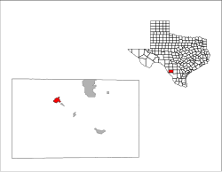
Dimmit County is a county located in the U.S. state of Texas. As of the 2020 census, its population was 8,615. The county seat is Carrizo Springs. The county was founded in 1858 and later organized in 1880. It is named after Philip Dimmitt, a major figure in the Texas Revolution. The spelling of the county name and the individual's name differ because of a spelling error in the bill creating the county name.

<span class="mw-page-title-main">Valley Falls, Rhode Island</span> Village and census-designated place in Rhode Island, US

Valley Falls is a village and census-designated place (CDP) in the town of Cumberland, Providence County, Rhode Island, United States. The population was 12,094 at the 2020 census.

<span class="mw-page-title-main">Asherton, Texas</span> City in Texas, United States

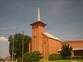
Asherton is a city in Dimmit County, Texas, United States. The population was 1,084 at the 2010 census, down from 1,342 at the 2000 census. The estimated population in 2018 was 1,064. U.S. Highway 83 passes through Asherton.

<span class="mw-page-title-main">Big Wells, Texas</span> City in Texas, United States

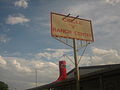
Big Wells is a city in Dimmit County, Texas, United States. The population was 697 at the 2010 census, with an estimated population of 712 in 2018.

<span class="mw-page-title-main">Brundage, Texas</span> Census-designated place in Texas, United States

Brundage is an unincorporated community and census-designated place (CDP) in Dimmit County, Texas, United States. The population was 27 at the 2010 census.

<span class="mw-page-title-main">Carrizo Hill, Texas</span> CDP in Texas, United States

Carrizo Hill is a census-designated place (CDP) in Dimmit County, in the U.S. state of Texas, United States. The population was 582 at the 2010 census.

<span class="mw-page-title-main">Catarina, Texas</span> CDP in Texas, United States

Catarina is a census-designated place (CDP) in Dimmit County, Texas, United States. The population was 118 at the 2010 census. The community has no U.S. Post Office.

<span class="mw-page-title-main">Rocksprings, Texas</span> Town in Texas, United States

Rocksprings is a town in Edwards County, Texas, United States. As of the 2010 census, the town population was 1,182, down from 1,285 at the 2000 census. It is the county seat of Edwards County. The town received its name from natural springs associated with the porous limestone rocks in the area.

<span class="mw-page-title-main">Dilley, Texas</span> City in Texas, United States

Dilley is a city in Frio County, Texas, United States. The population was 3,894 at the 2010 census. It is located off Interstate 35, south of the county seat in Pearsall.

<span class="mw-page-title-main">Cotulla, Texas</span> City in Texas, United States

Cotulla is a city in and the county seat of La Salle County, Texas, United States. Its population was 3,718 as of the 2020 census.

<span class="mw-page-title-main">George West, Texas</span> City in Texas, United States

George West is a city in Live Oak County, Texas, United States, and named for cattle rancher George Washington West. The population was 2,445 at the 2010 census. It is the county seat of Live Oak County. George West was named the "storytelling capital of Texas" in 2005 by the Texas Senate; and it hosts the George West Storyfest, a festival that features storytelling, cowboy poetry, and music. Numerous ranches surround George West.

<span class="mw-page-title-main">Leakey, Texas</span> City in Texas, United States

Leakey is a city in and the county seat of Real County, Texas, United States. The population was 425 at the 2010 census.

<span class="mw-page-title-main">Gilmer, Texas</span> City in Texas, United States

Gilmer is a city in, and the county seat of, Upshur County, Texas, United States. It is best known for being the home of the East Texas Yamboree and the birthplace of popular music singers Don Henley of the Eagles band and Johnny Mathis, as well as blues musician Freddie King. Its population was 4,843 at the 2020 census.

<span class="mw-page-title-main">Ore City, Texas</span> City in Texas, United States

Ore City is a city in Upshur County, Texas, United States. The population was 1,108 at the 2020 census.

<span class="mw-page-title-main">Sabinal, Texas</span> City in Texas, United States

Sabinal is a city in Uvalde County, Texas, United States. The population was 1,695 at the 2010 census.

<span class="mw-page-title-main">Uvalde, Texas</span> City in Texas, United States

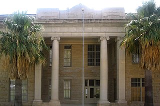
Uvalde is a city in and the county seat of Uvalde County, Texas, United States. The population was 15,217 at the 2020 census. Uvalde is located in the Texas Hill Country, 80 miles (130 km) west of downtown San Antonio and 54 miles (87 km) east of the Mexico–United States border.

References

  1. "2019 U.S. Gazetteer Files". United States Census Bureau. Retrieved August 7, 2020.
  2. 1 2 U.S. Geological Survey Geographic Names Information System: Carrizo Springs, Texas
  3. 1 2 "Population and Housing Unit Estimates". United States Census Bureau. May 24, 2020. Retrieved May 27, 2020.
  4. 1 2 "U.S. Census website". United States Census Bureau . Retrieved January 31, 2008.
  5. "Find a County". National Association of Counties. Archived from the original on May 31, 2011. Retrieved June 7, 2011.
  6. https://www.census.gov/ [ not specific enough to verify ]
  7. Handbook of Texas Online.
  8. "Nancy Beck Young, "San Antonio, Uvalde and Gulf Railroad Company"". Texas State Historical Association on-line. Retrieved April 28, 2013.
  9. Texas Olive Ranch
  10. "US Gazetteer files: 2010, 2000, and 1990". United States Census Bureau. February 12, 2011. Retrieved April 23, 2011.
  11. Edwards, Roger. "SUPERCELLS OF THE SERRANIAS DEL BURRO (MEXICO)" (PDF).
  12. "NowData – NOAA Online Weather Data". National Oceanic and Atmospheric Administration . Retrieved August 11, 2021.
  13. "Station Name: TX CARRIZO SPRINGS 3S". National Oceanic & Atmospheric Administration. Retrieved August 11, 2021.
  14. "Census of Population and Housing". Census.gov. Retrieved June 4, 2015.
  15. "Explore Census Data". data.census.gov. Retrieved May 20, 2022.
  16. http://www.census.gov [ not specific enough to verify ]
  17. "About the Hispanic Population and its Origin". www.census.gov. Retrieved May 18, 2022.
  18. "Trump Prepares to Open New 'Captured Children' Facility in Texas as Hundreds of Rights Groups Call for Decriminalizing Migration". Common Dreams. Retrieved June 28, 2019.
  19. Priscilla Alvarez (June 6, 2019). "HHS to open new housing for unaccompanied minors". CNN. Retrieved June 28, 2019.
  20. Dwyer, Mimi (June 7, 2019). "The Trump Administration is Converting a Former "Man Camp" in Texas into a Shelter for Migrant Kids". Vice News. Retrieved June 28, 2019.
  21. Foster-Frau, Silvia (February 23, 2021). "First migrant facility for children opens under Biden". Washington Post . ISSN   0190-8286 . Retrieved May 21, 2021.