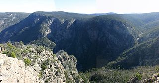
The Tambo River or Berrawan is a perennial river of the Mitchell River catchment, located in the East Gippsland region of the Australian state of Victoria. With a total length in excess of 186 kilometres (116 mi), the Tambo River is one of the longest rivers in the East Gippsland drainage basin, extending from the steep forested southern slopes of the Victorian Alps through forest and farmland to the Gippsland Lakes.

The Nicholson River is a perennial river of the Mitchell River catchment, located in the East Gippsland region of the Australian state of Victoria.

The Ingeegoodbee River is a perennial river of the Snowy River catchment, located in the Alpine regions of the states of New South Wales and Victoria, Australia.
The Hartland River is a perennial river of the East Gippsland catchment, located in the Australian state of Victoria.
The Dargo River is a perennial river of the Mitchell River catchment, located in the Alpine and East Gippsland regions of the Australian state of Victoria.
The Wentworth River is a perennial river of the Mitchell River catchment, located in the East Gippsland region of the Australian state of Victoria.

The Little River is a perennial river of the Snowy River catchment, located in the Alpine region of the Australian state of Victoria. It is one of two rivers of the same name that are tributaries of the Snowy River, the other being the Little River.

The Moroka River is a perennial river of the Mitchell River catchment, located in the Alpine region of the Australian state of Victoria.

The Bonang River is a perennial river of the Snowy River catchment, located in the Alpine region of the Australian state of Victoria.
The Yalmy River is a perennial river of the Snowy River catchment, located in the Alpine region of the Australian state of Victoria.

The Berrima River, also called the Berrima Creek, is a perennial river of the Snowy River catchment, located in the Alpine region of the Australian states of New South Wales and Victoria.
The Back River is a perennial river of the Mitchell River catchment, located in the Alpine region of the Australian state of Victoria.
The Little River is a perennial river of the Mitchell River catchment, located in the East Gippsland region of the Australian state of Victoria.
The Wonnangatta River is a perennial river of the Mitchell River catchment, located in the Alpine and East Gippsland regions of the Australian state of Victoria.
Swamp Creek is a perennial stream of the Mitchell River catchment, located in the Alpine and East Gippsland regions of the Australian state of Victoria.
The Little Dargo River is a perennial river of the Mitchell River catchment, located in the Alpine region of the Australian state of Victoria.
The Little River is a perennial river of the Mitchell River catchment, located in the Alpine region of the Australian state of Victoria.
The Humffray River is a perennial river of the Mitchell River catchment, located in the Alpine region of the Australian state of Victoria.
The Wongungarra River is a perennial river of the Mitchell River catchment, located in the Alpine region of the Australian state of Victoria.
The Crooked River is a perennial river of the Mitchell River catchment, located in the Alpine region of the Australian state of Victoria.


