
The Moyne River, a perennial river of the Glenelg Hopkins catchment, is located in the Western District of Victoria, Australia.

The Hopkins River, a perennial river of the Glenelg Hopkins catchment, is located in the Western District of Victoria, Australia.

The Wimmera River, an inland intermittent river of the Wimmera catchment, is located in the Grampians and Wimmera regions of the Australian state of Victoria. Rising in the Pyrenees, on the northern slopes of the Great Dividing Range, the Wimmera River flows generally north by west and drains into Lake Hindmarsh and Lake Albacutya, a series of ephemeral lakes that, whilst they do not directly empty into a defined watercourse, form part of the Murray River catchment of the Murray-Darling basin.
The Henty River is a perennial river in the West Coast region of Tasmania, Australia. The river generally lies north of Queenstown and south of Zeehan.

The Glenelg River, a perennial river of the Glenelg Hopkins catchment, is located in the Australian states of Victoria and South Australia.
The Cann River is a perennial river located in the East Gippsland region of the Australian state of Victoria.

Tyrendarra is a locality in south west Victoria, Australia. The locality is split between the Shire of Glenelg and the Shire of Moyne local government areas, with most being in the former. It is on the Princes Highway, 338 kilometres (210 mi) south west of the state capital, Melbourne. The Tyrendarra township lies within a bend of Darlot Creek, before it enters the Fitzroy River—which also flows through the locality.

The Woady Yaloak River is a perennial river of the Corangamite catchment, located in the Western District Lakes region of the Australian state of Victoria.

The Wannon River, a perennial river of the Glenelg Hopkins catchment, is located in the Western District of Victoria, Australia.

The Mount Emu Creek, a perennial creek of the Glenelg Hopkins catchment, is located in the Western District of Victoria, Australia.
Budj Bim, also known as Mount Eccles, is a dormant volcano near Macarthur in southwestern Victoria, Australia. It lies within the geologically-defined area known as the Newer Volcanics Province, which is the youngest volcanic area in Australia and stretches from western Victoria to south-eastern South Australia.
The Cobboboonee National Park is a national park located in the Barwon South West region of Victoria, Australia. The 18,510-hectare (45,700-acre) national park is situated approximately 360 kilometres (220 mi) west of Melbourne city centre, with access via the town of Heywood near the junctions of the Princes and Henty highways, north of Portland.
The Merri River, a perennial river of the Glenelg Hopkins catchment, is located in the Western District of Victoria, Australia.
The Shaw River, a perennial river of the Glenelg Hopkins catchment, is located in the Western District of Victoria, Australia.
The Surry River, sometimes incorrectly spelled as the Surrey River, a perennial river of the Glenelg Hopkins catchment, is located in the Western District of Victoria, Australia.
The Eumeralla River is a perennial river of the Glenelg Hopkins catchment, located in the Western District of Victoria, Australia.

The Big River, a perennial river of the North-East Murray catchment of the Murray-Darling basin, is located in the East Gippsland and alpine regions of Victoria, Australia. It flows from the northern slopes of Falls Creek in the Australian Alps, joining with the Cobungra River near Anglers Rest to form the Mitta Mitta River.
The Wando River, a perennial river of the Glenelg Hopkins catchment, is located in the Western District of Victoria, Australia.
Budj Bim heritage areas includes several protected areas in Victoria, Australia, the largest two being Budj Bim National Heritage Landscape and the Budj Bim Cultural Landscape. Within the latter, there are three Indigenous Protected Areas: the Tyrendarra Indigenous Protected Area, Kurtonitj Indigenous Protected Area, and the Lake Condah Indigenous Protected Area.
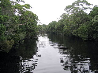
Darlot Creek, also known as Darlots Creek or Darlot's Creek, arises in Lake Condah in south-western Victoria, flows through the wetlands in the Budj Bim heritage areas, past the site of the Lake Condah Mission, and joins the Fitzroy River at the south-eastern corner of the Tyrendarra Nature Conservation Reserve. It lies within the Shire of Glenelg, and is heritage-listed.
