The Goulburn River, a major inland perennial river of the Goulburn Broken catchment, part of the Murray-Darling basin, is located in the Alpine, Northern Country/North Central, and Southern Riverina regions of the Australian state of Victoria. The headwaters of the Goulburn River rise in the western end of the Victorian Alps, below the peak of Corn Hill before descending to flow into the Murray River near Echuca, making it the longest river in Victoria at 654 kilometres (406 mi). The river is impounded by the Eildon Dam to create Lake Eildon, the Eildon Pondage, the Goulburn Weir and Waranga Basin.

The Avoca River, an inland intermittent river of the north–central catchment, part of the Murray-Darling basin, is located in the lower Riverina bioregion and Central Highlands and Wimmera regions of the Australian state of Victoria. The headwaters of the Avoca River rise on the northern slopes of the Pyrenees Range and descend to flow into the ephemeral Kerang Lakes.

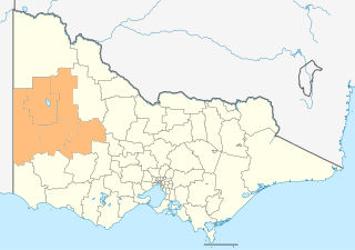
The Wimmera Southern Mallee subregion is part of the Grampians region in western Victoria. The district covers the dryland farming area south of the range of Mallee scrub, east of the South Australia border and north of the Great Dividing Range. It can also be defined as the land within the social catchment of Horsham, its main settlement.

Barwon River, a perennial river that is part of the Murray–Darling basin, is located in the north-west slopes and Orana regions of New South Wales, Australia.

The Loddon River, an inland river of the north–central catchment, part of the Murray-Darling basin, is located in the lower Riverina bioregion and Central Highlands and Loddon Mallee regions of the Australian state of Victoria. The headwaters of the Loddon River rise on the northern slopes of the Great Dividing Range east of Daylesford and descend to flow north into the Little Murray River, near Swan Hill. The river is impounded by the Cairn Curran and Laanecoorie reservoirs. The Tullaroop Creek tributary, which joins just above Laanecoorie Reservoir, is impounded by the Tullaroop Reservoir (72,950ML).

North Central Victoria is a rural region in the Australian state of Victoria. The region lies to the south of the Victorian/New South Wales border as defined by the Murray River, to the southwest of the Hume region, to the west of the Great Dividing Range contained within the Central Highlands and Victorian Alps, to the north of Greater Melbourne, to the northeast of the Wimmera, and to the east of the Mallee region.

The Mallee covers the most northwesterly part of Victoria, bounded by the South Australian and New South Wales borders. Definitions of the south-eastern boundary vary, however, all are based on the historic Victorian distribution of mallee eucalypts. These trees dominate the surviving vegetation through most of Mallee,. Its biggest settlements are Mildura and Swan Hill.

The Broken River, a minor inland perennial river of the Goulburn Broken catchment, part of the Murray–Darling basin, is located in the Alpine and Northern Country/North Central regions of the Australian state of Victoria. The headwaters of the Broken River rise in the western slopes of the Victorian Alps, near Bald Hill and descend to flow into the Goulburn River near Shepparton. The river is impounded by the Nillahcootie Dam to create Lake Nillahcootie and Benalla Dam to create Lake Benalla.

The Latrobe River is a perennial river of the West Gippsland catchment, located in the West Gippsland region of the Australian state of Victoria. The Latrobe River and its associated sub-catchment is an important source for the Gippsland Lakes, draining the south eastern slopes of the Great Dividing Range.

The Wimmera River, an inland intermittent river of the Wimmera catchment, is located in the Grampians and Wimmera regions of the Australian state of Victoria. Rising in the Pyrenees, on the northern slopes of the Great Dividing Range, the Wimmera River flows generally north by west and drains into Lake Hindmarsh and Lake Albacutya, a series of ephemeral lakes that, whilst they do not directly empty into a defined watercourse, form part of the Murray River catchment of the Murray-Darling basin.

The Delatite River, an inland perennial river of the Goulburn Broken catchment, part of the Murray-Darling basin, is located in the lower South Eastern Highlands bioregion and Northern Country/North Central regions of the Australian state of Victoria. The headwaters of the Delatite River rise on the western slopes of the Victorian Alps and descend to flow into the Goulburn River within Lake Eildon.

The Coliban River, an inland perennial river of the north–central catchment, part of the Murray-Darling basin, is located in the lower Riverina bioregion and Central Highlands region of the Australian state of Victoria. The headwaters of the Coliban River rise on the northern slopes of the Great Dividing Range and descend to flow north into the Campaspe River with the impounded Lake Eppalock.
The 1909 Western Victorian floods consisted of widespread flooding on rivers of the western half of the State of Victoria during the middle of August that year.
The Jardwadjali (Yartwatjali), also known as the Jaadwa, are an Aboriginal Australian people of the state of Victoria, whose traditional lands occupy the lands in the upper Wimmera River watershed east to Gariwerd (Grampians) and west to Lake Bringalbert.
The regions of Victoria vary according to the different ways that the Australian state of Victoria is divided into distinct geographic regions. The most commonly used regions are those created by the state government for the purposes of economic development.
Lake Hindmarsh, an ephemeral lake located in the Wimmera region of western Victoria, Australia, is the state's largest natural freshwater lake. The nearest towns are Jeparit to the south and Rainbow to the north. After more than a decade of drought, in early 2011 the lake filled as a result of flooding in the region. The Wemba Wemba name of the lake is recorded as Gour or Koor.

The Campaspe River, an inland intermittent river of the north–central catchment, part of the Murray-Darling basin, is located in the lower Riverina bioregion and Central Highlands and Wimmera regions of the Australian state of Victoria. The headwaters of the Campaspe River rise on the northern slopes of the Great Dividing Range and descend to flow north into the Murray River, Australia's longest river, near Echuca.
The Avon River, an inland intermittent river of the Wimmera catchment, located in the Grampians and Wimmera regions of the Australian state of Victoria. Rising on the northern slopes of the Great Dividing Range, the Avon River flows north-westerly to reach its confluence with the Richardson River. The rivers of the Wimmera catchment drain into a series of ephemeral lakes that, whilst they do not directly empty into a defined watercourse, form part of the Murray River catchment of the Murray-Darling basin.
The Mackenzie River, an inland intermittent river of the Wimmera catchment, is located in the Grampians region of the Australian state of Victoria. Rising in the Grampians National Park, on the northern slopes of the Great Dividing Range, the Mackenzie River flows generally north by west and drains into the Wimmera River, southwest of Horsham.
Lake Buloke is a eutrophic lake in the Wimmera region of north-western Victoria, Australia. The lake is fed by the Richardson River and is located adjacent to the township of Donald. Lake Buloke is also one of the most popular duck shooting lakes in Victoria. The Lake Buloke area comprises wetland habitat of high significance for waterbirds, particularly waterfowl and waders. The bull oak casuarina is found in the Shire and around Lake Buloke.


