
Traralgon is a town located in the east of the Latrobe Valley in the Gippsland region of Victoria, Australia and the most populous city of the City of Latrobe. The urban population of Traralgon at the 2021 census was 26,907. It is the largest and fastest growing city in the greater Latrobe Valley area, which has a population of 77,168 at the 2021 Census and is administered by the City of Latrobe.

Morwell is a town in the Latrobe Valley area of Gippsland, in South-Eastern Victoria, Australia approximately 152 km (94 mi) east of Melbourne.

Gippsland is a rural region that makes up the southeastern part of Victoria, Australia, mostly comprising the coastal plains to the rainward (southern) side of the Victorian Alps. It covers an elongated area of 41,556 km2 (16,045 sq mi) located further east of the Shire of Cardinia between Dandenong Ranges and Mornington Peninsula, and is bounded to the north by the mountain ranges and plateaus/highlands of the High Country, to the southwest by the Western Port Bay, to the south and east by the Bass Strait and the Tasman Sea, and to the east and northeast by the Black-Allan Line.

Sir Paweł Edmund Strzelecki, also known as Paul Edmund de Strzelecki and Sir Paul Strzelecki, was a Polish explorer, geologist, humanitarian, environmentalist, nobleman, scientist, businessman and philanthropist who in 1845 also became a British subject. He is noted for his contributions to the exploration of Australia, particularly the Snowy Mountains and Tasmania, and for climbing and naming the highest – 2228 metres – mountain on the continent, Mount Kosciuszko.

The Latrobe Valley is an inland geographical district and urban area of the Gippsland region in the state of Victoria, Australia. The traditional owners are the Brayakaulung of the Gunai nation. The district lies east of Melbourne and nestled between the Strzelecki Ranges to the south and the Baw Baw Ranges, part of the Great Dividing Range, to the north. Mount St Phillack is the highest peak to the north of the Latrobe Valley, due north of Moe. The highest peak to the south is Mt Tassie, south of Traralgon.

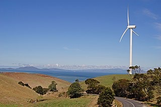
The Strzelecki Ranges is a set of low mountain ridges located in the West Gippsland and South Gippsland regions of the Australian state of Victoria.
Toora is a small farming town in Victoria, Australia whose main industry is dairy farming. It is located at the top of Corner Inlet opposite Wilsons Promontory National Park. In the 2016 census the population was 681.

The Bass River, a perennial river of the Western Port catchment, is located in the West Gippsland region of the Australian state of Victoria.

The Lang Lang River is a perennial river of the Western Port catchment, located in the West Gippsland region of the Australian state of Victoria.
West Gippsland, a region of Gippsland in Victoria, Australia, extends from the southeastern limits of metropolitan Melbourne and Western Port Bay in the west to the Latrobe Valley in the east, and is bounded by the Strzelecki Ranges to the south and the Mount Baw Baw Plateau in the Great Dividing Range to the north.
(The) Grand Ridge Road is a long tourist drive through Gippsland, in Victoria, Australia. As the name suggests, the road primarily follows ridgelines through the heavily undulating Strzelecki Ranges.
The Albert River is a perennial river of the West Gippsland catchment, located in the South Gippsland region of the Australian state of Victoria.

The Agnes River is a perennial river of the West Gippsland catchment, located in the South Gippsland region of the Australian state of Victoria.
The Tarra River is a perennial river of the West Gippsland catchment, located in the South Gippsland region of the Australian state of Victoria.
The Perry River is a perennial river of the West Gippsland catchment, located in the Gippsland region of the Australian state of Victoria.
The Yeerung River is a perennial river located in the East Gippsland region of the Australian state of Victoria.
The Tarwin River is a perennial river of the West Gippsland catchment, located in the South Gippsland region of the Australian state of Victoria. The Tarwin River is the primary river system within South Gippsland Shire and has a catchment area of approximately 1,500 square kilometres (580 sq mi), predominantly rural with small pockets of residential land use. It flows south from the Strzlecki Ranges and discharges in the eastern reaches of Anderson Inlet, a shallow estuary connected to Bass Strait.
The Morwell River is a perennial river of the West Gippsland catchment, located in the West Gippsland and South Gippsland regions of the Australian state of Victoria.
The Turton River is a perennial river of the West Gippsland catchment, located in the Gippsland region of the Australian state of Victoria.
The Tanjil River is a perennial river of the West Gippsland catchment, located in the West Gippsland region of the Australian state of Victoria.
