Dwellingup, Western Australia

Last updated

Dwellingup
Western Australia
Dwellingup History and Visitor Information Centre, November 2019.jpg
Dwellingup History and Visitor Information Centre
Dwellingup, Western Australia
Coordinates 32°43′S116°04′E / 32.72°S 116.06°E / -32.72; 116.06
Population524 (SAL 2021) [1]
Established1910
Postcode(s) 6213
Elevation267 m (876 ft)
Area37 km2 (14 sq mi)
Location97 km (60 mi) S of Perth
LGA(s) Shire of Murray
State electorate(s) Murray-Wellington
Federal division(s) Canning
Mean max tempMean min tempAnnual rainfall
21.9 °C
71 °F
9.6 °C
49 °F
1,233.0 mm
48.5 in
Localities around Dwellingup:
Teesdale Holyoake Holyoake
Teesdale Dwellingup Marradong
Nanga Brook Nanga Brook Etmilyn

Dwellingup is a town in Western Australia located in a timber and fruitgrowing area in the Darling Range east-south-east of Pinjarra. At the 2011 census, Dwellingup had a population of 383. [2]

Contents

Name

Townsite lots were surveyed at this place by surveyor W.F. Rudall in 1909 after the Lands Department became aware that the site was planned as the terminus of the "Pinjarra-Marrinup Railway". Names suggested for the place by Rudall were "Dwellingerup" or "Marrinup", after nearby brooks, or "McLarty" after a local MLA who had been very active concerning the railway (John or Edward McLarty). Surveyor General H.F. Johnston chose "Dwellingupp" after being misinformed regarding the spelling of Dwellingerup Brook. Ignoring a suggestion from the Under Secretary to amend the name to "Dwellingdown", the Minister for Lands approved the name as "Dwellingup" in December 1909. Eventually, the spelling "Dwellingupp" was chosen by order of the Under Secretary for Lands, and the townsite was gazetted as Dwellingupp in February 1910. The spelling was amended to Dwellingup in 1915. [3] Dwellingup is an Aboriginal name said to mean "place of nearby water" or "on and by the whole place there is fog, dew and mist". [4]

Bushfires

In one of Western Australia's worst bushfires, the fires of 1961, many small surrounding communities in the area were destroyed, including 132 houses in Dwellingup itself. There were no fatalities, but 800 people were left homeless. The town was rebuilt. [5]

Dwellingup experienced serious bushfires again over the week starting on 3 February 2007. Sixteen houses were destroyed and thousands of hectares of private property and forest were burnt. There was no loss of life. [6] [7]

Bauxite mining

Dwellingup is near the one of the largest bauxite mines in the world, at Huntly, [8] which supplies ore to the Pinjarra and Kwinana aluminium refineries.

Facilities

Dwellingup is home to Nanga Bush Camp, a popular camp for senior primary schools and high schools. Some of the activities at Nanga Bush Camp include water rafting, night watching, swimming and bush walks. [9]

Another major attraction in the area is the Hotham Valley Railway. A Dwellingup Forest Ranger Tour operates between May and October, and is steam hauled between Pinjarra and Dwellingup. [10]

Dwellingup has a skate park and pump track. It also has the Munda Biddi Bike Trail and the Captain Fawcett 4WD Trail.[ citation needed ]

The Bibbulmun Track, a long-distance walk trail, passes through Dwellingup. [11]

Climate

Dwellingup is one of the wettest inhabited places in Western Australia, with an average annual rainfall of over 1,200 mm. [12] It has a hot-summer Mediterranean climate (Köppen climate classification: Csa).

Climate data for Dwellingup
MonthJanFebMarAprMayJunJulAugSepOctNovDecYear
Record high °C (°F)42.9
(109.2)
43.5
(110.3)
40.6
(105.1)
34.7
(94.5)
29.0
(84.2)
24.3
(75.7)
23.1
(73.6)
24.7
(76.5)
30.4
(86.7)
35.6
(96.1)
38.0
(100.4)
42.0
(107.6)
43.5
(110.3)
Average high °C (°F)29.7
(85.5)
29.6
(85.3)
27.0
(80.6)
22.5
(72.5)
18.5
(65.3)
16.0
(60.8)
15.0
(59.0)
15.7
(60.3)
17.3
(63.1)
20.1
(68.2)
23.8
(74.8)
27.3
(81.1)
21.9
(71.4)
Daily mean °C (°F)22.0
(71.6)
22.1
(71.8)
20.0
(68.0)
16.4
(61.5)
13.1
(55.6)
11.3
(52.3)
10.3
(50.5)
10.6
(51.1)
11.9
(53.4)
14.1
(57.4)
17.2
(63.0)
20.0
(68.0)
15.7
(60.3)
Average low °C (°F)14.3
(57.7)
14.6
(58.3)
13.0
(55.4)
10.3
(50.5)
7.7
(45.9)
6.5
(43.7)
5.5
(41.9)
5.5
(41.9)
6.5
(43.7)
8.0
(46.4)
10.5
(50.9)
12.6
(54.7)
9.6
(49.3)
Record low °C (°F)6.0
(42.8)
5.0
(41.0)
3.0
(37.4)
0.0
(32.0)
−3.9
(25.0)
−3.0
(26.6)
−3.9
(25.0)
−2.2
(28.0)
−1.7
(28.9)
−0.8
(30.6)
0.6
(33.1)
0.9
(33.6)
−3.9
(25.0)
Average precipitation mm (inches)17.1
(0.67)
21.7
(0.85)
26.4
(1.04)
65.5
(2.58)
157.7
(6.21)
235.8
(9.28)
234.8
(9.24)
194.0
(7.64)
131.5
(5.18)
79.0
(3.11)
45.7
(1.80)
21.2
(0.83)
1,233
(48.54)
Average precipitation days (≥ 0.2mm)3.43.45.09.615.818.820.919.216.212.28.14.9137.5
Mean monthly sunshine hours 325.5268.4244.9183.0158.1117.0133.3161.2177.0232.5255.0310.02,565.9
Source: [12]

See also

Related Research Articles

<span class="mw-page-title-main">Waroona, Western Australia</span> Town in Western Australia

Waroona is a town located in the Peel region of Western Australia along the South Western Highway, between Pinjarra and Harvey. The town is the seat of the Shire of Waroona. At the 2016 census, Waroona had a population of 2,934.

<span class="mw-page-title-main">Hotham Valley Railway</span>

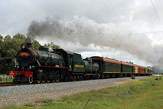
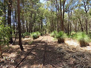
The Hotham Valley Tourist Railway is a tourist and heritage railway in the Peel region of Western Australia.

<span class="mw-page-title-main">Pinjarra, Western Australia</span> Town in Western Australia

Pinjarra is a town in the Peel region of Western Australia along the South Western Highway, 82 kilometres (51 mi) from the state capital, Perth and 21 kilometres (13 mi) south-east of the coastal city of Mandurah. Its local government area is the Shire of Murray. At the 2016 census, Pinjarra had a population of 4910.

<span class="mw-page-title-main">Balingup, Western Australia</span> Town in Western Australia

Balingup is a town in the South West of Western Australia, 241 kilometres (150 mi) south of the state capital, Perth, and 31 kilometres (19 mi) southeast of the town of Donnybrook.

<span class="mw-page-title-main">Boddington, Western Australia</span> Town in Western Australia

Boddington is a town and shire in the Peel region of Western Australia, located 120 kilometres (75 mi) south-east of Perth. The town sits on the road from Pinjarra to Williams on the Hotham River. The population of the town was 1,844 at the 2016 Census.

In early 1961, a series of bushfires burned in the south-west region of Western Australia. The devastating fires burned large areas of forest in and around Dwellingup from 20 to 24 January, at Pemberton and in the Shannon River region between 11 and 15 February, and in the Augusta-Margaret River area in early March. There were also major fires which burned in the Darling Scarp around Kalamunda. The towns of Dwellingup and Karridale were largely destroyed by the fires, as were a number of smaller railway and mill settlements. There was no loss of human life.

<span class="mw-page-title-main">Nanga Brook, Western Australia</span> Town in Western Australia

Nanga Brook is a former town located in the Peel region of Western Australia in the Lane Poole Reserve between Dwellingup and Waroona.

<span class="mw-page-title-main">Banksiadale, Western Australia</span> Town in Western Australia

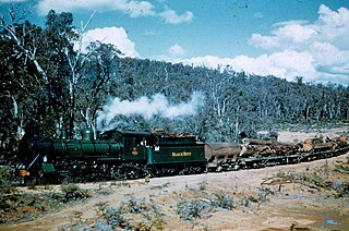
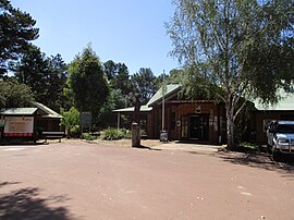
Banksiadale is a locality and former town in the Peel region of Western Australia north of Dwellingup. Its local government area is the Shire of Murray.

<span class="mw-page-title-main">Shire of Murray</span> Local government area in Western Australia

The Shire of Murray is a local government area of Western Australia. It has an area of 1,710.1 square kilometres (660.3 sq mi) and is located in the Peel Region about 80 kilometres (50 mi) south of the Perth central business district.

<span class="mw-page-title-main">South Western Railway, Western Australia</span> Main railway route between Perth and Bunbury in Western Australia

The South Western Railway, also known as the South West Main Line, is the main railway route between Perth and Bunbury in Western Australia.

Gleneagle or Glen Eagle is a locality in Western Australia. The locality is south east of the state capital, Perth, close to Jarrahdale on the Albany Highway.

Meelon is a small townsite in the Peel region of Western Australia, located between Pinjarra and Dwellingup within the Shire of Murray. At the 2011 census, Meelon had a population of 224.

<span class="mw-page-title-main">Pinjarra to Narrogin railway</span> Former railway line in Western Australia

The Pinjarra to Narrogin railway was a 153 kilometre cross-country railway line built between the towns of Pinjarra and Narrogin in Western Australia.

<span class="mw-page-title-main">Murray Land District</span> Cadastral in Western Australia

Murray Land District is a land district of Western Australia, located within the South-West Land Division on the state's west coast. It spans roughly 32°25'S - 32°56'S in latitude and 115°25'E - 116°30'E in longitude, and is located on the Indian Ocean coast, taking in the Shires of Murray and Waroona, the eastern part of the Serpentine-Jarrahdale and the western suburbs of Mandurah.

The Department of Parks and Wildlife (DPaW) was the department of the Government of Western Australia responsible for managing lands described in the Conservation and Land Management Act 1984 and implementing the state's conservation and environment legislation and regulations. The minister responsible for the department was the Minister for the Environment.

<span class="mw-page-title-main">Marrinup, Western Australia</span> Ghost town in Western Australia

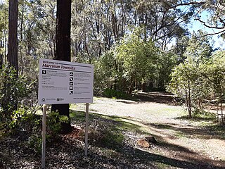
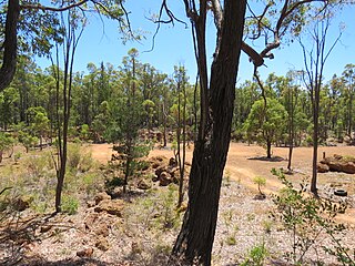
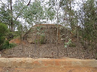
Marrinup is a ghost town in the Peel region of Western Australia between Dwellingup and Pinjarra. Its local government area is the Shire of Murray. The town was destroyed in the 1961 bushfires and the townsite is now used as a campground. The ruins of the townsite are heritage listed. Little remains of the town other than an old bridge over Marrinup Creek and some wooden railway sleepers.

<span class="mw-page-title-main">Etmilyn, Western Australia</span> Locality in the Shire of Murray

Etmilyn is a rural locality of the Shire of Murray in the Peel Region of Western Australia, located within the Dwellingup State Forest.

Holyoake is a rural locality of the Shire of Murray in the Peel Region of Western Australia, located within the Dwellingup State Forest.

<span class="mw-page-title-main">Inglehope, Western Australia</span> Locality in the Shire of Murray

Inglehope is a rural locality of the Shire of Murray in the Peel Region of Western Australia, located within the Dwellingup State Forest.

<span class="mw-page-title-main">Wuraming, Western Australia</span> Locality in the Shire of Boddington, Western Australia

Wuraming is a rural locality located in the Shire of Boddington in the Peel Region of Western Australia. The locality is almost completely forested except for a section in the north-east where parts of the Boddington Gold Mine operation are located.

References

  1. Australian Bureau of Statistics (28 June 2022). "Dwellingup (Suburb and Locality)". Australian Census 2021 QuickStats. Retrieved 28 June 2022.  OOjs UI icon edit-ltr-progressive.svg
  2. Australian Bureau of Statistics (31 October 2012). "2011 Census Quickstats: Dwellingup". 2011 Census QuickStats. Retrieved 31 October 2012. OOjs UI icon edit-ltr-progressive.svg
  3. "History of country town names – D". Western Australian Land Information Authority. Archived from the original on 14 March 2022. Retrieved 8 June 2007.
  4. Nyungar Boodjera Wangkiny (The People’s Land is Speaking): Nyungar Place Nomenclature of the Southwest of Western Australia Nyungar names of the boodjar or land in the southwest of Australia and their interpretations http://www.boodjar.sis.uwa.edu.au/_literature.../Nyungar_Boodjera_Wangkiny.{{cite web}}: Missing or empty |title= (help)[ permanent dead link ]
  5. Courtney, Joe; Middelmann, Miriam (2005). "Meteorological hazards". Natural hazard risk in Perth, Western Australia – Cities Project Perth Report. Geoscience Australia . Retrieved 25 December 2012.
  6. "Fire recovery work continues in Dwellingup". Australia: ABC News. 14 February 2007. Retrieved 25 December 2012.
  7. "WA blaze contained but crews still busy". Australia: ABC News. 5 February 2007. Archived from the original on 15 January 2013. Retrieved 25 December 2012.
  8. Global Operations Alcoa World Alumina and Chemicals. Retrieved 18 May 2021.
  9. "Nanga Bush Camp Website ". Western Australia. Retrieved 27 July 2012.
  10. "Hotham Valley Railway Website". Western Australia. Retrieved 27 July 2012.
  11. Website Bibbulmun Track Foundation
  12. 1 2 "Climate statistics for Dwellingup". Bureau of Meteorology. August 2018. Retrieved 29 August 2018.

Commons-logo.svg Media related to Dwellingup, Western Australia at Wikimedia Commons