
The City of Stirling is a local government area in the northern suburbs of the Western Australian capital city of Perth about 10 kilometres (6 mi) north of Perth's central business district. The City covers an area of 105.2 square kilometres (40.6 sq mi) and has a population of over 223,000, making it the largest local government area by population in Western Australia.

Jandakot is a southern suburb of Perth, Western Australia, located within the City of Cockburn local government area. It is best known for Jandakot Airport that is situated entirely within the suburb, the airport being "the busiest general aviation airport in Australia in terms of aircraft movements", the sixth-busiest civilian airport in Australia in the fiscal year ending 30 June 2018, and in the 2011 fiscal year even the busiest civilian airport in Australia.

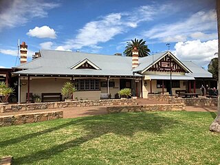
Pinjarra is a town in the Peel region of Western Australia along the South Western Highway, 82 kilometres (51 mi) from the state capital, Perth and 21 kilometres (13 mi) south-east of the coastal city of Mandurah. Its local government area is the Shire of Murray. At the 2016 census, Pinjarra had a population of 4910.

Dwellingup is a town in Western Australia located in a timber and fruitgrowing area in the Darling Range east-south-east of Pinjarra. At the 2011 census, Dwellingup had a population of 383.
Orange Grove is a suburb of Perth, Western Australia in the City of Gosnells.
Coodanup is a south-eastern suburb of Mandurah, Western Australia. Its local government area is the City of Mandurah.

Halls Head is a coastal suburb (locality) of Mandurah, immediately west of Mandurah's central area. It is largely residential and contains several canal estates developed since the 1980s.
Roelands is a town in the South West region of Western Australia on the South Western Highway, between Brunswick Junction and Bunbury. At the 2011 census, Roelands had a population of 620.
Wokalup is a town located in the South West region of Western Australia along the South Western Highway, between Harvey and Brunswick Junction. At the 2006 census, Wokalup had a population of 449.

The Shire of Murray is a local government area of Western Australia. It has an area of 1,710.1 square kilometres (660.3 sq mi) and is located in the Peel Region about 80 kilometres (50 mi) south of the Perth central business district.
Quindanning is a small town located halfway between Boddington and Williams along the Pinjarra-Williams Road. At the 2006 census, Quindanning had a population of 163.

Pinjarra Hills is a suburb in the City of Brisbane, Queensland, Australia. In the 2016 census, Pinjarra Hills had a population of 606 people.

Barragup is a locality near Mandurah, Western Australia, located north of Pinjarra Road and east of the Serpentine River within the Shire of Murray. Its postcode is 6209. At the 2016 census, Barragup had a population of 806.

Oldbury is a district to the south of Perth, Western Australia, within the Peel region. It has no central township, and lies west of the South Western Highway, close to Byford and Mundijong. Part of the Pinjarra Plain, the district is a productive environment featuring dairy and rural engagements, although consisting of sandy soils and largely felled. The area was part of the Group Settlement Scheme, being established in 1922 as Group 35, along with the drainage scheme that contributed to the Peel Estuary environmental task and the consequent Dawesville Cut. Oldbury is part of a major realigning process in the Perth metro area, as divisions of regional land and urban districts develop, boundaries maintained since European settlement. It was established as a locality name on 1 May 1997.

Burekup is a small town located on the South Western Highway in the South West region of Western Australia.

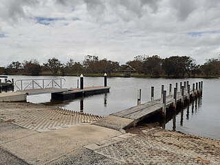
South Yunderup is a township near Mandurah, Western Australia, located on the south bank of the Murray River within the Shire of Murray. Its postcode is 6208, and in the 2011 Census, it had a population of 2,235 with a median age of 50. South Yunderup is also the second-largest township in the Shire of Murray after the main town, Pinjarra.
Meelon is a small townsite in the Peel region of Western Australia, located between Pinjarra and Dwellingup within the Shire of Murray. At the 2011 census, Meelon had a population of 224.

Furnissdale is a locality near Mandurah, Western Australia, to the south of Pinjarra Road and near the Serpentine River entrance into the Peel Inlet within the Shire of Murray. Its postcode is 6209. At the 2011 census, Furnissdale had a population of 1,027.
Pureba is a locality in the Australian state of South Australia located on the west coast of Eyre Peninsula and on land to the immediate north of the peninsula about 528 kilometres north-west of the state capital of Adelaide and about 52 kilometres north-east and 90 kilometres north respectively of the municipal seats of Ceduna and Streaky Bay.
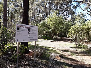
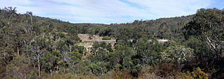
Marrinup is a ghost town in the Peel region of Western Australia between Dwellingup and Pinjarra. Its local government area is the Shire of Murray. The town was destroyed in the 1961 bushfires and the townsite is now used as a campground. The ruins of the townsite are heritage listed. Little remains of the town other than an old bridge over Marrinup Creek and some wooden railway sleepers.
