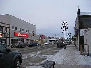
Flin Flon is a mining city, located on a correction line on the border of the Canadian provinces of Manitoba and Saskatchewan, with the majority of the city located within Manitoba. Residents thus travel southwest into Saskatchewan, and northeast into Manitoba. The city is incorporated in and is jointly administered by both provinces.

Cranbrook is a city in southeast British Columbia, Canada, located on the west side of the Kootenay River at its confluence with the St. Mary's River. It is the largest urban centre in the region known as the East Kootenay. As of 2016, Cranbrook's population is 20,499 with a census agglomeration population of 27,040. It is the location of the headquarters of the Regional District of East Kootenay and also the location of the regional headquarters of various provincial ministries and agencies, notably the Rocky Mountain Forest District.

Morden is a city located in the Pembina Valley region of southern Manitoba, Canada near the United States border. It is about 11 km (6.8 mi) west of the neighbouring city of Winkler; together Morden and Winkler are often referred to as Manitoba's Twin Cities. Morden, which is surrounded by the Rural Municipality of Stanley, is the eighth largest and fastest-growing city in Manitoba. According to Statistics Canada, the city had a population of 9,929 in 2021, an increase of 14.5% from 2016, making it Manitoba's fastest growing city.

Pickle Lake is a township in the Canadian province of Ontario, and is the most northerly community in the province that has year-round access by road. Located 530 kilometres (330 mi) north of Thunder Bay, highway access is via Highway 599, the only access road to the town from the south. More northerly communities rely on winter roads for access and are cut off to land travel in the summer. Highway 599 meets the Northern Ontario Resource Trail, formerly Tertiary Highway 808, at Pickle Lake. The township of Pickle Lake is located on the traditional territory of the Mishkeegogamang Ojibway people.

Elm Creek is an unincorporated community recognized as a local urban district in Manitoba, Canada. It is about 50 km west of Winnipeg and about 35 km southeast of Portage la Prairie. It is located in the Rural Municipality of Grey. It is home to the second largest fire hydrant in the world which was unveiled on Canada Day, 2001. It is also the home of the second largest H4 chondrite ever found in Canada. The 8.2-kg mass was found by a local grader driver on a rural road in 1997. Elm Creek has a Kindergarten to Grade 12 school.
Plum Coulee is an unincorporated urban community in the Municipality of Rhineland within the Canadian province of Manitoba that held town status prior to January 1, 2015. It is west of Altona, one hour southwest of Winnipeg and 22 kilometres from the United States border. It is also the former home to the Plum Coulee Xpress hockey club. It has an artificial beach located in town called Sunset Beach.
Ashern is an unincorporated community recognized as a local urban district located in the Municipality of West Interlake in Manitoba's Interlake Region. The RM of Siglunes was incorporated in 1917. Ashern was named after A. S. Hern, a timekeeper of the firm that constructed the railway that served the Western Interlake.
Lundar is an unincorporated community recognized as a local urban district situated in Manitoba, Canada. It is located in the Rural Municipality of Coldwell, in Manitoba's Interlake Region, 99 km north of Winnipeg on Hwy 6. Nearby attractions are Lake Manitoba and its beaches, and the Lundar Provincial Park. Lundar is home to a Canada goose refuge, and a large statue of a Canada goose is located in the community. Lundar was founded by Icelandic settlers.
McCreary is an unincorporated urban community in the Municipality of McCreary, Manitoba, Canada.
Brochet is an unincorporated community located in Northern Manitoba on the northern shore of Reindeer Lake near the Saskatchewan border; it is designated as a northern community.

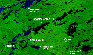
Cross Lake is a community in the Northern Region of the Canadian province of Manitoba, situated on the shores of the Nelson River where the river enters the namesake Cross Lake. An all-weather road, PR 374, connects the communities to PR 373 via the Kichi Sipi Bridge.
Fisher Branch is an unincorporated community recognized as a local urban district in the Rural Municipality of Fisher in the Canadian province of Manitoba. It is located on Highway 17 in the north Interlake Region of the province. Fisher Branch was originally named Wasoo, but later was changed to Fisher Branch because it was beside a branch of the Fisher River. The primary industry of Fisher Branch is agriculture.

Grand Rapids is a town in Manitoba, Canada, on the northwestern shore of Lake Winnipeg where the Saskatchewan River enters the lake. As the name implies, the river had a significant drop at this point. In modern days, a large hydroelectric plant has been built there. Cedar Lake, a short distance upriver, provides a natural water source for the plant. Provincial Trunk Highway 6, the region's primary roadway, crosses the Saskatchewan River at the Grand Rapids Bridge.

Gladstone is an unincorporated urban community in the Municipality of WestLake – Gladstone within the Canadian province of Manitoba that held town status prior to January 1, 2015. It is located on the Yellowhead Highway at the intersection with Highway 34. The Gladstone railway station receives Via Rail service.

Oak Lake is an unincorporated urban community in the Rural Municipality of Sifton within the Canadian province of Manitoba that held town status prior to January 1, 2015. It is located 52 km (32 mi) west of Brandon along the Trans-Canada Highway. The lake after which it was named is in the rural municipality's western area.

Ste. Anne, or Sainte-Anne-des-Chênes, is a town in Manitoba, Canada, located about 42 km southeast of Winnipeg. The population was 2,114 in 2016, 1,524 in 2011, and 1,513 in 2011. It is known for being located on the Seine River and at the heart of the Old Dawson Trail. The town is surrounded by the Rural Municipality of Ste. Anne.

Berens River is a community in Manitoba, Canada, along the eastern shore of Lake Winnipeg, at the mouth of the Berens River, which flows west from the Ontario headwaters. Together with the adjacent Berens River 13 reserve, it forms one a population centre collectively called Berens River. Both are served by the Berens River Airport.

Ninette is an unincorporated community recognized as a local urban district located in Manitoba, Canada at the north end of Pelican Lake. It is located in the Rural Municipality of Prairie Lakes. Ninette has many small businesses, and is known locally for its wide range of sports facilities. In the summer, activities such as boating, fishing, and hunting are offered, while snowmobiling and ice fishing are offered during the wintertime.
Plumas is an unincorporated community recognized as a local urban district located in the Municipality of WestLake – Gladstone, in the Canadian province of Manitoba. Plumas is roughly 70 km northwest of Portage la Prairie, Manitoba, and about 150 km northwest of the provincial capital, Winnipeg.

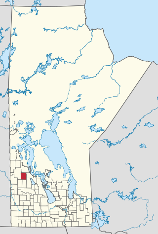
The Municipality of Ethelbert is a rural municipality (RM) in the Canadian province of Manitoba.


