Birtle, Manitoba

Last updated

Birtle
Unincorporated Community
Canada Manitoba location map 2.svg
Red pog.svg
Birtle
Coordinates: 50°25′21″N101°02′51″W / 50.42250°N 101.04750°W / 50.42250; -101.04750 Coordinates: 50°25′21″N101°02′51″W / 50.42250°N 101.04750°W / 50.42250; -101.04750
Country Flag of Canada (Pantone).svg  Canada
Province Flag of Manitoba.svg  Manitoba
Established1884;139 years ago (1884)
Area
  Total9.26 km2 (3.58 sq mi)
Population
 (2021) [1]
  Total625
  Density67/km2 (170/sq mi)
Time zone UTC−6 (CST)
  Summer (DST) UTC−5 (CDT)
Postal Code
R0M 0C0
Area codes 204, 431

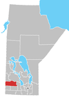
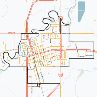
Birtle is an unincorporated urban community in the Prairie View Municipality within the Canadian province of Manitoba that held town status prior to 1 January 2015. It is located at the junction of Highways 83 and 42.

Contents

History

Originally incorporated in 1884, the community lies in the Birdtail River valley. It features a spacious community park developed in the early years of the community with additions through the years to bring it to the current time where the original golf course designed to take advantage of the valley contours now enjoys the modern amenities and the tennis courts still located in the original location now feature modern plexipave surfaces and are some of the best in western Manitoba.

Another attraction is the Birdtail Country Museum, housed in an historic stone building on Main Street. [2] The building was built in the early 1900s to be used as the Union Bank. Later it was purchased by the Royal Bank of Canada. The main floor was the bank premises. The second floor was the bank manager's living-quarters.

In 1983, the building was purchased by the former town and the former Rural Municipality of Birtle. It officially opened as the Birdtail Country Museum on 24 May 1984, as a joint centennial project of the former town and former rural municipality. Inside are more than 4,000 artifacts related to the area, including such historical items such as the diaries of original settlers (Alfred Morton's, from 1878), button hooks for ladies' boots, and ice-saws and ice-tongs used for harvesting ice from the Birdtail River in the winter. The Museum houses the trophies awarded to Samuel Larcombe, one of the early settlers of Birtle. In 1917, Larcombe, the "World Wheat King", developed a variety of rust-resistant wheat. The second floor of the Museum is set up to resemble a Victorian home. People often come to the Museum to do genealogy research through the microfilm reader, which contains every edition of the Birtle 'Eye Witness' newspaper, dating back to 1891. Local history books for the community and surrounding districts provide additional sources of information.

A self-guided Heritage Walking Tour [3] describes the history of many of the buildings and sites in the community.

In 1974, the Municipality of Birtle History Committee published A View of the Birdtail [4] documenting the history of the municipality from 1878 to 1974. The History Committee was chaired by then Mayor, Ray Howard and included representatives from each of the districts of the municipality. A second book, Passing it On [5] , documenting the history of the municipality and town was published in 2009.

Birtle was designated as Birds Tail Rivulet on the Thompson map of 1813–14. The settlement was founded in 1879 and first called St. Clair City. [6]

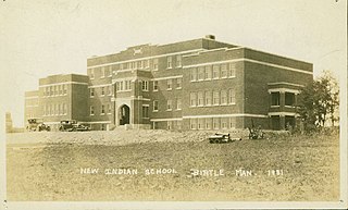
The Birtle Indian Residential School operated from 1888 to 1970. [7] :355

Geography

The Birdtail River is smaller slow flowing river dammed just above the Birtle Park, creating a small lake suitable for canoeing, kayaking and fishing. The Birdtail flows into the Assiniboine just a few miles south of Birtle. A 15-minute drive west the Qu'Apelle River flows into the Assiniboine. Many tributaries, ravines and valleys make this a very scenic region with ample habitat for a variety of wildlife and a popular area for birders. Fertile agricultural fields surround the community in all directions. Home of Chelsey Collier

Climate

Summers are warm, with a mean temperature of 17.9 °C (64.2 °F) in July. Winter are long and cold, with a mean temperature of −18.3 °C (−0.9 °F) in January.

Climate data for Birtle
MonthJanFebMarAprMayJunJulAugSepOctNovDecYear
Record high °C (°F)7.8
(46.0)
13
(55)
19
(66)
34
(93)
36.5
(97.7)
40.6
(105.1)
40
(104)
38.3
(100.9)
37.2
(99.0)
32.5
(90.5)
18.9
(66.0)
13.3
(55.9)
30.6
(87.1)
Average high °C (°F)−13.1
(8.4)
−9.1
(15.6)
−1.5
(29.3)
9.2
(48.6)
18.4
(65.1)
22.3
(72.1)
24.5
(76.1)
24
(75)
17.5
(63.5)
10
(50)
−2
(28)
−10.8
(12.6)
7.4
(45.3)
Daily mean °C (°F)−18.3
(−0.9)
−14.4
(6.1)
−6.7
(19.9)
3.1
(37.6)
11.4
(52.5)
15.7
(60.3)
17.9
(64.2)
17
(63)
11
(52)
4.1
(39.4)
−6.5
(20.3)
−15.6
(3.9)
1.6
(34.9)
Average low °C (°F)−23.3
(−9.9)
−19.6
(−3.3)
−12
(10)
−3
(27)
4.3
(39.7)
9.1
(48.4)
11.2
(52.2)
10
(50)
4.5
(40.1)
−1.8
(28.8)
−11
(12)
−20.2
(−4.4)
−4.3
(24.3)
Record low °C (°F)−45.6
(−50.1)
−44.5
(−48.1)
−45.6
(−50.1)
−28.9
(−20.0)
−13.5
(7.7)
−6.1
(21.0)
−4.4
(24.1)
−4
(25)
−12.8
(9.0)
−26.7
(−16.1)
−38
(−36)
−43
(−45)
−45.6
(−50.1)
Average precipitation mm (inches)20.5
(0.81)
15.3
(0.60)
21.6
(0.85)
27
(1.1)
48.8
(1.92)
85.1
(3.35)
70.8
(2.79)
65.3
(2.57)
50.7
(2.00)
28.7
(1.13)
19.9
(0.78)
19.4
(0.76)
473.1
(18.63)
Source: Environment Canada [8]

Facilities and tourism

The local high school (grades 5 to 12), Birtle Collegiate Institute, draws students from surrounding communities. In addition to regular academic classes, the school offers a construction technology program and in 2014–15 offered an opportunity to receive both a highschool diploma and a health care aide certificate. The elementary school houses Kindergarten to grade 4 classes and houses the Park West School Division offices.

The feature outdoor community recreation development is the Birtle Riverside Park where many amenities are found in one location. These include a golf course, licensed clubhouse restaurant, tennis courts, serviced campground, picnic area, tennis courts, a large playground and the Birtle beach – a sand bottom chlorinated swimming area alongside but separate from the river. There are many other recreation facilities in the community that include a skating arena and curling rink both with artificial ice, a 24/7 fitness centre, baseball and soccer leagues, and trails for cross country skiing and snowmobile trails linked to the Snowtraxx and Snowman routes across the province.

An attraction for tourists and locals is a costume barn, Whooo's That? where visitors can peruse thousands of theme and period costumes or opt for a photo shoot in period dress.

The area has become known for its community of gardeners. National Communities in Bloom titles were won in 2000 and 2001. A biannual Gallery in the Garden event features art displayed in private and community gardens. Some private gardens are also available to be viewed throughout the summer season. Some are part of the Gardens of Western Manitoba seasonal self-guided tour.

Also see the museum and heritage self-guided tour under "history".

Economy

The main industries of the area are agriculture and livestock: cattle and hogs primarily, and to a lesser extent sheep, goats, dairy cows, etc. The climate and soil are best suited for hard grains such as wheat, rye and barley, but canola also thrives. Crops are sown in spring (May) and harvested at the end of summer (August/September).

The potash mine located 50 km away just inside the Saskatchewan border provides employment for many people in the area. This has become more prominent since a large expansion of the industry which began in 2009. With the mine being so close, there are many additional services that serve Birtle and the surrounding communities. Mainline Motors, a locally owned car dealership as well as the Birtle Pharmacy, also locally owned. The Birdtail Oilfield has also offered a boost to the economy with revenue from oil rights as well and supporting industries. More aggressive drilling began taking place in 2010.

Demographics

In the 2021 Census of Population conducted by Statistics Canada, Birtle had a population of 625 living in 285 of its 324 total private dwellings, a change of

Notable people

Related Research Articles

<span class="mw-page-title-main">Winnipeg</span> Capital city of Manitoba, Canada

Winnipeg is the capital and largest city of the province of Manitoba in Canada. It is centred on the confluence of the Red and Assiniboine rivers, near the longitudinal centre of North America. As of 2021, Winnipeg had a city population of 749,607 and a metropolitan population of 834,678, making it the sixth-largest city, and eighth-largest metropolitan area in Canada.

<span class="mw-page-title-main">Brandon, Manitoba</span> City in Manitoba, Canada

Brandon is the second-largest city in the province of Manitoba, Canada. It is located in the southwestern corner of the province on the banks of the Assiniboine River, approximately 214 km (133 mi) west of the provincial capital, Winnipeg, and 120 km (75 mi) east of the Saskatchewan border. Brandon covers an area of 77.41 km2 (29.89 sq mi) with a population of 51,313, and a census metropolitan area population of 54,268. It is the primary hub of trade and commerce for the Westman Region as well as parts of southeastern Saskatchewan and northern North Dakota, an area with a combined population of over 180,000 people.

<span class="mw-page-title-main">St. Albert, Alberta</span> City in Alberta, Canada

St. Albert is a city in Alberta on the Sturgeon River northwest of the City of Edmonton. It was originally settled as a Métis community, and is now the second-largest city in the Edmonton Metropolitan Region. St. Albert first received its town status in 1904 and was reached by the Canadian Northern Railway in 1906. Originally separated from Edmonton by several miles of farmland, the 1980s expansion of Edmonton's city limits placed St. Albert immediately adjacent to the larger city on St. Albert's south and east sides.

<span class="mw-page-title-main">Assiniboine River</span> River in the Canadian provinces of Saskatchewan and Manitoba

The Assiniboine River is a 1,070-kilometre (660 mi) river that runs through the prairies of Western Canada in Saskatchewan and Manitoba. It is a tributary of the Red River. The Assiniboine is a typical meandering river with a single main channel embanked within a flat, shallow valley in some places and a steep valley in others. Its main tributaries are the Qu'Appelle, Souris and Whitesand Rivers. For early history and exploration see Assiniboine River fur trade.
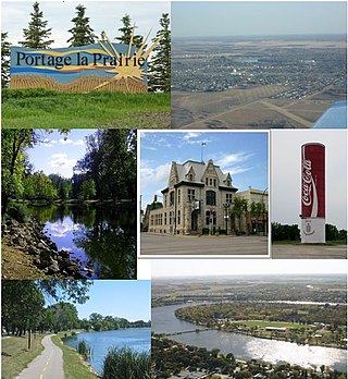
<span class="mw-page-title-main">Portage la Prairie</span> City in Manitoba, Canada

Portage la Prairie is a small city in the Central Plains Region of Manitoba, Canada. As of 2016, the population was 13,304 and the land area of the city was 24.68 square kilometres (9.53 sq mi).
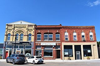
<span class="mw-page-title-main">Souris, Manitoba</span> Community in Manitoba

Souris is an unincorporated urban community in the Municipality of Souris – Glenwood within the Canadian province of Manitoba that held town status prior to January 1, 2015. It is located within the municipality at the confluence of Plum Creek and Souris River, from which it takes its name. Before 1882, the town was called Plum Creek. The community is home to Canada's longest historic cable-stayed footbridge (177 m [581 ft]), known as the Swinging Bridge, which spans the Souris River that divides the community. The Swinging Bridge was built in 1904 as a means of transportation over the Souris River. Residents of Souris are referred to as Sourisites.
<span class="mw-page-title-main">Swan River, Manitoba</span> Town in Manitoba, Canada

Swan River is a town in Manitoba, Canada. It is surrounded by the Municipality of Swan Valley West in the Swan River Valley region. According to the 2021 Canadian Census, Swan River had a population of 4,049, making it Manitoba's 18th largest in population.
<span class="mw-page-title-main">Asessippi Provincial Park</span> Provincial park in Manitoba, Canada

Asessippi Provincial Park is a provincial park in the Rural Municipality of Riding Mountain West, Manitoba, Canada.

<span class="mw-page-title-main">St. James-Assiniboia, Winnipeg</span> Suburb in Winnipeg, Manitoba, Canada

St. James-Assiniboia is a major community area in Winnipeg, Manitoba, Canada. As it encapsulates most of the city ward of St. James, which includes the major St. James Street, the area itself is often simply referred to "St. James."

<span class="mw-page-title-main">Carberry, Manitoba</span> Town in Manitoba, Canada

Carberry is a town in southwestern Manitoba, Canada. It is situated 3 kilometres south of the Trans-Canada Highway on Highway 5 in the Municipality of North Cypress – Langford, and has a population of 1,738 people.

<span class="mw-page-title-main">Neepawa</span> Town in Manitoba, Canada

Neepawa is a town in Manitoba, Canada located on the Yellowhead Highway at the intersection with Highway 5. As of 2021 its population was 5,685. Neepawa was incorporated as a town in 1883. It is bordered by the Municipality of North Cypress – Langford and Rural Municipality of Rosedale. Neepawa is the self-proclaimed Lily capital of the world in part because of its Lily Festival.

Glenboro is an unincorporated urban community in the Municipality of Glenboro – South Cypress within the Canadian province of Manitoba that held village status prior to January 1, 2015. it is located about 80 km southeast of the City of Brandon. In the 2016 census it had a population of 624. The community is a service centre for the surrounding farming community.
<span class="mw-page-title-main">Russell, Manitoba</span> Unincorporated urban community in Manitoba, Canada

Russell is an unincorporated urban community in the Municipality of Russell – Binscarth, Manitoba.

<span class="mw-page-title-main">Oak Lake, Manitoba</span> Place in Manitoba, Canada

Oak Lake is an unincorporated urban community in the Rural Municipality of Sifton within the Canadian province of Manitoba that held town status prior to January 1, 2015. It is located 52 km (32 mi) west of Brandon along the Trans-Canada Highway. The lake after which it was named is in the rural municipality's western area.

Churchbridge is a town in the province of Saskatchewan, Canada, located at the junction of the Yellowhead Highway, and Highway 80. Churchbridge is a part of the rural municipality of Churchbridge 211, which is located within Saskatchewan Association of Rural Municipalities (SARM) Division No. 1 and census division Number 5.

<span class="mw-page-title-main">Division No. 15, Manitoba</span> Census division in Manitoba, Canada

Census Division No. 15 is a census division located within the Westman Region of the province of Manitoba, Canada. Unlike in some other provinces, census divisions do not reflect the organization of local government in Manitoba. These areas exist solely for the purposes of statistical analysis and presentation; they have no government of their own.

The Rural Municipality of Archie is a former rural municipality (RM) in the Canadian province of Manitoba. It was originally incorporated as a rural municipality on December 22, 1883. It ceased on January 1, 2015 as a result of its provincially mandated amalgamation with the RM of Ellice and the Village of St. Lazare to form the Rural Municipality of Ellice – Archie.

The Rural Municipality of Miniota is a former rural municipality (RM) in the Canadian province of Manitoba. It was originally incorporated as a rural municipality on December 22, 1883. It ceased on January 1, 2015 as a result of its provincially mandated amalgamation with the RM of Birtle and the Town of Birtle to form the Prairie View Municipality.

The Prairie Mountain Health is the governing body responsible for healthcare delivery and regulation for the eponymous health region in southwest Manitoba.
<span class="mw-page-title-main">Birtle Indian Residential School</span> Defunct Canadian residential school

The Birtle Indian Residential School was a school within the Canadian Indian residential school system that operated in Birtle, Manitoba from 1888 to 1970. Operated by the Presbyterian Church in Canada, attendance during the school's operation ranged from 19 to 170 students.

References

  1. 1 2 "Population and dwelling counts: Canada and designated places". Statistics Canada. 9 February 2022. Retrieved 3 September 2022.
  2. The Birdtail Museum
  3. "Self-Guided Heritage Walking Tour".
  4. Abra, Marion, ed. (1974). A View of the Birdtail. History Committee of the Municipality of Birtle.
  5. Passing it on. RM and Town of Birtle History Committee. 2009.
  6. Hamilton, William (1978). The Macmillan Book of Canadian Place Names. Toronto: Macmillan. p. 56. ISBN   0-7715-9754-1.
  7. "Honouring the Truth, Reconciling for the Future: Summary of the Final Report of the Truth and Reconciliation Commission of Canada" (PDF). National Centre for Truth and Reconciliation. Truth and Reconciliation Commission of Canada. 31 May 2015. Retrieved 25 June 2021.
  8. Environment Canada – Canadian Climate Normals 1971–2000—Canadian Climate Normals 1971–2000, accessed 7 April 2011