
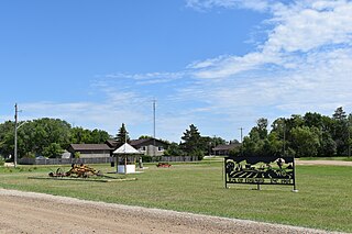
Manitou is an unincorporated urban community in the Municipality of Pembina within the Canadian province of Manitoba that held town status prior to January 1, 2015. The Boundary Trail Railway is based in Manitou. The community's motto is "More Than A Small Town". The community is adjacent to PTH 3 and PR 244. Manitou is located near Mennonite communities such as Winkler, Manitoba and is right next to the St. Leon Wind Farm, the largest wind farm in Manitoba and one of the largest in Canada.

Winkler is a city in Manitoba, Canada with a population of 13,745, making it the 4th largest city in Manitoba, as of the 2021 Canadian census. It is located in southern Manitoba, surrounded by the Rural Municipality of Stanley, about one hundred kilometres southwest of Winnipeg and thirteen kilometres east of its "twin city" Morden. As the largest city in the Pembina Valley, it serves as a regional hub for commerce, agriculture and industry. Winkler is the third-fastest growing city in the province after Morden and Steinbach.
Austin is an unincorporated community recognized as a local urban district in western Manitoba on the Trans-Canada Highway about 110 km (68 mi) west of Winnipeg. It is part of the Municipality of North Norfolk. It sits at the western edge of the table-flat Portage Plains, but to the south and west is surrounded by miles of low wooded hills known as the Carberry sandhills. The biggest attraction is the annual rodeo and Threshermen's Reunion held at the Manitoba Agricultural Museum the last four business days of July.

Altona is a town in southern Manitoba, Canada, about 100 km south-west of Winnipeg and 158 km north of Grand Forks, North Dakota. The population at the 2021 Census was 4,390 residents. Old Altona was founded in 1880 by Plautdietsch-speaking Mennonites from the Russian Empire. It is surrounded by the Municipality of Rhineland. Much of the surrounding area is devoted to farming and agriculture-based business.
Plum Coulee is an unincorporated urban community in the Municipality of Rhineland within the Canadian province of Manitoba that held town status prior to January 1, 2015. It is west of Altona, one hour southwest of Winnipeg and 22 kilometres from the United States border. It is also the former home to the Plum Coulee Xpress hockey club. It has an artificial beach located in town called Sunset Beach.
Rosenort, Manitoba, is an unincorporated community recognized as a local urban district within the Rural Municipality of Morris about 17 kilometres from the town of Morris and about 47 kilometres south of Winnipeg.

Gainsborough is a village in the Canadian province of Saskatchewan within the Rural Municipality of Argyle No. 1 and Census Division No. 1. A farming community, the village is located on Highway 18 in the southeastern corner of Saskatchewan. Gainsborough is approximately 6 km (3.7 mi) from the Manitoba border, and 19 km (12 mi) from the North Dakota, United States border. The first post office was established on April 1, 1884 as the community of Antler. On September 1, 1885, the name of the community changed to Gainsborough, after Gainsborough, Lincolnshire in England, which was the former home of J. J. Sadler, an early settler.

Waldheim is a town of 1,035 residents in the Rural Municipality of Laird No. 404, in the Canadian province of Saskatchewan, 57 kilometres (35 mi) north of Saskatoon. Waldheim is located on Highway 312 in central Saskatchewan, the "Heart of the Old North-Wes". Fort Carlton, Batoche, Battle of Fish Creek, and Seager Wheeler's Maple Grove Farm are all near Waldheim.

Bracken is a village in the Canadian province of Saskatchewan within the Rural Municipality of Lone Tree No. 18 and Census Division No. 4. The village is named after John Bracken, Premier of Manitoba and leader of the Progressive Conservative Party of Canada, who was a professor at the University of Saskatchewan. The small village is located approximately 160 km south of the City of Swift Current on Highway 18, directly north of Grasslands National Park, and approximately 20 km north of the Montana-Saskatchewan border.
North Portal is a village in the Canadian province of Saskatchewan within the Rural Municipality of Coalfields No. 4 and Census Division No. 1. It is adjacent to the Canada–United States border opposite Portal, North Dakota. The border crossing is considered the major entry point to and from the U.S. within Saskatchewan.

Division No. 3 is a census division located within the Pembina Valley Region in the south-central region of the province of Manitoba, Canada. Unlike in some other provinces, census divisions do not reflect the organization of local government in Manitoba. These areas exist solely for the purposes of statistical analysis and presentation; they have no government of their own.
Division No. 6 (Virden) is a census division located within the Westman Region of south west Manitoba, Canada. Unlike in some other provinces, census divisions do not reflect the organization of local government in Manitoba. These areas exist solely for the purposes of statistical analysis and presentation; they have no government of their own.
Census Division No. 9 is a census division located within the Central Plains Region of the province of Manitoba, Canada. Unlike in some other provinces, census divisions do not reflect the organization of local government in Manitoba. These areas exist solely for the purposes of statistical analysis and presentation; they have no government of their own.
The Rural Municipality of Rhineland is a former rural municipality (RM) in the Canadian province of Manitoba. Since 1876, the area made up part of the Mennonite West Reserve. The R.M. of Rhineland was originally incorporated as a rural municipality on February 14, 1880 and later absorbed the neighbouring RM of Douglas in January 1891. It ceased on January 1, 2015 as a result of its provincially mandated amalgamation with the towns of Gretna and Plum Coulee to form the Municipality of Rhineland.

Stanley is a rural municipality (RM) in the province of Manitoba in Western Canada. It is located in the southern part of the province, along its border with the state of North Dakota in the United States. Since 1876, the area made up part of the Mennonite West Reserve. The municipality has a population of 8,969 as of the 2016 Canada Census. The cities of Winkler and Morden lie geographically within the municipality but are separate urban municipalities.

Portage la Prairie is a rural municipality (RM) in the province of Manitoba in Western Canada. It surrounds the city of Portage la Prairie, Manitoba's fifth-largest city. Also within the borders of the municipality are the Dakota Plains First Nation and most of the Long Plain First Nation Indian reserves.
Killarney-Turtle Mountain is a rural municipality (RM) located in the Westman Region of Manitoba, Canada. It is located to the immediate north of the Canada–United States border opposite Rollete and Towner Counties, North Dakota.
Pierson is an unincorporated community recognized as a local urban district located in the Municipality of Two Borders in southwestern Manitoba, Canada. The Antler–Lyleton Border Crossing is located south of Pierson.

The Municipality of Boissevain-Morton is a rural municipality (RM) in the Westman Region of the Canadian province of Manitoba.
The Municipality of Rhineland is a rural municipality (RM) in the Canadian province of Manitoba. The RM had a population of 5,945 as of the 2016 Canada Census. The average age in the municipality is 31.

