Neepawa

Last updated
Neepawa
Town of Neepawa
NeepawaCH.jpg
Neepawa Courthouse
437 Neepawa, Manitoba.svg
Town boundaries
Canada Manitoba location map 2.svg
Red pog.svg
Neepawa
Location in Manitoba
Coordinates: 50°13′44″N99°27′56″W / 50.22889°N 99.46556°W / 50.22889; -99.46556
CountryCanada
Province Manitoba
Region Westman
Incorporated1883
Government
  MayorBrian Hedley
   Town Council Neepawa Town Council
   MLA Agassiz Jodie Byram (PC)
   MP Dauphin-Swan River-Neepawa Dan Mazier (CPC)
Area
  Total17.09 km2 (6.60 sq mi)
Elevation
358.1 m (1,175 ft)
Population
  Total5,685
  Density332.7/km2 (862/sq mi)
Time zone UTC-6 (Central (CST))
  Summer (DST) UTC-5 (Central (CDT))
Postal code
Area code 204
Website neepawa.ca

Neepawa is a town in Manitoba, Canada, located on the Yellowhead Highway at the intersection with Highway 5.

Contents

As of 2021 its population was 5,685. [1] Neepawa was incorporated as a town in 1883. Located in western Manitoba, it is bordered by the Municipality of North Cypress – Langford and Rural Municipality of Rosedale.

Neepawa is the self-proclaimed Lily capital of the world in part because of its Lily Festival. [2] The Lily Festival ran for 18 years beginning in 1996 and ending in 2014. [3]

Etymology

The town name of Neepawa comes from the Cree word for "Land of Plenty". The name was first used around 1873. [4]

History

In the many years before European settlement, the lands around Neepawa were primarily used by the Cree and the Assiniboine. Native peoples in the area followed a regular cycle by following the Plains Bison to take shelter in the areas north of Neepawa in the winter, and then heading south again across the plains and beyond Neepawa in the summer. [5] Prior to settlement, the only Europeans in the area were primarily fur traders, many people made their way through the area on the North Fort Ellice Trail which went from the Red River to Edmonton. [5] It was on this trail that a group of settlers from Listowel, Ontario, eventually decided to settle in 1877, where the Stony and Boggy creeks meet. [5]

The Neepawa area was in what was then known as "The Northwest Territories", just to the west of the 1870 boundary of Manitoba. During the next 30 years, many settlers came to live in the area. The first settlers were from the British Isles. Eastern European settlers also came from countries such as Poland and Hungary and built the Hun Valley Settlement near Neepawa. [4] Neepawa only joined Manitoba when the western edge of the then "postage stamp province" was expanded to its present western borders in 1881. [4]

John A. Davidson and Jonathon J. Hamilton arrived in the town in 1880, they were the first real business men of the town buying land and surveying them into lots. [5] In 1881 John Hamilton and John Davidson built a store and a grist mill near the junction of Boggy and Stoney Creeks. Like many western Manitoba towns at the time, Neepawa eagerly await the arrival of the railway in the 1880s. Sometime after the railway reached Gladstone, Manitoba in 1882, Davidson and Hamilton offered the Manitoba and Northwestern Railway (which was leased to CPR) a land grant and a financial bonus of $16,000 to construct their line within the town limits and the railway agreed to build their station within Neepawa. [5]

Soon a village grew and on the 23 of September, 1883 the town of Neepawa was incorporated. [6] David Howard Harrison who owned a private bank in Neepawa was elected Premier of Manitoba in 1887. [7] Neepawa's first hospital was completed in 1904 and had the capacity for 20 patients. The hospital included a nursing school. Neepawa's first school opened in 1881. It was a three-story building finally completed in 1898 and used until 1928. The Neepawa Salt Company mined salt here from 1932 until 1970. [8]

Author Margaret Laurence wrote several books through the 1960s and 1970s, depicting the town under the name of Manawaka. On May 12, 2010 Neepawa was the host of Manitoba's 140th birthday party. The town was chosen as the site of the festivities as a result of winning a contest within the province. [9]

Geography

Neepawa lies on the Manitoba Escarpment, the rolling hills around Neepawa are typical of the escarpment. Neepawa lies within the Canadian Prairies, the region around Neepawa is defined as Aspen parkland. Although Neepawa is part of the prairies the area to the north is heavily forested parkland. Riding Mountain National Park and Duck Mountain Provincial Park lie to the north, are part of this parkland, and are also an extension of the escarpment. The boreal forest which extends all the way across Canada and is also found to the north of Neepawa. Spruce Woods Provincial Park is located about 60 km south of the town.

Neepawa lies at the source of the Whitemud River, it is also about 40 km east of the Little Saskatchewan River, a tributary of the Assiniboine River which is 60 km south of the town. The town is also about 60 km west of Lake Manitoba, one of the largest lakes in Manitoba.

Climate

Climate data for Neepawa Water
MonthJanFebMarAprMayJunJulAugSepOctNovDecYear
Record high °C (°F)7
(45)
10
(50)
17
(63)
34
(93)
36
(97)
37
(99)
36
(97)
37.5
(99.5)
35.5
(95.9)
30
(86)
20.6
(69.1)
8.3
(46.9)
37.5
(99.5)
Mean daily maximum °C (°F)−11.9
(10.6)
−8
(18)
−0.9
(30.4)
9.4
(48.9)
17.9
(64.2)
22.4
(72.3)
24.8
(76.6)
24.2
(75.6)
17.7
(63.9)
10.4
(50.7)
−1
(30)
−9.3
(15.3)
8
(46)
Mean daily minimum °C (°F)−22.2
(−8.0)
−18.5
(−1.3)
−11.2
(11.8)
−2.6
(27.3)
5.1
(41.2)
10.6
(51.1)
13
(55)
11.5
(52.7)
6.1
(43.0)
−0.1
(31.8)
−9.4
(15.1)
−18.9
(−2.0)
−3.1
(26.4)
Record low °C (°F)−41
(−42)
−42.5
(−44.5)
−36
(−33)
−27.2
(−17.0)
−12
(10)
0
(32)
3
(37)
0
(32)
−6
(21)
−21
(−6)
−34
(−29)
−42
(−44)
−42.5
(−44.5)
Average precipitation mm (inches)20.1
(0.79)
14.6
(0.57)
24.4
(0.96)
35
(1.4)
58.4
(2.30)
79.5
(3.13)
82
(3.2)
70.4
(2.77)
57.9
(2.28)
31.3
(1.23)
20.8
(0.82)
22
(0.9)
516.3
(20.33)
Source: Environment Canada [10]

Demographics

Historical population
YearPop.±%
19011,418    
19111,864+31.5%
19211,887+1.2%
19311,910+1.2%
19412,292+20.0%
19512,895+26.3%
19613,197+10.4%
1996 3,301+3.3%
2001 3,325+0.7%
2006 3,298−0.8%
2011 3,629+10.0%
2016 4,609+27.0%
2021 5,685+23.3%
[1] [11] [12] [13] [14]

In the 2021 Census of Population conducted by Statistics Canada, Neepawa had a population of 5,685 living in 1,866 of its 1,946 total private dwellings, a change of

Panethnic groups in the Town of Neepawa (2001−2021)
Panethnic group2021 [15] 2016 [16] 2011 [17] 2006 [18] 2001 [19]
Pop. %Pop.%Pop.%Pop.%Pop.%
Southeast Asian [lower-alpha 1] 2,6551,680320010
European [lower-alpha 2] 2,3552,4402,8103,0403,090
Indigenous 2501356012055
African 90300015
South Asian 4503500
East Asian [lower-alpha 3] 304570010
Latin American 30109000
Middle Eastern [lower-alpha 4] 00000
Other/multiracial [lower-alpha 5] 95200020
Total responses5,5454,3403,4003,1603,195
Total population5,6854,6093,6293,2983,325
Note: Totals greater than 100% due to multiple origin responses

Economy

The economy of Neepawa and the region is strongly dependent on agriculture. The rolling fields in the area support many types of crops and livestock operations. Neepawa serves as a major agricultural service centre for many of the producers in the region.

More prominently, growers in Neepawa produce some of the finest and most diverse lilies in the world. As of 2009 over 2,000 kinds of Lily were grown locally. [2] These flowers are shipped directly from Neepawa to many of the major international floral markets.[ citation needed ] Neepawa proclaims itself the "Lily capital of the world" because of this. [2] Neepawa also attracts a number of tourists throughout the year in part because of the lilies. An estimated 12,000 people visit the Lily Festival and Neepawa each July. [2]

As well as being an agricultural centre, Neepawa's businesses serve as a shopping and retail centre for much of the area's residents.

Attractions

Margaret Laurence Home Former home of Margaret Laurence.jpg
Margaret Laurence Home

The Margaret Laurence Home is a designated Provincial Heritage Site and a Level 2 Museum. This is the house where Margaret Laurence grew up in Neepawa as a youth. In addition the Riverside Cemetery in Neepawa is the resting place of Margaret Laurence. The cemetery's Davidson Memorial was the signature of Laurence's book The Stone Angel . [20] This cemetery is also the furthest west in which any Titanic passenger was buried. Four young men from the village of Fritham in Hampshire, England, went down with the Titanic in 1912: Lewis Hickman (aged 32), Leonard Mark Hickman (aged 24), Stanley George Hickman (aged 21), and Ambrose Hood (aged 21). A gravestone in memory of the Hickman brothers can be found in Riverside Cemetery. [20] The Beautiful Plains Museum is a heritage railway station that was the home of the museum since 1981. The original railway station was built in 1901. [21]

The Lily Festival in Neepawa first began in 1996 and today features the over 2,000 different kinds of Lily that are grown in Neepawa. [2] Neepawa sees around 12,000 visitors in the town during the Lily Festival each July. [2]

The Roxy Theatre Neepawa is a community-run theatre that was built in 1906. The theatre hosts live arts and films. The Roxy Theatre was the setting for the 2015 film Amityville Playhouse (UK/Europe release) or Amityville Theatre (U.S. release). Both the Roxy and the Towns Court House were used in the film (as were other locations in the town) which was shot in September 2014.

Sports

Yellowhead Centre

The Yellowhead Centre is a 1,200-seat arena, built in 1972. It serves the Town of Neepawa and surrounding municipalities. [22] It is home to a number of local recreational and minor hockey teams, as well as the Neepawa Titans (Manitoba Junior Hockey League), Neepawa Farmers (Tiger Hills Senior Hockey League), and Neepawa Area Collegiate Institute Tigers (high school hockey). The Yellowhead Chiefs male and female midget 'AAA' hockey teams both play some home games in Neepawa.

Aside from hockey, the Yellowhead Centre has also hosted major curling events, most notably the 2009 Manitoba Scotties Tournament of Hearts and the 2013 Safeway Championship.

Government

Neepawa is governed by a town council consisting of a mayor and six councilors. The town council is elected to a four-year term. The current Mayor of Neepawa is Blake McCutcheon. The Deputy Mayor is Brian Hedley and the remaining council consists of Marijka Kostenchuk, Darren Pudlo, Murray Parrott, Jason Nadeau and Darryl Gerrard.

Transportation

Neepawa is located along Highway 16 (the Yellowhead Highway) and Highway 5 (the Parks Route). Neepawa Airport features a 3,500 feet (1,100 m) runway that is able to service air ambulance and small jets.

Education

Hazel M. Kellington Elementary School (named after longtime teacher) has about 350 students and the Neepawa Area Collegiate Institute has about 500 students. Neepawa Nursery School teaches 3- and 4-year-old children. Neepawa is part of the Beautiful Plains School Division.

Assiniboine Community College has a campus in Neepawa and offers various post-secondary courses.

Media

Radio

Television

Notable people

Notes

  1. Statistic includes total responses of "Filipino" and "Southeast Asian" under visible minority section on census.
  2. Statistic includes all persons that did not make up part of a visible minority or an indigenous identity.
  3. Statistic includes total responses of "Chinese", "Korean", and "Japanese" under visible minority section on census.
  4. Statistic includes total responses of "West Asian" and "Arab" under visible minority section on census.
  5. Statistic includes total responses of "Visible minority, n.i.e." and "Multiple visible minorities" under visible minority section on census.

Related Research Articles

<span class="mw-page-title-main">Weyburn</span> City in Saskatchewan, Canada

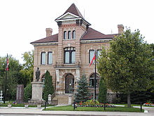
Weyburn is the tenth-largest city in Saskatchewan, Canada. The city has a population of 11,019. It is on the Souris River 110 kilometres (68 mi) southeast of the provincial capital of Regina and is 70 kilometres (43 mi) north from the North Dakota border in the United States. The name is reputedly a corruption of the Scottish "wee burn," referring to a small creek. The city is surrounded by the Rural Municipality of Weyburn No. 67.

<span class="mw-page-title-main">Brandon, Manitoba</span> City in Manitoba, Canada

Brandon is the second-largest city in the province of Manitoba, Canada. It is located in the southwestern corner of the province on the banks of the Assiniboine River, approximately 214 km (133 mi) west of the provincial capital, Winnipeg, and 120 km (75 mi) east of the Saskatchewan border. Brandon covers an area of 77.41 km2 (29.89 sq mi) with a population of 51,313, and a census metropolitan area population of 54,268. It is the primary hub of trade and commerce for the Westman Region as well as parts of southeastern Saskatchewan and northern North Dakota, an area with a population of over 190,000 people.

<span class="mw-page-title-main">North Battleford</span> City in Saskatchewan, Canada

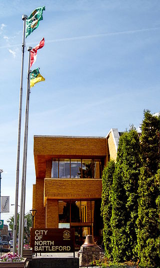
North Battleford is a city in west-central Saskatchewan, Canada. It is the seventh largest city in the province and is directly across the North Saskatchewan River from the Town of Battleford. Together, the two communities are known as "The Battlefords". North Battleford borders the Rural Municipality of North Battleford No. 437, as well as the North Battleford Crown Colony.

<span class="mw-page-title-main">Dauphin, Manitoba</span> City in Manitoba, Canada

Dauphin is a city in Manitoba, Canada, with a population of 8,368 as of the 2021 Canadian Census. The community is surrounded by the Rural Municipality of Dauphin. The city takes its name from Lake Dauphin and Fort Dauphin, which were named by explorer Pierre Gaultier de La Vérendrye in honour of the Dauphin of France, the heir to the French throne. Dauphin is Manitoba's ninth largest community and serves as a hub to the province's Parkland Region.

<span class="mw-page-title-main">Brandon—Souris</span> Federal electoral district in Manitoba, Canada

Brandon—Souris is a federal electoral district in Manitoba, Canada, that has been represented in the House of Commons of Canada since 1953.

<span class="mw-page-title-main">Selkirk, Manitoba</span> City in Manitoba, Canada

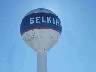
Selkirk is a city in the western Canadian province of Manitoba, located on the Red River about 22 kilometres (14 mi) northeast of Winnipeg, the provincial capital. It has a population of 10,504 as of the 2021 census.

<span class="mw-page-title-main">Morden, Manitoba</span> City in Manitoba, Canada

Morden is a city located in the Pembina Valley region of southern Manitoba, Canada near the United States border. It is about 11 km (6.8 mi) west of the neighbouring city of Winkler; together Morden and Winkler are often referred to as Manitoba's Twin Cities. Morden, which is surrounded by the Rural Municipality of Stanley, is the eighth largest and fastest-growing city in Manitoba. According to Statistics Canada, the city had a population of 9,929 in 2021, an increase of 14.5% from 2016, making it Manitoba's fastest growing city.

<span class="mw-page-title-main">Visible minority</span> Canadian demographic category

A visible minority is defined by the Government of Canada as "persons, other than aboriginal peoples, who are non-Caucasian in race or non-white in colour". The term is used primarily as a demographic category by Statistics Canada, in connection with that country's Employment Equity policies. The qualifier "visible" was chosen by the Canadian authorities as a way to single out newer immigrant minorities from both Aboriginal Canadians and other "older" minorities distinguishable by language and religion, which are "invisible" traits.

<span class="mw-page-title-main">Niverville, Manitoba</span> Place in Manitoba, Canada

Niverville is a town in the Eastman Region, Manitoba, Canada. The town lies between the northwest corner of the Rural Municipality of Hanover and the southeastern portion of the Rural Municipality of Ritchot. Niverville's population as of the 2021 census is 5,947, the largest town and 10th-largest community in Manitoba.

<span class="mw-page-title-main">Portage—Lisgar</span> Federal electoral district in Manitoba, Canada

Portage—Lisgar is a federal electoral district in Manitoba, Canada, that has been represented in the House of Commons of Canada since 1997.

<span class="mw-page-title-main">Winnipeg Metropolitan Region</span> Metropolitan area in Manitoba, Canada

The Winnipeg Metropolitan Region is a metropolitan area in the Canadian province of Manitoba located in the Red River Valley in the southeast portion of the province of Manitoba, Canada. It contains the provincial capital of Winnipeg and 17 surrounding rural municipalities, cities, and towns.

<span class="mw-page-title-main">Rural Municipality of Hanover</span> Rural municipality in Manitoba, Canada

The Rural Municipality of Hanover is a rural municipality (RM) in southeastern Manitoba, Canada, located southeast of Winnipeg in Division No. 2.

<span class="mw-page-title-main">Rural Municipality of St. Clements</span> Rural municipality in Manitoba, Canada

St. Clements is a rural municipality (RM) in Manitoba, Canada. It is located to the north-east of Winnipeg, stretching from East St. Paul and Birds Hill Provincial Park in the south to Lake Winnipeg and Grand Beach Provincial Park to the north. The Red River demarcates the western boundary of the municipality. St. Clements contains the communities of East Selkirk, and Lockport east of the Red River. It almost completely surrounds the Brokenhead 4 Indian reserve, with the exception of a small lakefront on Lake Winnipeg.

<span class="mw-page-title-main">Rural Municipality of Taché</span> Rural municipality in Manitoba, Canada

Taché is a rural municipality in Manitoba, Canada, incorporated in 1880.

<span class="mw-page-title-main">Rural Municipality of Rockwood</span> Rural Municipality in Manitoba, Canada

Rockwood is a rural municipality (RM) lying north of Winnipeg, Manitoba, Canada. It is part of the Winnipeg Metro Region and had a 2021 census population of 8,440. The independently governed towns of Stonewall and Teulon are both enclaved within Rockwood.

<span class="mw-page-title-main">Demographics of Saskatchewan</span>

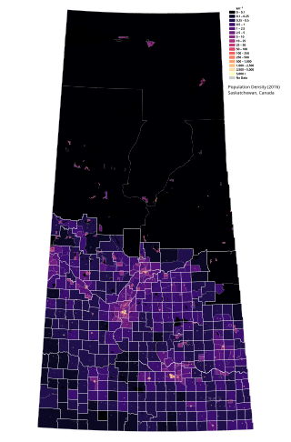
Saskatchewan is the middle province of Canada's three Prairie provinces. It has an area of 651,900 km² (251,700 mi²) and a population of 1,132,505 (Saskatchewanians) as of 2021. Saskatchewan's population is made of 50.3% women and 49.7% men. Most of its population lives in the Southern half of the province.

<span class="mw-page-title-main">Demographics of Manitoba</span>

Manitoba is one of Canada's 10 provinces. It is the easternmost of the three Prairie provinces.

According to the 2021 census, the City of Edmonton had a population of 1,010,899 residents, compared to 4,262,635 for all of Alberta, Canada. The total population of the Edmonton census metropolitan area (CMA) was 1,418,118, making it the sixth-largest CMA in Canada.

<span class="mw-page-title-main">Demographics of Calgary</span>

In the 2021 Census, the City of Calgary had a population of 1,306,784 residents, representing 30.7% of the 4,262,635 residents in all of Alberta, and 3.5% compared to a population of 36,991,981 in all of Canada. The total population of the Calgary census metropolitan area (CMA) was 1,481,806. Calgary is the largest city in Alberta, and the third-largest municipality and fifth-largest metropolitan area in Canada, as of 2021.

<span class="mw-page-title-main">Dauphin—Swan River—Neepawa</span> Federal electoral district in Manitoba, Canada

Dauphin—Swan River—Neepawa is a federal electoral district in Manitoba. It encompasses a portion of Manitoba previously included in the electoral districts of Dauphin—Swan River—Marquette, Brandon—Souris and Portage—Lisgar.

References

  1. 1 2 3 "Census Profile, 2021 Census of Population, Neepawa". Statistics Canada. 9 February 2022. Retrieved February 9, 2022.
  2. 1 2 3 4 5 6 "NEEPAWA: Lily Capital of the World; home of literary legend". Winnipeg Free Press. 1 August 2009. Retrieved 2010-07-21.
  3. "Lily Festival is no more".
  4. 1 2 3 "Our History". The Town of Neepawa. Archived from the original on 2015-03-01. Retrieved 2012-11-21.
  5. 1 2 3 4 5 "Introduction to the History of Neepawa". The Town of Neepawa. Archived from the original on 2011-07-06. Retrieved 2010-08-04.
  6. "Town of Neepawa". The Manitoba Historical Society. Retrieved 2010-07-20.
  7. "Harrison, David Howard". Canadian Biography Online. Retrieved 2010-07-22.
  8. "Manitoba Mining Through the Centuries". Government of Manitoba. Archived from the original on 2011-04-05. Retrieved 2010-08-04.
  9. "Neepawa hosts Manitoba birthday bash". Winnipeg Free Press. 12 May 2010. Retrieved 2010-07-21.
  10. Environment Canada. Retrieved 22 July 2010.
  11. , Censuses 1871–1931
  12. , Census 1941-1951
  13. , Census 1961
  14. 1 2 "Population and dwelling counts: Canada, provinces and territories, and census subdivisions (municipalities), Manitoba". Statistics Canada. February 9, 2022. Retrieved February 20, 2022.
  15. Government of Canada, Statistics Canada (2022-10-26). "Census Profile, 2021 Census of Population". www12.statcan.gc.ca. Retrieved 2023-06-10.
  16. Government of Canada, Statistics Canada (2021-10-27). "Census Profile, 2016 Census". www12.statcan.gc.ca. Retrieved 2023-06-10.
  17. Government of Canada, Statistics Canada (2015-11-27). "NHS Profile". www12.statcan.gc.ca. Retrieved 2023-06-10.
  18. Government of Canada, Statistics Canada (2019-08-20). "2006 Community Profiles". www12.statcan.gc.ca. Retrieved 2023-06-10.
  19. Government of Canada, Statistics Canada (2019-07-02). "2001 Community Profiles". www12.statcan.gc.ca. Retrieved 2023-06-10.
  20. 1 2 "Riverside Cemetery". The Town of Neepawa. Archived from the original on 2015-03-01. Retrieved 2010-07-21.
  21. "Beautiful Plains Museum". The Town of Neepawa. Archived from the original on 2015-03-01. Retrieved 2012-11-21.
  22. "Looking Back". Brandon Sun. 2011-11-07.
  23. "Team Robertson Curling". Archived from the original on 2014-08-19. Retrieved 2018-09-12.