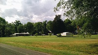
Onslow County is a county located in the U.S. state of North Carolina. As of the 2020 census, the population was 204,576. Its county seat is Jacksonville. The county was created in 1734 as Onslow Precinct and gained county status in 1739. Onslow County comprises the Jacksonville, NC Metropolitan Statistical Area. The southern border is the coast of the Atlantic Ocean.

Swansboro is a town in Onslow County, North Carolina, United States, located along the Atlantic Ocean. In 2010, the population was 2,663. By 2021, the population had grown to 3,825.

Rougemont is an unincorporated community and census-designated place (CDP) in Durham and Person counties, North Carolina, United States. The population of the CDP was 978 at the 2010 census. An act to incorporate Rougemont as a town was introduced to the North Carolina General Assembly in 2011.
Advance is an unincorporated community and census-designated place (CDP) in Davie County, North Carolina, United States. It is seventy-five miles northeast of Charlotte. As of the 2010 census it had a population of 1,138. It is located along North Carolina Highway 801 just south of Bermuda Run. Advance is part of the Piedmont Triad region of North Carolina.

Currituck is an unincorporated community in extreme northeastern North Carolina, United States. Situated along the Currituck Sound, it serves as the county seat for Currituck County. Currituck is part of the Inner Banks region and is one of the state's few unincorporated county seats. The community harbors the Knotts Island Ferry, which provides free shuttles across the sound to Knotts Island. North Carolina Highway 168 and Courthouse Road are the community's most prominent roads. The Currituck Beach Lighthouse is not located on mainland Currituck but is located across the sound on the Outer Banks.

Barnardsville is an unincorporated community and census-designated place (CDP) in Buncombe County, North Carolina, United States. It was first listed as a CDP in the 2020 census with a population of 559.
Broad Creek is an unincorporated area and census-designated place (CDP) in Carteret County, North Carolina, United States. As of the 2010 census, it had a population of 2,334. It is part of the Greater Newport area and currently shares the Newport ZIP Code of 28570.
Smithtown is an unincorporated community and census-designated place (CDP) in northern Yadkin County, North Carolina, United States. It was first listed as a CDP in the 2020 census with a population of 224.

Eureka is an unincorporated community and census-designated place (CDP) in Clinton County in the U.S. state of Michigan. The population of the CDP was 233 at the 2020 census. The community is located within Greenbush Township.
Mamers ( MAY-murs is an unincorporated community and census-designated place in Harnett County, North Carolina, United States. The population was 826 at the 2010 census. It is a part of the Dunn Micropolitan Area, which is also a part of the greater Raleigh–Durham–Cary Combined Statistical Area as defined by the United States Census Bureau.
Gerton is an unincorporated community and census-designated place (CDP) in Henderson County, North Carolina, United States. As of the 2010 census it had a population of 254. It is part of the Asheville Metropolitan Statistical Area.
Hollister is a census-designated place and unincorporated community in Halifax County in northeastern North Carolina, United States. As of the 2010 census it had a population of 674. Hollister's ZIP code is 27844.

Alexis is an unincorporated community and census-designated place (CDP) in Gaston County, North Carolina, United States. It is located approximately three miles north of Stanley. It was first listed as a CDP in the 2020 census with a population of 589.
Wallace is a census-designated place and unincorporated community in northwestern Marlboro County, South Carolina, United States. It lies at the intersection of U.S. Route 1 with SC 9 and SC 177, northwest of the city of Bennettsville, the county seat of Marlboro County. Its elevation is 151&feet (46 m). Although Wallace is unincorporated, it has a post office, with the ZIP code of 29596; the ZCTA for ZIP code 29596 had a population of 2,606 at the 2000 census.
Horse Shoe is an unincorporated community and census-designated place (CDP) in Henderson County, North Carolina, United States. Its ZIP code is 28742. As of the 2010 census, its population was 2,351.
Cordova is an unincorporated community and census-designated place in Richmond County, North Carolina, United States. Its population was 1,775 as of the 2010 census. Cordova has a post office with ZIP code 28330.
Crouse is an unincorporated community and census-designated place (CDP) in Lincoln County, North Carolina, United States. It was first listed as a CDP in the 2020 census with a population of 322. Crouse has a post office with ZIP code 28033.

Swansboro Country; a subdivision within the community of Mosquito, is a residential area northeast of Placerville, the county seat of El Dorado County, California. The population was approximately 1,000 at the 2010 census. It is part of the Sacramento–Arden-Arcade–Roseville Metropolitan Statistical Area.
Blue Clay Farms is an unincorporated community and census-designated place in New Hanover County, North Carolina, United States. Its population was 33 as of the 2010 census.
Northchase is an unincorporated community and census-designated place in New Hanover County, North Carolina, United States. Its population was 3,747 as of the 2010 census. U.S. Route 117 passes through the community.


