Sneads Ferry, North Carolina

Last updated

Sneads Ferry, North Carolina
CDP
Sneads Ferry NC 04.JPG
NCMap-doton-SneadsFerry.PNG
Location of Sneads Ferry, North Carolina
Coordinates: 34°33′23″N77°22′57″W / 34.55639°N 77.38250°W / 34.55639; -77.38250
Country United States
State North Carolina
County Onslow
Area
[1]
  Total5.84 sq mi (15.12 km2)
  Land3.80 sq mi (9.84 km2)
  Water2.04 sq mi (5.28 km2)
Elevation
[2]
30 ft (9 m)
Population
 (2020)
  Total2,548
  Density670.53/sq mi (258.88/km2)
Time zone UTC-5 (Eastern (EST))
  Summer (DST) UTC-4 (EDT)
ZIP code
28460
Area codes 910, 472
FIPS code 37-62680 [3]
GNIS feature ID2402862 [2]
Website www.sneadsferrynorthcarolina.com

Sneads Ferry is a census-designated place (CDP) in Onslow County, North Carolina, United States. It is the second largest municipality in Onslow County, behind Jacksonville and is part of the Jacksonville, North Carolina Metropolitan Statistical Area. [4] Once a rural fishing village, Sneads Ferry has experienced a surge in development since 2000. Based on U.S. Census data, the study area has grown from 5,425 residents in 2000 to approximately 9,750 residents in 2014, an 80% increase. Growth primarily has been driven by accessibility to MCB Camp Lejeune from the gate on NC 172 and expansion of the United States Marine Corps Special Operations Command (MARSOC) accessed from NC 210. Sneads Ferry is expected to continue growing rapidly at 3.3% annually, adding 17,500 new residents through 2040 reaching 20,000 in total population by 2030. [5]

Contents

Geography

According to the United States Census Bureau, the CDP has a total area of 5.8 square miles (15 km2), of which 3.8 square miles (9.8 km2) is land and 2.1 square miles (5.4 km2) (35.79%) is water.

Demographics

Historical population
CensusPop.Note
2020 2,548
U.S. Decennial Census [6]

2020 census

Sneads Ferry racial composition [7]
RaceNumberPercentage
White (non-Hispanic)2,10982.77%
Black or African American (non-Hispanic)783.06%
Native American 100.39%
Asian 240.94%
Other/Mixed 1897.42%
Hispanic or Latino 1385.42%

As of the 2020 United States census, there were 2,548 people, 1,087 households, and 775 families residing in the CDP.

2007-2011 ACS

According to the U.S. Census Bureau, American Community Survey, [8] there were 2,550 people in 1,445 households residing in the CDP. The population density was 598.2 inhabitants per square mile (231.0/km2). There were 1,331 housing units at an average density of 354.2 per square mile (136.8/km2). The racial makeup of the CDP was 90.97% White, 5.12% African American, 0.53% Native American, 0.93% Asian, 0.09% Pacific Islander, 0.71% Ridgeweian, and 1.65% from two or more races. Hispanic or Latino of any race were 1.69% of the population.

There were 960 households, out of which 24.6% had children under the age of 18 living with them, 55.1% were married couples living together, 8.2% had a female householder with no husband present, and 32.2% were non-families. 26.8% of all households were made up of individuals, and 8.8% had someone living alone who was 65 years of age or older. The average household size was 2.34 and the average family size was 2.78.

In the CDP, the population was spread out, with 20.7% under the age of 18, 9.4% from 18 to 24, 29.5% from 25 to 44, 25.6% from 45 to 64, and 14.8% who were 65 years of age or older. The median age was 37 years. For every 100 females, there were 104.7 males. For every 100 females age 18 and over, there were 102.0 males.

The median income for a household in the CDP was $34,509, and the median income for a family was $37,765. Males had a median income of $30,625 versus $28,542 for females. The per capita income for the CDP was $16,355. About 11.7% of families and 13.5% of the population were below the poverty line, including 26.3% of those under age 18 and 3.9% of those age 65 or over.

History

In 1728, Edmund Ennett established a ferry on the banks of the New River. Some of Ennett's descendants still reside in the area. Originally called "Ennett's Ferry," it became a key element in the Post road linking Suffolk, Virginia with Charleston, South Carolina. By 1759, two ferries operated there, one from each bank of New River. Robert Snead was the proprietor of the ferry on the north shore, so the community that developed on the banks of the crossing site became known as "Sneads Ferry." Caroline Pearson propelled the ferry until it was replaced with a bridge in 1939. The village is heavily dependent on the seafood industry. The village annually catches over 385 tons of shrimp, 25 tons of flounder, and approximately 493 tons of other seafood like clams, scallops, oysters, mullet, spot, grouper, soft shell and hard shell crabs, sea bass, and more. [9] The town holds an annual Shrimp Festival to honor the local seafood industry. [10]

The Yopps Meeting House was listed on the National Register of Historic Places in 1999. [11]

Libraries

Beginning in 1991, the original Sneads Ferry Library was housed in an old First Citizen's Bank and the new Environmental Education Center and Sneads Ferry Branch Library began construction in September 2012, with a grand opening in April 2014. [12] Onslow County, North Carolina, in which Sneads Ferry is located, has three other libraries: the Jacksonville Main Library, the Richlands Branch Library, and the Swansboro Branch Library. [13]

Related Research Articles

<span class="mw-page-title-main">Onslow County, North Carolina</span> County in North Carolina, United States

Onslow County is a county located in the U.S. state of North Carolina. As of the 2020 census, the population was 204,576. Its county seat is Jacksonville. The county was created in 1734 as Onslow Precinct and gained county status in 1739. Onslow County comprises the Jacksonville, NC Metropolitan Statistical Area. The southern border is the coast of the Atlantic Ocean.

<span class="mw-page-title-main">Ferry Pass, Florida</span> Census-designated place in Florida, United States

Ferry Pass is a census-designated place (CDP) in Escambia County, Florida. It is a community in Pensacola, and is located north of Pensacola City Limits. As of the 2010 United States Census, the population was 28,921. The University of West Florida, located in Ferry Pass, is the only university located in the Pensacola Metropolitan Area.

<span class="mw-page-title-main">East Lake-Orient Park, Florida</span> Census-designated place in Florida, United States

East Lake-Orient Park is an unincorporated census-designated place in Hillsborough County, Florida, United States. The population was 22,753 at the 2010 census, up from 5,703 at the 2000 census following an expansion of its borders. The area is the home of the Florida State Fairgrounds, which hosts the Florida State Fair in mid-February of each year. It was previously home to East Lake Square Mall. The ZIP code for East Lake-Orient Park is 33610 and 33619.

<span class="mw-page-title-main">St. Stephens, North Carolina</span> Census-designated place in North Carolina, United States

St. Stephens is a census-designated place (CDP) in Catawba County, North Carolina, United States. The population was 8,759 at the 2010 census, down from 9,439 in 2000. It is part of the Hickory–Lenoir–Morganton Metropolitan Statistical Area.

<span class="mw-page-title-main">Wanchese, North Carolina</span> CDP in North Carolina, United States

Wanchese is a census-designated place (CDP) on Roanoke Island in Dare County, North Carolina, United States. It was named after Wanchese, the last known ruler of the Roanoke Native American tribe encountered by English colonists in the sixteenth century. The population was 1,642 at the 2010 census. Today, Wanchese is the center of commercial fishing and boatbuilding on the Outer Banks.

<span class="mw-page-title-main">Rockfish, North Carolina</span> Census-designated place in North Carolina, United States

Rockfish is a census-designated place (CDP) in Hoke County, North Carolina, United States. The population was 3,298 at the 2010 census, up from 2,353 at the 2000 census.

<span class="mw-page-title-main">Half Moon, North Carolina</span> CDP in North Carolina, United States

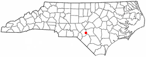
Half Moon is a census-designated place (CDP) in Onslow County, North Carolina, United States. The population was 6,645 at the 2000 census. It is part of the Jacksonville, North Carolina Metropolitan Statistical Area.

<span class="mw-page-title-main">Holly Ridge, North Carolina</span> Town in North Carolina, United States

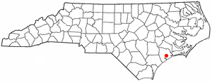
Holly Ridge is a town in Onslow County, North Carolina, United States. The 2010 population was 1,268. It is part of the Jacksonville, North Carolina Metropolitan Statistical Area. It is considered the gateway to Topsail Island.

<span class="mw-page-title-main">Jacksonville, North Carolina</span> City in North Carolina, United States

Jacksonville is a city in Onslow County, North Carolina, United States. As of the 2020 census, the population was 72,723, which makes Jacksonville the 14th-most populous city in North Carolina. Jacksonville is the county seat and most populous community of Onslow County, which is coterminous with the Jacksonville, NC Metropolitan Statistical Area. Demographically, Jacksonville is the youngest city in the United States, with an average age of 22.8 years old, which can be attributed to the large military presence. The low age may also be in part due to the population drastically going up over the past 80 years, from 783 in the 1930 census to 72,876 in the 2021 Census estimate.

<span class="mw-page-title-main">Piney Green, North Carolina</span> CDP in North Carolina, United States

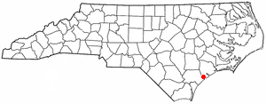
Piney Green is a census-designated place (CDP) in Onslow County, North Carolina, United States. The population was 11,658 at the 2000 census. It is part of the Jacksonville, North Carolina Metropolitan Statistical Area.

<span class="mw-page-title-main">Pumpkin Center, North Carolina</span> CDP in North Carolina, United States

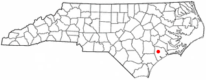
Pumpkin Center is a census-designated place (CDP) in Onslow County, North Carolina, United States. The population was 2,228 at the 2000 census. It is part of the Jacksonville, North Carolina Metropolitan Statistical Area.

<span class="mw-page-title-main">Chesterland, Ohio</span> Census-designated place in Ohio, United States

Chesterland is a census-designated place (CDP) in Geauga County, Ohio, United States. As of the 2020 census, the CDP had a population of 7,074.

<span class="mw-page-title-main">Clearwater, South Carolina</span> Census-designated place in South Carolina, United States of America

Clearwater is a census-designated place (CDP) in Aiken County, South Carolina. It lies near North Augusta, South Carolina, and is part of the Augusta, Georgia metropolitan area. Clearwater is located in historic Horse Creek Valley. The population was 4,370 at the time of the 2010 census.

<span class="mw-page-title-main">McClellanville, South Carolina</span> Town in South Carolina, United States

McClellanville is a small fishing town in rural Charleston County, South Carolina, United States. The population was 1,040 at the 2010 census. It is situated on the Atlantic coast, on land surrounded by Francis Marion National Forest, and has traditionally derived its livelihood from the Atlantic Ocean and coastal marshes by fishing, shrimping and oystering. McClellanville is part of the Charleston-North Charleston-Summerville metropolitan area and the Charleston-North Charleston Urbanized Area.

Five Forks is a census-designated place (CDP) in Greenville County, South Carolina, United States. The population was 17,737 at the 2020 census, up from 14,140 in 2010, and 8,064 in 2000. It is a growing, affluent suburb of Greenville and is part of the Greenville–Mauldin–Easley Metropolitan Statistical Area.

<span class="mw-page-title-main">Bucksport, South Carolina</span> Census-designated place in South Carolina, United States

Bucksport is an unincorporated community and census-designated place (CDP) in Horry County, South Carolina, United States. The population was 876 at the 2010 census. It is a rural port on the Atlantic Intracoastal Waterway at the merger point with the Waccamaw River. The port has some services available for boaters and is also home to the Bucksport Restaurant.

<span class="mw-page-title-main">Red Bank, South Carolina</span> Census-designated place in South Carolina, United States

Red Bank is an unincorporated community and census-designated place (CDP) in Lexington County, South Carolina, United States. The population was 9,617 at the 2010 census, up from 8,811 at the 2000 census. It is part of the Columbia, South Carolina Metropolitan Statistical Area.

<span class="mw-page-title-main">St. Andrews, South Carolina</span> Census-designated place in South Carolina, United States

St. Andrews is a census-designated place (CDP) in Richland County, South Carolina, United States. The population was 20,493 at the 2010 census. It is part of the Columbia, South Carolina Metropolitan Statistical Area.

<span class="mw-page-title-main">Boiling Springs, South Carolina</span> CDP in South Carolina, United States

Boiling Springs is a census-designated place (CDP) in Spartanburg County, South Carolina, United States. The population was 8,219 at the 2010 census.

<span class="mw-page-title-main">Groveton, Virginia</span> Census-designated place in Virginia, United States

Groveton is a census-designated place (CDP) in Fairfax County, Virginia, United States. The population was 14,598 at the 2010 census, down from 21,296 in 2000 due to a reduction in area. Located south of the city of Alexandria, it encompasses numerous neighborhoods including Groveton, Bucknell Manor, Stoneybrooke, and portions of Hollin Hills. Huntley Meadows Park, Fairfax County's largest park, is located in the southwest part of the CDP.

References

  1. "ArcGIS REST Services Directory". United States Census Bureau. Retrieved September 20, 2022.
  2. 1 2 U.S. Geological Survey Geographic Names Information System: Sneads Ferry, North Carolina
  3. "U.S. Census website". United States Census Bureau . Retrieved January 31, 2008.
  4. Archived 2014-10-06 at the Wayback Machine
  5. Archived 2014-10-06 at the Wayback Machine
  6. "Census of Population and Housing". Census.gov. Retrieved June 4, 2016.
  7. "Explore Census Data". data.census.gov. Retrieved December 24, 2021.
  8. 2007-2011 American Community Survey
  9. Welcome to Sneads Ferry North Carolina Archived 2006-11-05 at the Wayback Machine
  10. Welcome to the Sneads Ferry Shrimp Festival Website
  11. "National Register Information System". National Register of Historic Places . National Park Service. July 9, 2010.
  12. "New Library being built in Sneads Ferry", Lindell Kay, September 12, 2012, http://www.jdnews.com/20120925/new-library-being-built-in-sneads-ferry/309259860. Retrieved October 20, 2018.
  13. "Public Grand Opening of the Environmental Education Center and Sneads Ferry Branch Library", Todd Lyman, April 2, 2014, http://www.jdnews.com/20140402/public-grand-opening-of-the-environmental-education-center-and-sneads-ferry-branch-library/304029893. Retrieved October 20, 2018.