Swansboro, North Carolina

Last updated

Swansboro, North Carolina
NC Swansboro downtown.jpg
Downtown Swansboro
Swansboro, NC Town Flag.gif
Swansboro, NC Town Seal.png
Motto: 
"The Friendly City by the Sea"
NCMap-doton-Swansboro.PNG
Location of Swansboro, North Carolina shown in North Carolina
Coordinates: 34°41′48″N77°07′13″W / 34.69667°N 77.12028°W / 34.69667; -77.12028
Country United States
State North Carolina
County Onslow
Government
  MayorJohn Davis
Area
[1]
  Total2.38 sq mi (6.16 km2)
  Land2.23 sq mi (5.79 km2)
  Water0.14 sq mi (0.37 km2)
Elevation
[2]
30 ft (9 m)
Population
 (2020)
  Total3,744
  Density1,675.17/sq mi (646.90/km2)
Time zone UTC-5 (Eastern (EST))
  Summer (DST) UTC-4 (EDT)
ZIP code
28584
Area codes 910, 472
FIPS code 37-66360 [3]
GNIS feature ID2406700 [2]
Website swansboro-nc.org

Swansboro is a town in Onslow County, North Carolina, United States, located along the Crystal Coast. In 2020, the population was 3,744. [4]

Contents

History

Swansboro started as a settlement around the plantation of Theophilus Weeks. In 1783, Swansboro was incorporated as a town, taking its name from Samuel Swann, a Speaker in the North Carolina House of Commons and a resident of Onslow County. In 1818, Otway Burns built the Prometheus, the first river steamboat constructed in North Carolina.

The town, originally spelled Swannsborough, is sometimes called "The Friendly City by the Sea". M.N. Lisk, a popular Swansboro mayor, initiated the annual Mullet Festival, [5] one of the first coastal seafood festivals in North Carolina.

The town is featured as the setting of Nicholas Sparks' novel The Guardian.

The Swansboro Historic District was listed on the National Register of Historic Places in 1990. [6]

In 2018, Swansboro was among the hardest hit cities by Hurricane Florence. A record 30.58 inches (77 cm) of rain fell at Swansboro, North Carolina, breaking the previous state record of 24.06 inches (61 cm). [7]

Geography

According to the United States Census Bureau, the town has a total area of 1.3 square miles (3.4 km2), of which 1.2 square miles (3.1 km2) is land and 0.1 square miles (0.26 km2) (8.96%) is water.

Town government

The Town of Swansboro is governed by five Board of Commissioner members and the Mayor. The Commissioners are elected for four-year and two-year terms. The Mayor is elected for a four-year term. They are elected as Town-wide representatives. The Mayor presides at all meetings as the "Chairman" of the Board of Commissioners. The mayor votes only to break a tie, and the Mayor Pro Tem is appointed by the Commissioners and conducts the meetings in the absence of the Mayor. [8]

Demographics

Historical population
CensusPop.Note
1850 801
1870 141
1880 128−9.2%
1890 23382.0%
1900 26513.7%
1910 39047.2%
1920 4207.7%
1930 394−6.2%
1940 45415.2%
1950 55923.1%
1960 1,10497.5%
1970 1,2079.3%
1980 976−19.1%
1990 1,16519.4%
2000 1,42622.4%
2010 2,66386.7%
2020 3,74440.6%
U.S. Decennial Census [9]

2020 census

Swansboro racial composition [10]
RaceNumberPercentage
White (non-Hispanic)3,09182.56%
Black or African American (non-Hispanic)1213.23%
Native American 140.37%
Asian 772.06%
Pacific Islander 40.11%
Other/Mixed 2015.37%
Hispanic or Latino 2366.3%

As of the 2020 United States census, there were 3,744 people, 1,360 households, and 755 families residing in the town.

2000 census

As of the census of 2000, there were 1,426 people, 655 households, and 419 families residing in the town. The population density was 1,168.2 inhabitants per square mile (451.0/km2). There were 770 housing units at an average density of 630.8 per square mile (243.6/km2). The racial makeup of the town was 90.18% White, 4.63% African American, 0.21% Native American, 0.77% Asian, 0.91% from other races, and 3.30% from two or more races. Hispanic or Latino of any race were 2.81% of the population.

There were 655 households, out of which 28.9% had children under the age of 18 living with them, 44.6% were married couples living together, 15.0% had a female householder with no husband present, and 36.0% were non-families. 32.4% of all households were made up of individuals, and 13.1% had someone living alone who was 65 years of age or older. The average household size was 2.18 and the average family size was 2.72.

In the town, the population was spread out, with 24.4% under the age of 18, 7.6% from 18 to 24, 28.1% from 25 to 44, 23.1% from 45 to 64, and 16.8% who were 65 years of age or older. The median age was 38 years. For every 100 females, there were 83.5 males. For every 100 females age 18 and over, there were 81.2 males.

The median income for a household in the town was $37,740, and the median income for a family was $45,357. Males had a median income of $32,188 versus $25,556 for females. The per capita income for the town was $19,625. About 10.3% of families and 11.9% of the population were below the poverty line, including 18.9% of those under age 18 and 7.6% of those age 65 or over.

Education

Tourism

Swansboro sits across the Intracoastal Waterway from Hammocks Beach State Park and is a popular destination for tourists, outdoor enthusiasts and recreational fishermen.

The Rotary Club of Swansboro is active in the community and regularly hosts events such as the annual King Mackerel Tournament and numerous fundraising gatherings. The Mullet Festival is the most notable and longest running Annual festival of 68 years that features a parade, street vendors, and live music. [11]

Notable person

Related Research Articles

<span class="mw-page-title-main">Yancey County, North Carolina</span> County in North Carolina, United States

Yancey County is a county located in the U.S. state of North Carolina. As of the 2020 census, the population was 18,470. Its county seat is Burnsville.

<span class="mw-page-title-main">Pender County, North Carolina</span> County in North Carolina, United States

Pender County is a county located in the U.S. state of North Carolina. As of the 2020 census, the population was 60,203. Its county seat is Burgaw. Pender County is part of the Wilmington, NC Metropolitan Statistical Area.

<span class="mw-page-title-main">Onslow County, North Carolina</span> County in North Carolina, United States

Onslow County is a county located in the U.S. state of North Carolina. As of the 2020 census, the population was 204,576. Its county seat is Jacksonville. The county was created in 1734 as Onslow Precinct and gained county status in 1739. Onslow County comprises the Jacksonville, NC Metropolitan Statistical Area. The southern border is the coast of the Atlantic Ocean.

<span class="mw-page-title-main">Cedar Point, North Carolina</span> Town in North Carolina, United States

Cedar Point is a town in Carteret County, North Carolina, United States. The population was 1,297 in 2010.

<span class="mw-page-title-main">Peletier, North Carolina</span> Town in North Carolina, United States

Peletier is a town in Carteret County, North Carolina, United States. The population was 644 at the 2010 census.

<span class="mw-page-title-main">Clemmons, North Carolina</span> Village in North Carolina

Clemmons is a village in Forsyth County, North Carolina, United States and a suburb of Winston-Salem. The population was 21,177 at the 2020 census, with an estimated population of 21,517 in 2021.

<span class="mw-page-title-main">Youngsville, North Carolina</span> Town in North Carolina, United States

Youngsville is a town in Franklin County, North Carolina, United States. The population was 2,016 at the 2020 census.

<span class="mw-page-title-main">Micro, North Carolina</span> Town in North Carolina, United States

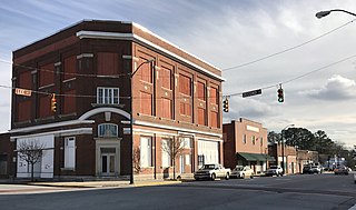
Micro is a town in Johnston County, North Carolina, United States. The population was 458 as of the 2020 census, up from 441 in the 2010 census.

<span class="mw-page-title-main">Holly Ridge, North Carolina</span> Town in North Carolina, United States

Holly Ridge is a town in Onslow County, North Carolina, United States. The 2010 population was 1,268. The 2020 census population was 4,171. It is part of the Jacksonville, North Carolina Metropolitan Statistical Area. It is considered the gateway to Topsail Island.

<span class="mw-page-title-main">Jacksonville, North Carolina</span> City in North Carolina, United States

Jacksonville is a city in Onslow County, North Carolina, United States. As of the 2020 census, the population was 72,723, which makes Jacksonville the 14th-most populous city in North Carolina. Jacksonville is the county seat and most populous community of Onslow County, which is coterminous with the Jacksonville, NC Metropolitan Statistical Area. Demographically, Jacksonville is the youngest city in the United States, with an average age of 22.8 years old, which can be attributed to the large military presence. The low age may also be in part due to the population drastically increasing over the past 80 years, from 783 in the 1930 census to 72,723 in the 2020 census.

<span class="mw-page-title-main">North Topsail Beach, North Carolina</span> Town in North Carolina, United States

North Topsail Beach is a town in Onslow County, North Carolina, United States. As of the 2020 U.S. census, the population was 1,005. It is located on Topsail Island. North Topsail Beach is part of the Jacksonville, North Carolina Metropolitan Statistical Area.

<span class="mw-page-title-main">Richlands, North Carolina</span> Town in North Carolina, United States

Richlands is a town in Onslow County, North Carolina, United States. In the 2020 U.S. census, the population was 2,287. It is included in the Jacksonville, North Carolina Metropolitan Statistical Area. Incorporated on March 29, 1880, it was the first town in Onslow County to have its own library and museum. Richlands was also the first town in Onslow County to have a female mayor, Annette Hargett.

<span class="mw-page-title-main">Sneads Ferry, North Carolina</span> CDP in North Carolina, United States

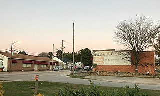
Sneads Ferry is a census-designated place (CDP) in Onslow County, North Carolina, United States. It is the second largest municipality in Onslow County, behind Jacksonville and is part of the Jacksonville, North Carolina Metropolitan Statistical Area. Once a rural fishing village, Sneads Ferry has experienced a surge in development since 2000. Based on U.S. Census data, the study area has grown from 5,425 residents in 2000 to approximately 9,750 residents in 2014, an 80% increase. Growth primarily has been driven by accessibility to MCB Camp Lejeune from the gate on NC 172 and expansion of the United States Marine Corps Special Operations Command (MARSOC) accessed from NC 210. Sneads Ferry is expected to continue growing rapidly at 3.3% annually, adding 17,500 new residents through 2040 reaching 20,000 in total population by 2030.

<span class="mw-page-title-main">Ayden, North Carolina</span> Town in North Carolina, United States

Ayden is a town in Pitt County, North Carolina, United States. The population was 4,977 at the 2020 census. The town is a part of the Greenville Metropolitan Area of North Carolina's Inner Banks region.

<span class="mw-page-title-main">Garland, North Carolina</span> Town in North Carolina, United States

Garland is a town in Sampson County, North Carolina, United States. The population was 595 at the 2020 census.

Newton Grove is a town in Sampson County, North Carolina, United States. It was chartered in 1879. The population was 585 at the 2020 census.

<span class="mw-page-title-main">New London, North Carolina</span> Town in North Carolina, United States

New London is a town in Stanly County, North Carolina, United States. The population was 600 at the 2010 census, and was estimated to be 724 as of 2019. The town lies between Albemarle and Richfield along U.S. 52 in the southern Piedmont region of the state, approximately 45 miles (72 km) east-northeast of Charlotte. It was the site of a gold mine, which was active during periods of the mid-1800s and early 1900s.

<span class="mw-page-title-main">Unionville, North Carolina</span> Town in North Carolina, United States

Unionville is a rural town in Union County, North Carolina, United States. The population was 6,643 at the 2020 census.

<span class="mw-page-title-main">Weddington, North Carolina</span> Town in North Carolina, United States

Weddington is a suburban town in Union County, North Carolina, United States. The population was 9,459 at the 2010 census. It is a suburb in the Charlotte metropolitan area. The current mayor of Weddington is Jim Bell.

<span class="mw-page-title-main">Surf City, North Carolina</span> Town in North Carolina, United States

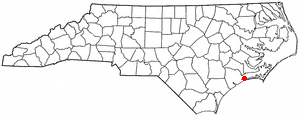
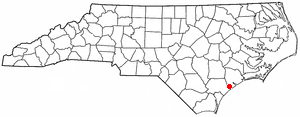
Surf City is a town in Onslow and Pender counties in the U.S. state of North Carolina. The population was 3,867 at the 2020 census. It is located on Topsail Island.

References

  1. "ArcGIS REST Services Directory". United States Census Bureau. Retrieved September 20, 2022.
  2. 1 2 U.S. Geological Survey Geographic Names Information System: Swansboro, North Carolina
  3. "U.S. Census website". United States Census Bureau . Retrieved January 31, 2008.
  4. "Timelines Explorer - Data Commons". datacommons.org. Retrieved October 24, 2023.
  5. The Official Town of Swansboro, North Carolina Website
  6. "National Register Information System". National Register of Historic Places . National Park Service. July 9, 2010.
  7. Brady Dennis; Mark Berman; Emily Wax-Thibodeaux (September 15, 2018). "Death toll rises to at least 11, officials say, as some areas grapple with intense flooding due to Carolinas storm". The Washington Post . Washington, D.C. ISSN   0190-8286. OCLC   1330888409.
  8. "The Official Town of Swansboro, North Carolina Website". Archived from the original on February 2, 2008. Retrieved February 6, 2008.
  9. "Census of Population and Housing". Census.gov. Retrieved June 4, 2015.
  10. "Explore Census Data". data.census.gov. Retrieved December 24, 2021.
  11. "Mullet Festival".