Marlborough, Missouri

Last updated
Marlborough, Missouri
Marlborough.jpg
Marlborough, Missouri
St. Louis County Missouri Incorporated and Unincorporated areas Marlborough Highlighted.svg
Location of Marlborough, Missouri
Coordinates: 38°34′06″N90°20′21″W / 38.56833°N 90.33917°W / 38.56833; -90.33917 Coordinates: 38°34′06″N90°20′21″W / 38.56833°N 90.33917°W / 38.56833; -90.33917
Country United States
State Missouri
County St. Louis
Area
[1]
  Total0.23 sq mi (0.59 km2)
  Land0.23 sq mi (0.59 km2)
  Water0.00 sq mi (0.00 km2)
Elevation
[2]
535 ft (163 m)
Population
 (2020)
  Total2,221
  Density9,784.14/sq mi (3,776.00/km2)
Time zone UTC-6 (Central (CST))
  Summer (DST) UTC-5 (CDT)
FIPS code 29-46208 [3]
GNIS feature ID2399260 [2]

Marlborough is a village in St. Louis County, Missouri, United States. The population was 2,179 at the 2010 census. [4]

Contents

Geography

According to the United States Census Bureau, the village has a total area of 0.23 square miles (0.60 km2), all land. [5]

Demographics

Historical population
CensusPop.Note
1950 219
1960 650196.8%
1970 1,492129.5%
1980 2,01234.9%
1990 1,949−3.1%
2000 2,23514.7%
2010 2,179−2.5%
2020 2,2211.9%
U.S. Decennial Census [6]

2010 census

As of the census [7] of 2010, there were 2,179 people, 1,330 households, and 394 families living in the village. The population density was 9,473.9 inhabitants per square mile (3,657.9/km2). Marlborough is the most densely-populated community in the state of Missouri. There were 1,456 housing units at an average density of 6,330.4 per square mile (2,444.2/km2). The racial makeup of the village was 80.0% White, 8.2% African American, 0.4% Native American, 6.7% Asian, 2.1% from other races, and 2.6% from two or more races. Hispanic or Latino of any race were 5.6% of the population.

There were 1,330 households, of which 13.0% had children under the age of 18 living with them, 18.6% were married couples living together, 8.2% had a female householder with no husband present, 2.9% had a male householder with no wife present, and 70.4% were non-families. 57.7% of all households were made up of individuals, and 7.4% had someone living alone who was 65 years of age or older. The average household size was 1.64 and the average family size was 2.59.

The median age in the village was 31.6 years. 11.7% of residents were under the age of 18; 19.8% were between the ages of 18 and 24; 36.8% were from 25 to 44; 22.6% were from 45 to 64; and 9% were 65 years of age or older. The gender makeup of the village was 48.4% male and 51.6% female.

2000 census

As of the census [3] of 2000, there were 2,235 people, 1,344 households, and 426 families living in the village. The population density was 9,829.4 inhabitants per square mile (3,795.2/km2). There were 1,422 housing units at an average density of 6,253.9 per square mile (2,414.6/km2). The racial makeup of the village was 79.60% White, 5.06% African American, 0.18% Native American, 11.59% Asian, 1.12% from other races, and 2.46% from two or more races. Hispanic or Latino of any race were 2.86% of the population.

There were 1,344 households, out of which 13.2% had children under the age of 18 living with them, 20.8% were married couples living together, 7.9% had a female householder with no husband present, and 68.3% were non-families. 58.3% of all households were made up of individuals, and 8.2% had someone living alone who was 65 years of age or older. The average household size was 1.66 and the average family size was 2.61.

In the village, the population was spread out, with 12.5% under the age of 18, 19.4% from 18 to 24, 39.3% from 25 to 44, 18.7% from 45 to 64, and 10.1% who were 65 years of age or older. The median age was 32 years. For every 100 females, there were 99.6 males. For every 100 females age 18 and over, there were 101.2 males.

The median income for a household in the village was $25,386, and the median income for a family was $40,331. Males had a median income of $27,155 versus $24,112 for females. The per capita income for the village was $18,442. About 11.4% of families and 15.4% of the population were below the poverty line, including 27.8% of those under age 18 and 1.6% of those age 65 or over.

Related Research Articles

<span class="mw-page-title-main">Butterfield, Missouri</span> City in Missouri, United States

Butterfield is a city in Butterfield Township, Barry County, Missouri, United States. The population was 378 at the 2020 census.

<span class="mw-page-title-main">Agency, Missouri</span> Village in Missouri, United States

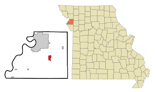
Agency is a village in Buchanan County, Missouri, United States. The population was 684 at the 2010 census. It is part of the St. Joseph, MO–KS Metropolitan Statistical Area.

<span class="mw-page-title-main">Jerico Springs, Missouri</span> Village in Missouri, United States

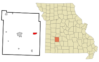
Jerico Springs is a village in Cedar County, Missouri, United States. The population was 160 at the 2020 census.

<span class="mw-page-title-main">Parkway, Missouri</span> Village in Missouri, United States

Parkway is a village in Franklin County, Missouri, United States. The population was 439 at the 2010 census.

<span class="mw-page-title-main">Laurie, Missouri</span> City in Missouri, United States

Laurie is a city in southern Morgan and northern Camden counties, Missouri, United States. The population was 945 at the 2010 census.

<span class="mw-page-title-main">Bakersfield, Missouri</span> Village in Missouri, United States

Bakersfield is a village in southeastern Ozark County in the Ozarks of southern Missouri, United States. The population was 186 at the 2020 census.

<span class="mw-page-title-main">Flemington, Missouri</span> Village in Missouri, United States

Flemington is a village in Polk County, Missouri, United States. The population was 148 at the 2010 census. It is part of the Springfield, Missouri Metropolitan Statistical Area.

<span class="mw-page-title-main">Halfway, Missouri</span> Village in Missouri, United States

Halfway is a village in Polk County, Missouri, United States. According to the 2010 census, the population of Halfway is 173. It is part of the Springfield, Missouri Metropolitan Statistical Area.

<span class="mw-page-title-main">Leonard, Missouri</span> Village in Missouri, United States

Leonard is a village in northwestern Shelby County, Missouri, United States. The population was 57 at the 2020 census.

<span class="mw-page-title-main">Bellerive Acres, Missouri</span> City in Missouri, United States

Bellerive Acres is a northern suburban village in St. Louis County, Missouri, United States. The population was 188 at the 2010 census. In April, 2015, the residents voted to change the village of Bellerive to a fourth class city named Bellerive Acres.

<span class="mw-page-title-main">Grantwood Village, Missouri</span> Town in Missouri, United States

Grantwood Village is a town in St. Louis County, Missouri, United States. The population was 863 at the 2010 census.

<span class="mw-page-title-main">Norwood Court, Missouri</span> Village in Missouri, United States

Norwood Court is a village in St. Louis County, Missouri, United States. The population was 959 at the 2010 census.

<span class="mw-page-title-main">Pasadena Park, Missouri</span> Village in Missouri, United States

Pasadena Park is a village in St. Louis County, Missouri, United States. The population was 470 at the 2010 census. It is part of the Normandy School District, and is distinct from the city of Pasadena Hills.

<span class="mw-page-title-main">Westwood, Missouri</span> Village in Missouri, United States

Westwood is a village in west St. Louis County, Missouri, United States. The population was 316 at the 2020 census.

<span class="mw-page-title-main">Wilbur Park, Missouri</span> Village in Missouri, United States

Wilbur Park is a village in St. Louis County, Missouri, United States. The population was 439 at the 2020 census.

<span class="mw-page-title-main">Merriam Woods, Missouri</span> City in Missouri, United States

Merriam Woods is a city in Taney County, Missouri, United States. The population was 2,006 at the 2020 census. It is part of the Branson, Missouri Micropolitan Statistical Area.

<span class="mw-page-title-main">Taneyville, Missouri</span> Village in Missouri, United States

Taneyville is a village in Taney County, Missouri, United States. The population was 274 at the 2020 census. It is part of the Branson, Missouri Micropolitan Statistical Area.

<span class="mw-page-title-main">Country Club, Missouri</span> Village in Missouri, United States

Country Club is a village in Andrew County, Missouri, United States. The population was 2,449 at the 2010 census. It is part of the St. Joseph, MO–KS Metropolitan Statistical Area.

<span class="mw-page-title-main">Hanley Hills, Missouri</span> Village in Missouri, United States

Hanley Hills is a village in St. Louis County, Missouri, United States. The population was 2,101 at the 2010 census.

<span class="mw-page-title-main">Ionia, Missouri</span> Village in Missouri, United States

Ionia is a village in northern Benton and southern Pettis counties in the U.S. state of Missouri. The population was 88 at the 2010 census.

References

  1. "ArcGIS REST Services Directory". United States Census Bureau. Retrieved August 28, 2022.
  2. 1 2 U.S. Geological Survey Geographic Names Information System: Marlborough, Missouri
  3. 1 2 "U.S. Census website". United States Census Bureau . Retrieved 2008-01-31.
  4. "Race, Hispanic or Latino, Age, and Housing Occupancy: 2010 Census Redistricting Data (Public Law 94-171) Summary File (QT-PL), Marlborough village, Missouri". United States Census Bureau . Retrieved October 25, 2011.
  5. "US Gazetteer files 2010". United States Census Bureau. Archived from the original on 2012-01-25. Retrieved 2012-07-08.
  6. "Census of Population and Housing". Census.gov. Retrieved June 4, 2015.
  7. "U.S. Census website". United States Census Bureau . Retrieved 2012-07-08.