Richmond Heights, Missouri

Last updated

Richmond Heights, Missouri
The Boulevard from the South (4692672370).jpg
The Boulevard shopping area, June 2010
St. Louis County Missouri Incorporated and Unincorporated areas Richmond Heights Highlighted.svg
Location of Richmond Heights, Missouri
Coordinates: 38°37′42″N90°19′43″W / 38.62833°N 90.32861°W / 38.62833; -90.32861
Country United States
State Missouri
County St. Louis
Government
  Type Council-Manager
  MayorJim Thomson
  City ManagerAmy Hamilton
Area
[1]
  Total2.29 sq mi (5.93 km2)
  Land2.29 sq mi (5.93 km2)
  Water0.00 sq mi (0.00 km2)
Elevation
[2]
495 ft (151 m)
Population
 (2020)
  Total9,286
  Density4,053.25/sq mi (1,565.30/km2)
Time zone UTC-6 (Central (CST))
  Summer (DST) UTC-5 (CDT)
ZIP code
63117
Area code 314
FIPS code 29-61706 [3]
GNIS feature ID2396370 [2]
Website http://www.richmondheights.org/

Richmond Heights is a city in St. Louis County, Missouri. It is an inner-ring suburb of St. Louis, Missouri, United States. The population was 8,603 at the 2010 census. [4] According to Robert L. Ramsay, the name was suggested by Robert E. Lee, who thought the topography of the area resembled Richmond, Virginia.

Contents

Geography

According to the United States Census Bureau, the city has a total area of 2.30 square miles (5.96 km2), all land. [5]

Highways

Richmond Heights has several major highways within its boundaries: Interstate 170, Interstate 64 and U.S. Route 40.

Demographics

Historical population
CensusPop.Note
1920 2,136
1930 9,150328.4%
1940 12,80239.9%
1950 15,04517.5%
1960 15,6223.8%
1970 13,802−11.7%
1980 11,516−16.6%
1990 10,448−9.3%
2000 9,602−8.1%
2010 8,603−10.4%
2020 9,2867.9%
U.S. Decennial Census [6]

2020 census

The 2020 United States census [7] counted 9,286 people, 3,986 households, and 2,004 families in Richmond Heights. The population density was 4,055.0 per square mile (1,565.9/km2). There were 4,259 housing units at an average density of 1,859.8 per square mile (718.2/km2). The racial makeup was 78.04% (7,247) white, 8.7% (808) black or African-American, 0.1% (9) Native American, 5.85% (543) Asian, 0.01% (1) Pacific Islander, 0.97% (90) from other races, and 6.33% (588) from two or more races. Hispanic or Latino of any race was 3.2% (273) of the population.

Of the 3,986 households, 21.9% had children under the age of 18; 42.8% were married couples living together; 27.4% had a female householder with no husband present. Of all households, 40.2% consisted of individuals and 9.4% had someone living alone who was 65 years of age or older. The average household size was 2.1 and the average family size was 3.1.

17.7% of the population was under the age of 18, 4.5% from 18 to 24, 38.2% from 25 to 44, 20.2% from 45 to 64, and 11.8% who were 65 years of age or older. The median age was 36.7 years. For every 100 females, the population had 99.5 males. For every 100 females ages 18 and older, there were 93.6 males.

The 2016-2020 5-year American Community Survey [8] estimates show that the median household income was $88,289 (with a margin of error of +/- $14,706) and the median family income was $130,283 (+/- $16,078). Males had a median income of $54,616 (+/- $8,409) versus $54,154 (+/- $8,790) for females. The median income for those above 16 years old was $54,405 (+/- $6,603). Approximately, 2.4% of families and 4.6% of the population were below the poverty line, including 1.2% of those under the age of 18 and 6.7% of those ages 65 or over.

The educational attainment of residents 25 years and older was 7.9% high school or equivalent degree, 10.6% some college with no degree, 4.4% associate’s degree, 35.4% bachelor’s degree, and 40.3% graduate or professional degree. The population ages 3 and over enrolled in school was 12% in nursery or preschool, 54.8% in kindergarten to 12th grade, 20.8% college undergraduate, and 12.4% in graduate school.

2010 census

As of the census [9] of 2010, there were 8,603 people, 4,244 households, and 2,012 families living in the city. The population density was 3,740.4 inhabitants per square mile (1,444.2/km2). There were 4,680 housing units at an average density of 2,034.8 per square mile (785.6/km2). The racial makeup of the city was 81.7% White, 11.6% African American, 0.2% Native American, 4.2% Asian, 0.5% from other races, and 1.8% from two or more races. Hispanic or Latino of any race were 2.3% of the population.

There were 4,244 households, of which 20.9% had children under the age of 18 living with them, 35.8% were married couples living together, 8.4% had a female householder with no husband present, 3.3% had a male householder with no wife present, and 52.6% were non-families. 42.4% of all households were made up of individuals, and 10.4% had someone living alone who was 65 years of age or older. The average household size was 2.01 and the average family size was 2.84.

The median age in the city was 38.6 years. 18.2% of residents were under the age of 18; 7.9% were between the ages of 18 and 24; 32.8% were from 25 to 44; 27.7% were from 45 to 64; and 13.5% were 65 years of age or older. The gender makeup of the city was 46.8% male and 53.2% female.

2000 census

As of the census [3] of 2000, there were 9,602 people, 4,647 households, and 2,202 families living in the city. The population density was 4,191.5 inhabitants per square mile (1,618.3/km2). There were 4,931 housing units at an average density of 2,152.5 per square mile (831.1/km2). The racial makeup of the city was 81.54% White, 13.32% African American, 0.25% Native American, 3.20% Asian, 0.01% Pacific Islander, 0.34% from other races, and 1.34% from two or more races. Hispanic or Latino of any race were 1.74% of the population.

In the city the population was spread out, with 19.2% under the age of 18, 9.0% from 18 to 24, 36.0% from 25 to 44, 21.0% from 45 to 64, and 14.7% who were 65 years of age or older. The median age was 36 years. For every 100 females, there were 85.6 males. For every 100 females age 18 and over, there were 80.1 males.

The median income for a household in the city was $50,557, and the median income for a family was $69,681. Males had a median income of $47,536 versus $35,407 for females. The per capita income for the city was $37,217. About 4.4% of families and 7.3% of the population were below the poverty line, including 8.3% of those under age 18 and 11.7% of those age 65 or over.

Economy

Panera Bread was formerly headquartered in Richmond Heights. [10] The Sisters of Saint Mary hospital, a movie theater, various notable small businesses, specialty shops, and franchised business locations. The Saint Louis Galleria is a prominent shopping mall in the area, and a large source of municipal revenue. [11] The Parkmoor restaurant was a local institution [12] in neighboring Clayton that used to face Oak Knoll Park, also in Clayton right across from Richmond Heights on the north side of Clayton Road. It was demolished as part of a chain drugstore expansion. [13]

Transportation

Public transportation

Richmond Heights is served by the Blue Line of the St. Louis region's MetroLink light rail system. The city is served by the Richmond Heights station.[ citation needed ]

Major roads and highways

Major arterial routes in Richmond Heights include Big Bend Boulevard, Brentwood Boulevard, Clayton Road, Eager Road, Hanley Road, and McKnight Road. Interstate 64 also passes through the city traveling east and west, while Interstate 170 enters from the north and ends at I-64 and Eager Road.[ citation needed ]

Education

Public education in Richmond Heights is administered by Maplewood-Richmond Heights School District. [14]

Richmond Heights has a public library, the Richmond Heights Memorial Library. [15] [16]

See also

Related Research Articles

<span class="mw-page-title-main">East Richmond Heights, California</span> Unincorporated community in California, United States

East Richmond Heights is an unincorporated community and census-designated place (CDP) in western Contra Costa County, California, United States. Its population was 3,280 at the 2010 census.

<span class="mw-page-title-main">Fairview Heights, Illinois</span> City in Illinois, United States

Fairview Heights is a city in St. Clair County, Illinois, United States within Greater St. Louis. It is an eastern suburb of St. Louis. The population was 17,078 at the 2010 census. Fairview Heights is a dominant shopping center for Greater St. Louis and Southern Illinois and includes numerous shopping plazas and St. Clair Square mall.

<span class="mw-page-title-main">Rantoul, Kansas</span> City in Franklin County, Kansas

Rantoul is a city in Franklin County, Kansas, United States. As of the 2020 census, the population of the city was 165.

<span class="mw-page-title-main">Richmond, Kansas</span> City in Franklin County, Kansas

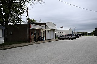
Richmond is a city in Franklin County, Kansas, United States. As of the 2020 census, the population of the city was 459.

<span class="mw-page-title-main">Proctor, Minnesota</span> City in Minnesota, United States

Proctor is a city in Saint Louis County, Minnesota, United States. Established in 1894, the town was named after former Kentucky Governor J. Proctor Knott. It is part of the Duluth Metropolitan Area. The population was 3,120 at the 2020 census.

<span class="mw-page-title-main">Brentwood, Missouri</span> City in Missouri, United States

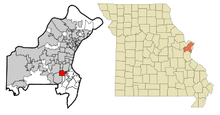
Brentwood is an inner-ring suburb of St. Louis, located in St. Louis County, Missouri, United States. The population was 8,233 at the 2020 census.

<span class="mw-page-title-main">Crestwood, Missouri</span> City in the United States

Crestwood is a city in south St. Louis County, Missouri, United States, part of the Metropolitan Statistical Area known as Greater St. Louis. The population was 11,912 at the 2010 census.

<span class="mw-page-title-main">Glendale, Missouri</span> City in Missouri, United States

Glendale is a city in St. Louis County, Missouri, United States. The population was 5,925 at the 2010 census.

<span class="mw-page-title-main">Hazelwood, Missouri</span> City in Missouri, United States

Hazelwood is a city in St. Louis County, Missouri, within Greater St. Louis. It is a second-ring northern suburb of St. Louis. Based on the 2020 United States census, the city had a total population of 25,485. It is located north of St. Louis-Lambert International Airport and is situated on Interstates 270 and 170, as well as the much-traveled Lindbergh Boulevard and Highway 370.

<span class="mw-page-title-main">Manchester, Missouri</span> City in Missouri, United States

Manchester is a city in St. Louis County, Missouri, United States. The population was 18,333 at the 2020 census.

<span class="mw-page-title-main">Maplewood, Missouri</span> City in Missouri, United States

Maplewood is an inner-ring suburb of St. Louis, located in St. Louis County, Missouri, United States.

<span class="mw-page-title-main">Maryland Heights, Missouri</span> City in Missouri, United States

Maryland Heights is a second-ring north suburb of St. Louis, located in St. Louis County, Missouri, United States. The population was 27,472 at the 2010 census. The city was incorporated in 1985. Edwin L. Dirck was appointed the city's first mayor by then County Executive Gene McNary. Mark M. Levin served as City Administrator from August 1985 to 2015.

<span class="mw-page-title-main">Oakville, Missouri</span> CDP in Missouri, United States

Oakville is a census-designated place (CDP) in south St. Louis County, Missouri, United States. The population was 36,301 at the 2020 census. Oakville is 18 miles south of the city of St. Louis and borders the Mississippi and Meramec rivers; the area is part of "South County".

<span class="mw-page-title-main">Olivette, Missouri</span> City in Missouri, United States

Olivette is an inner-ring suburb of St. Louis, located in St. Louis County, Missouri, United States. The population was 8,504 at the 2020 census.

<span class="mw-page-title-main">Town and Country, Missouri</span> City in Missouri, United States

Town and Country is a city in west St. Louis County, Missouri, United States with a population of 11,640 as of the 2020 census. It is home to Missouri Baptist Medical Center,.

<span class="mw-page-title-main">Vinita Park, Missouri</span> City in Missouri, United States

Vinita Park is a city in St. Louis County, Missouri, United States, located just east of I-170 and south of St. Charles Rock Road. The population was 1,970 at the 2020 census.

<span class="mw-page-title-main">Wildwood, Missouri</span> City in Missouri, United States

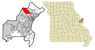
Wildwood is a city in St. Louis County, Missouri, United States. It is located in the far western portion of the county. As of the 2020 census, the population was 35,417. Wildwood is the home of the Al Foster Trail, and numerous other trails, parks, and reserves such as Rockwoods Reservation and Babler State Park.

<span class="mw-page-title-main">St. Ann, Missouri</span> City in Missouri, United States

St. Ann or Saint Ann is a city in northwest St. Louis County, Missouri, United States. The population was 13,019 at the 2020 census.

<span class="mw-page-title-main">Richmond Heights, Ohio</span> City in Ohio, United States

Richmond Heights is a city in Cuyahoga County, Ohio, United States. The population was 10,801 at the 2020 census. A suburb of Cleveland, it is part of the Cleveland metropolitan area.

<span class="mw-page-title-main">Willoughby Hills, Ohio</span> City in Ohio, United States

Willoughby Hills is a city in Lake County, Ohio, United States, along the Chagrin River. The population was 10,019 at the 2020 census. A suburb of Cleveland, it is part of the Cleveland metropolitan area.

References

  1. "ArcGIS REST Services Directory". United States Census Bureau. Retrieved August 28, 2022.
  2. 1 2 U.S. Geological Survey Geographic Names Information System: Richmond Heights, Missouri
  3. 1 2 "U.S. Census website". United States Census Bureau . Retrieved January 31, 2008.
  4. "Race, Hispanic or Latino, Age, and Housing Occupancy: 2010 Census Redistricting Data (Public Law 94-171) Summary File (QT-PL), Richmond Heights city, Missouri". United States Census Bureau . Retrieved October 24, 2011.
  5. "US Gazetteer files 2010". United States Census Bureau. Archived from the original on January 12, 2012. Retrieved July 8, 2012.
  6. "Census of Population and Housing". Census.gov. Retrieved June 4, 2015.
  7. "Explore Census Data". data.census.gov. Retrieved December 17, 2023.
  8. "Explore Census Data". data.census.gov. Retrieved December 17, 2023.
  9. "U.S. Census website". United States Census Bureau . Retrieved July 8, 2012.
  10. "Panera tests $16.99 lobster sandwich." Dayton Business Journal . Tuesday August 18, 2009. Retrieved on August 19, 2009.
  11. "Archived copy". Archived from the original on July 22, 2011. Retrieved July 29, 2009.{{cite web}}: CS1 maint: archived copy as title (link)
  12. "Getting Closure After 70 years, St. Louis' beloved Parkmoor serves up its last meals -- with distraught regulars in attendance." the Riverfront Times . November 3, 1999
  13. "Demolished: Five St. Louis Restaurants That Are No More." the Riverfront Times . June 27, 2011
  14. "Homepage". Maplewood-Richmond Heights School District. Retrieved June 4, 2019.
  15. "Missouri Public Libraries". PublicLibraries.com. Archived from the original on June 10, 2017. Retrieved June 2, 2019.
  16. "Richmond Heights Public Library". www.richmondheightslibrary.org. Retrieved October 13, 2023.