Westwood, Missouri

Last updated
Westwood, Missouri
St. Louis County Missouri Incorporated and Unincorporated areas Westwood Highlighted.svg
Location of Westwood, Missouri
Coordinates: 38°38′37″N90°26′01″W / 38.64361°N 90.43361°W / 38.64361; -90.43361 Coordinates: 38°38′37″N90°26′01″W / 38.64361°N 90.43361°W / 38.64361; -90.43361
Country United States
State Missouri
County St. Louis
Area
[1]
  Total0.63 sq mi (1.63 km2)
  Land0.63 sq mi (1.63 km2)
  Water0.00 sq mi (0.00 km2)
Elevation
[2]
587 ft (179 m)
Population
 (2020)
  Total316
  Density502.38/sq mi (194.06/km2)
Time zone UTC-6 (Central (CST))
  Summer (DST) UTC-5 (CDT)
FIPS code 29-79054 [3]
GNIS feature ID2400158 [2]

Westwood is a village in west St. Louis County, Missouri, United States. The population was 316 at the 2020 census.

Contents

Geography

According to the United States Census Bureau, the village has a total area of 0.61 square miles (1.58 km2), all land. [4]

Demographics

Historical population
CensusPop.Note
1960 291
1970 3116.9%
1980 3357.7%
1990 309−7.8%
2000 284−8.1%
2010 278−2.1%
2020 31613.7%
U.S. Decennial Census [5]

2020 census

As of the 2020 census there were 316 people and 116 households living in the village. The racial makeup of the village was 80.7% White, 3.2% African American, 10.8% Asian, 0.3% from other races, and 4.7% from two or more races. Hispanic or Latino of any race were 5.1% of the population. [6]

2010 census

At the 2010 census there were 278 people, 120 households, and 88 families living in the village. The population density was 455.7 inhabitants per square mile (175.9/km2). There were 125 housing units at an average density of 204.9 per square mile (79.1/km2). The racial makeup of the village was 92.1% White, 2.2% African American, 3.6% Asian, 0.7% from other races, and 1.4% from two or more races. Hispanic or Latino of any race were 2.2%. [7]

Of the 120 households 23.3% had children under the age of 18 living with them, 67.5% were married couples living together, 3.3% had a female householder with no husband present, 2.5% had a male householder with no wife present, and 26.7% were non-families. 21.7% of households were one person and 12.5% were one person aged 65 or older. The average household size was 2.32 and the average family size was 2.66.

The median age in the village was 53.9 years. 16.5% of residents were under the age of 18; 5.1% were between the ages of 18 and 24; 12.9% were from 25 to 44; 38.8% were from 45 to 64; and 26.6% were 65 or older. The gender makeup of the village was 47.5% male and 52.5% female.

2000 census

At the 2000 census there were 284 people, 120 households, and 93 families living in the village. The population density was 453.7 inhabitants per square mile (175.2/km2). There were 128 housing units at an average density of 204.5 per square mile (79.0/km2). The racial makeup of the village was 95.77% White, 3.17% African American and 1.06% Asian. [3] Of the 120 households 28.3% had children under the age of 18 living with them, 75.0% were married couples living together, 0.8% had a female householder with no husband present, and 22.5% were non-families. 20.0% of households were one person and 14.2% were one person aged 65 or older. The average household size was 2.37 and the average family size was 2.72.

The age distribution was 21.1% under the age of 18, 1.1% from 18 to 24, 17.6% from 25 to 44, 36.3% from 45 to 64, and 23.9% 65 or older. The median age was 50 years. For every 100 females, there were 101.4 males. For every 100 females age 18 and over, there were 86.7 males.

The median household income was $119,618 and the median family income was $144,381. Males had a median income of $100,000 versus $32,250 for females. The per capita income for the village was $80,990. None of the families and 0.7% of the population were living below the poverty line, including no one under 18 and 2.1% of those over 64.

Related Research Articles

<span class="mw-page-title-main">Lakewood Club, Michigan</span> Village in Michigan, United States

Lakewood Club is a village in Dalton Township of Muskegon County in the U.S. state of Michigan. The population was 1,291 at the 2010 census.

<span class="mw-page-title-main">Cedar Hill Lakes, Missouri</span> Village in Missouri, United States

Cedar Hill Lakes is a village in Jefferson County, Missouri, United States. The population was 203 at the 2020 census.

<span class="mw-page-title-main">Utica, Missouri</span> Village in Missouri, United States

Utica is a village in Livingston County, Missouri, United States. The population was 222 at the 2020 census.

<span class="mw-page-title-main">Marlborough, Missouri</span> Village in Missouri, United States

Marlborough is a village in St. Louis County, Missouri, United States. The population was 2,179 at the 2010 census.

<span class="mw-page-title-main">Norwood Court, Missouri</span> Village in Missouri, United States

Norwood Court is a village in St. Louis County, Missouri, United States. The population was 959 at the 2010 census.

<span class="mw-page-title-main">Wilbur Park, Missouri</span> Village in Missouri, United States

Wilbur Park is a village in St. Louis County, Missouri, United States. The population was 439 at the 2020 census.

<span class="mw-page-title-main">Innsbrook, Missouri</span> Village in Missouri, United States

Innsbrook is a village in Warren County, Missouri, United States. The population was 552 at the 2010 census. The village of Innsbrook is comprised almost entirely by Innsbrook Resort—a private, gated community. The village was founded in 1998.

<span class="mw-page-title-main">Murray, Nebraska</span> Village in Nebraska, United States

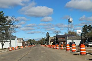
Murray is a village in Cass County, Nebraska, United States. The population was 480 at the 2020 census.

<span class="mw-page-title-main">Clatonia, Nebraska</span> Village in Nebraska, United States

Clatonia is a village in Gage County, Nebraska, United States. The population was 263 at the 2020 census.

<span class="mw-page-title-main">Brookside, Ohio</span> Village in Ohio, United States

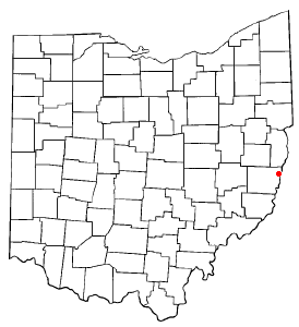
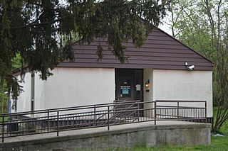
Brookside is a village in eastern Belmont County, Ohio, United States. The population was 538 at the 2020 census. It is part of the Wheeling metropolitan area.

<span class="mw-page-title-main">Donnelsville, Ohio</span> Village in Ohio, United States

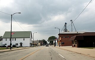
Donnelsville is a village in Clark County, Ohio, United States. The population was 304 at the 2010 census. It is part of the Springfield, Ohio Metropolitan Statistical Area.

<span class="mw-page-title-main">Valleyview, Ohio</span> Village in Ohio, United States

Valleyview is a village in Franklin County, Ohio, United States. The population was 669 at the 2020 census.

<span class="mw-page-title-main">Hanover, Ohio</span> Village in Ohio, United States

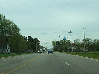
Hanover is a village in Licking County, Ohio, United States. The population was 921 at the 2010 census. The village lies along SR 16.

<span class="mw-page-title-main">Cloverdale, Ohio</span> Village in Ohio, United States

Cloverdale is a village in Perry Township, Putnam County, Ohio, United States. The population was 168 at the 2010 census.

<span class="mw-page-title-main">Kekoskee, Wisconsin</span> Village in Wisconsin, United States

Kekoskee is a village in Dodge County, Wisconsin, United States. The population was 161 at the 2010 census.

<span class="mw-page-title-main">Coleman, Wisconsin</span> Village in Wisconsin, United States

Coleman is a village in Marinette County, Wisconsin, United States. The population was 724 at the 2010 census. It is part of the Marinette, WI–MI Micropolitan Statistical Area.

<span class="mw-page-title-main">Ontario, Wisconsin</span> Village in Wisconsin, United States

Ontario is a village in Vernon County, Wisconsin, United States. The population was 554 at the 2010 census.

<span class="mw-page-title-main">Arena, Wisconsin</span> Village in Wisconsin, United States

Arena is a village in Iowa County, Wisconsin, United States. The population was 834 at the 2010 census. The village is located within the Town of Arena. It is part of the Madison Metropolitan Statistical Area.

<span class="mw-page-title-main">Wilton, Wisconsin</span> Village in Wisconsin, United States

Wilton is a village in Monroe County, Wisconsin, United States. The population was 504 at the 2010 census. The village is located partially within the Town of Wilton and partially within the Town of Wellington.

<span class="mw-page-title-main">Radisson, Wisconsin</span> Village in Wisconsin, United States

Radisson is a village in Sawyer County, Wisconsin, United States, along the Couderay River. The population was 241 at the 2010 census. The village is located within the Town of Radisson and was named in honor of the early French explorer, Pierre-Esprit Radisson (c.1636–1710).

References

  1. "ArcGIS REST Services Directory". United States Census Bureau. Retrieved August 28, 2022.
  2. 1 2 U.S. Geological Survey Geographic Names Information System: Westwood, Missouri
  3. 1 2 "U.S. Census website". United States Census Bureau . Retrieved 2008-01-31.
  4. "US Gazetteer files 2010". United States Census Bureau . Retrieved 2012-07-08.
  5. "Census of Population and Housing". Census.gov. Retrieved June 4, 2015.
  6. "United States Census Bureau" . Retrieved 2022-01-30.
  7. "U.S. Census website". United States Census Bureau . Retrieved 2012-07-08.