Matthews Ridge, Guyana

Last updated
Matthews Ridge
Guyana location map.svg
Red pog.svg
Matthews Ridge
Location in Guyana
Coordinates: 7°30′N60°10′W / 7.500°N 60.167°W / 7.500; -60.167
Country Guyana
Region Barima-Waini
Population
 (2012) [1]
  Total409

Matthews Ridge is a small village within the Barima-Waini administrative region of Guyana. The village name comes from the name of a public official, Matthew Young, as well as the ridges in the area. The village is divided into three sections, Heaven's Hill, Hell Hill and the valley. [2]

Contents

Demographics & Employment

A dredge being used in a nearby backdam. Dredge Operation.jpg
A dredge being used in a nearby backdam.

The population of Matthews Ridge as of 2012 is 409 people, [1] and is composed mainly of Afro-Guyanese and Amerindian persons. Carib is the language spoken by the local Amerindian people.

Agriculture is also an important economic activity in Matthews Ridge, however to a lesser extent than mining. [2]

History

Matthews Ridge was one of the oldest indigenous villages in the Barima-Waini region. [2] Between 1962 and 1968, Matthews Ridge was the location of a large manganese mining operation by Union Carbide. [3] A 38.5-mile (62.0 km) narrow gauge railway was built to Port Kaituma to transport the ore. [4] The mine was closed in 1968. [4] In 2011, it has been reopened by Reunion Manganese Incorporated. [5]

With the closing of the manganese mining operation in 1968, the village went into an economic downturn, which it struggled to recover from for many years. The mine was reopened by Canadian company Reunion Manganese Incorporated, but this operation was taken over by Guyana Manganese Incorporated (GMI) in 2019. Otherwise, small-scale gold mining is the basis for most other jobs in the area. This involves travel to backdams (small areas where gold is known to be located) by foot or on ATVs, where batels or dredges are used to mine. [6]

Education and health care

The local nursery and primary schools can accommodate students through Grade 11. The school (Matthew's Ridge Primary Tops School) had pupils sit CSEC for the first time in 2018, but it not yet recognised as a Secondary School meaning pupils sit exams in the nearby village of Port Kaituma. [7]

Matthew's Ridge has a health care centre, but as of 2017, it was lacking in facilities. [8]

Infrastructure

The main street of Matthews Ridge MR Main Street.jpg
The main street of Matthews Ridge

The infrastructure of the village is elementary. Cell-phone service is available, through the Digicel mobile network. Electric current is available during certain hours of the day, provided by the town's generator. Goods are brought into Matthews Ridge from Georgetown, and Port Kaituma. [2] The village is served Matthews Ridge Airport. [9] The village has a Pentecostal as well as Jehovah Witness church. [2]

Climate

The area experiences an annual shift between rainy and dry seasons. Average temperature ranges between 80 and 100'F.

Related Research Articles

<span class="mw-page-title-main">Barima-Waini</span> Region of Guyana

Barima-Waini is a region of Guyana and is located in the northwest of the country. Barima-Waini has three sub-regions: Mabaruma, Matakai, and Moruca.

<span class="mw-page-title-main">Port Kaituma</span> Place in Barima-Waini, Guyana

Port Kaituma is a small village within the Barima-Waini administrative region of Guyana. It became known internationally as a gateway village to the Peoples Temple settlement in nearby Jonestown. It has long been a hub for mining in the area.

<span class="mw-page-title-main">Mabaruma</span> Town and regional capital in Barima-Waini, Guyana

Mabaruma is the administrative centre and regional capital for Region One (Barima-Waini) of Guyana. It is located close to the Aruka River on a narrow plateau above the surrounding rainforest at an elevation of 13 metres.

<span class="mw-page-title-main">Santa Rosa, Guyana</span> Place in Barima-Waini, Guyana

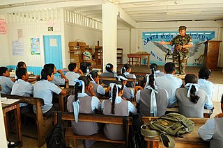
Santa Rosa is a community in the Barima-Waini region of northern Guyana. Santa Rosa mission was established in 1840, and is one of the earliest Catholic Missions in Guyana. The village is part of the North West Amerindian District.

Kwebanna is an Amerindian village in Barima-Waini region, in the north of Guyana. Kwebanna is connected by road to Kumaka, Barima-Waini.

Assakata or Asakata is a village in Barima-Waini region, in the north of Guyana. Assakata is an Amerindian village inhabited by Warao and Arawak people, located in the swamps and marshes between the Barima and Pomeroon River.

Baramita, is a community in the Barima-Waini region of northern Guyana, standing about 20 miles west of Matthew's Ridge, at an altitude of 99 metres.

Hosororo is a community in the Barima-Waini region of northern Guyana, on the west bank of the Aruka River, 10 km (6.2 mi) from the river's mouth, and three miles from Mabaruma.

Arakaka is a community in the Barima-Waini region of Guyana, standing on the Barima River and 12 miles southerly of Port Kaituma, at an altitude of 63 metres (209 feet).

Baracara was founded as a maroon community in the East Berbice-Corentyne Region of Guyana, located on the Canje River. The community has also been called New Ground Village or Wel te Vreeden. Baracara is 20 miles west of Corriverton and just north of the Torani Canal's connection to the Canje River.

Koriabo is a community in the Barima-Waini region of Guyana, standing at an altitude of 36 metres. Barima and Koriba form an Amerindian community which is mainly inhabited by Warao people with a minority of Arawak and Kalina people.

Port Kaituma Community School (PKCS) is a learning centre in Port Kaituma within the Barima-Waini administrative region of Guyana.

Jean La Rose is an Arawak environmentalist and indigenous rights activist in Guyana. She was awarded the Goldman Environmental Prize in 2002 for her work to halt mining in their territories, to secure inhabitants full rights to traditional lands, and to save Guyana's forests.

The Barama River is a tributary of the Waini River, both being in the Barima-Waini administrative region of Guyana.

The Kaituma River is a river of Guyana in the Barima-Waini region. The mouth is at the upper Barima River, and the area is made up of mostly mangrove swamps.

Morawhanna is a small Atlantic coast village in Guyana, on the left side of the Barima River and in close proximity to Venezuela.

Issano is a village of Cuyuni-Mazaruni, Guyana. It's located along the Mazaruni River, and is a hub for mining.

Isseneru is an Amerindian settlement in the Cuyuni-Mazaruni region of Guyana, approximately 15–20 miles west of Kurupung.

Whitewater is a village in the Barima-Waini Region of Guyana. Whitewater is located close to the border with Venezuela and is inhabited by Warao Amerindians.

References

  1. 1 2 "2012 Population by Village". Statistics Guyana. Retrieved 16 August 2020.
  2. 1 2 3 4 5 "Matthew's Ridge". Stabroek News. 2012-03-11. Retrieved 2021-01-28.
  3. "Miners thrilled with Matthews Ridge manganese find". Kaieteur News Online. 23 July 2013. Retrieved 19 August 2020.
  4. 1 2 "Mining Railways in Guyana, 2014". International Steam. Retrieved 29 November 2021.
  5. "Guyana Aims to Become a Top Manganese Producer". Investing News. 24 May 2012. Retrieved 19 August 2020.
  6. "October". 15 November 2018.
  7. "Matarkai education sector bolstering amidst challenges – DEO". Ministry of Education. Retrieved 19 August 2020.
  8. "Region one RDC seeks to address issues affecting Matthew's Ridge". Kaieteur News Online. Retrieved 19 August 2020.
  9. "MWJ - Facility". Great Circle Mapper. Retrieved 30 November 2021.