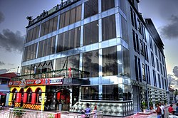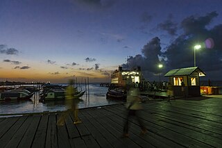
Parika is a port village located in the Essequibo Islands-West Demerara region of Guyana. Its ferry service is operated by the Ministry of Transportation, to and from the Essequibo Islands and West Demerara area. It is a hub for land transport, since it is a route stop for local taxis commonly called "buses."

The Pomeroon River is located in Guyana, South America, situated between the Orinoco and the Essequibo rivers. The area has long been inhabited by Lokono people. The Pomeroon River is also one of the deepest rivers in Guyana.

Fort Kyk-Over-Al was a Dutch fort in the colony of Essequibo, in what is now Guyana. It was constructed in 1616 at the intersection of the Essequibo, Cuyuni and Mazaruni rivers. It once served as the centre for the Dutch administration of the county, but now only ruins are left. The name Kyk-Over-Al derives from the Dutch for "See over all", a reference to the commanding view of the river from the fort.

Essequibo was a colony and later county on the Essequibo River in the Guiana region on the north coast of South America. It was a colony of the Dutch West India Company between 1616 and 1792 and a colony of the Dutch state from 1792 until 1815. It was merged with Demerara in 1812 by the British who took control. It formally became a British colony in 1815 till Demerara-Essequibo was merged with Berbice to form the colony of British Guiana in 1831. In 1838, it became a county of British Guiana till 1958. In 1966, British Guiana gained independence as Guyana and in 1970 it became a republic as the Co-operative Republic of Guyana. It was located around the lower course of the Demerara River, and its main settlement was Georgetown.
Kabakaburi is an Amerindian village in the Pomeroon-Supenaam Region of Guyana on the Pomeroon River, 56 km (35 mi) from its mouth. The village was founded in 1845 by William Henry Brett on the location where Fort Durban used to be.
Zeelandia, a community in the Essequibo Islands-West Demerara region of Guyana.
Vreed en Hoop is a village at the mouth of the Demerara River on its west bank, in the Essequibo Islands-West Demerara region of Guyana, located at sea level. It is the location of the Regional Democratic Council office making it the administrative center for the region. There is also a police station, magistrate's court and post office.
Suddie is a community in the Pomeroon-Supenaam region of Guyana, located on the Atlantic Ocean, one mile north of Onderneeming.
St. Monica Karawab is a village in the Pomeroon-Supenaam region of Guyana. The village is an Amerindian village.

Rockstone is a village on the right bank of the Essequibo River in the Upper Demerara-Berbice Region of Guyana, altitude 6 metres. Rockstone is approximately 26 km west of Linden and is linked by road.

Mainstay Lake is a lake in the Pomeroon-Supenaam Region of Guyana, near the Atlantic coast, northwest of the mouth of the Essequibo River, 12 mi (19 km) north of Adventure. There is a 0.5 mi (0.80 km) stretch of white sand at the edge of the lake.

The history of the Jews in Guyana goes as far back as the 1600s. Representation has always been low, and by the 1930s there was neither an organized Jewish community nor a synagogue in the capital city of Georgetown. In the late 19th and early 20th centuries, several Jewish families immigrated to British Guiana from Arab lands to avoid persecution and expand business opportunities.

Hampton Court is a village in the Pomeroon-Supenaam region of Guyana. The village is located on the Atlantic coast. Its population was 619 in 2012. The village was known for its sugar estate and later for its rice production.
Pickersgill is a village in the Pomeroon-Supenaam of Guyana. It is located near the Pomeroon River.
Onderneeming is a village in the Pomeroon-Supenaam region of Guyana. The village is located on the Atlantic coast. Its population was 1,095 in 2012.

Jacklow is a village in the Pomeroon-Supenaam Region of Guyana. The village is mainly inhabited by Indo-Guyanese and Amerindian people. Jacklow is situated on the Pomeroon River.
Capoey is a village in the Pomeroon-Supenaam Region of Guyana. The village is mainly inhabited by Lokono Amerindians. It is located on Lake Capoey, a blackwater lake, which is one of largest lakes of Essequibo.
Queenstown is a village in the Pomeroon-Supenaam Region of Guyana. It is located on the Atlantic Ocean coast. It is one of the first villages where the emancipated African slaves bought the lands. Queenstown is home to the oldest extant mosque of Guyana.

Lima Sands is a village in the Pomeroon-Supenaam Region of Guyana. It is located to the west of Anna Regina. The Cheddi Jagan Bio Diversity Park is in Lima Sands.