
Domesday Book is a manuscript record of the Great Survey of much of England and parts of Wales completed in 1086 at the behest of King William the Conqueror. The manuscript was originally known by the Latin name Liber de Wintonia, meaning "Book of Winchester", where it was originally kept in the royal treasury. The Anglo-Saxon Chronicle states that in 1085 the king sent his agents to survey every shire in England, to list his holdings and dues owed to him.

Until 1974, Radnorshire was an administrative county in mid Wales, later classed as one of the thirteen historic counties of Wales. It covered a sparsely populated area, and was bounded to the north by Montgomeryshire and Shropshire, to the east by Herefordshire, to the south by Brecknockshire and to the west by Cardiganshire.

Presteigne is a town and community in Radnorshire, Powys, Wales on the south bank of the River Lugg. Formerly the county town of the historic county of Radnorshire, the town has, in common with several other towns close to the Wales-England border, assumed the motto, "Gateway to Wales". The border wraps around three sides of the town. Nearby towns are Kington, Herefordshire to the south and Knighton to the north, and surrounding villages include Norton and Stapleton. The town falls within the Diocese of Hereford. The community has a population of 2,710; the built-up area had a population of 2,056.

A Month in the Country is the fifth novel by J. L. Carr, first published in 1980 and nominated for the Booker Prize. The book won the Guardian Fiction Prize in 1980.

Hook Norton is a village and civil parish in Oxfordshire, England. It lies 4+1⁄2 miles (7 km) northeast of Chipping Norton, close to the Cotswold Hills. The 2011 Census recorded the parish's population as 2,117. The village is formed of four neighbourhoods: East End, Scotland End, Down End and Southrop.

Wood Dalling is a village and civil parish in Norfolk, England. It is located 8 miles (13 km) south of Holt and 3 miles (4.8 km) north of Reepham, the nearest market towns.
Pilleth is a small village south of Knighton in Powys, Wales in the traditional county of Radnorshire. It is the site of the ancient church and holy well of St. Mary’s which stands on Bryn Glas Hill overlooking the River Lugg, as it makes its way to Presteigne.

Pudding Norton is a village and civil parish in the English county of Norfolk. It covers an area of 2.30 sq mi (6.0 km2) and had a population of 267 in 126 households at the 2001 census, falling to 252 at the 2011 Census. For the purposes of local government, it falls within the district of North Norfolk.
Radnor or New Radnor was a constituency in Wales between 1542 and 1885; it elected one Member of Parliament (MP) to the House of Commons of the Parliaments of England (1542–1707), Great Britain (1707–1800) and the United Kingdom (1801–1885), by the first past the post electoral system. In the Redistribution of Seats Act 1885, the division was merged into Radnorshire.

Norton Bavant is a small village and civil parish in Wiltshire, England, 2 miles (3.2 km) southeast of Warminster.

Cornwell is a small village and civil parish about 2.5 miles (4 km) west of Chipping Norton in the West Oxfordshire district of Oxfordshire, near the county border with Gloucestershire. The 2001 Census recorded the parish's population as 66.

Knill is a village and civil parish in Herefordshire, England.
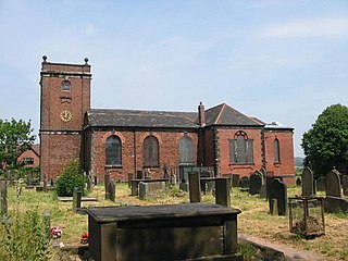
Norton le Moors is in the north-east of the city of Stoke-On-Trent, Staffordshire, England, mostly within the city boundary, with the rest in the Staffordshire Moorlands district.

Norton is an area in the eastern part of the town of Runcorn, Cheshire, England. It was originally a separate village 3 miles (5 km) to the east of Runcorn, but in the 1970s and 1980s became absorbed within Runcorn by the expansion of its new town.
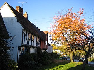
Clavering hundred was a hundred – or geographical subdivision – comprising parishes and settlements in Essex and Norfolk. Hundreds were divisions of areas of land within shires or counties for administrative and judicial purposes – and for the collection of taxes.

Norton, Buckland and Stone is a small rural civil parish 1 mile (1.6 km) east of Teynham and 3 miles (4.8 km) west of the centre of Faversham in the borough of Swale, Kent, England. It is bypassed by the M2 to the south and traverses the historic A2, on the route of the Roman road of Watling Street.
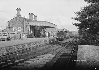
Presteign Railway Station was a railway station serving the town of Presteigne, Radnorshire, Wales. It was a terminus on the Leominster and Kington Railway.

Bredon's Norton or Norton-by-Bredon is a village and civil parish 11 miles (18 km) south east of Worcester, in the Wychavon district, in the county of Worcestershire, England. In 2021 the parish had a population of 254. The parish touches Eckington, Bredon, Strensham and Kemerton.
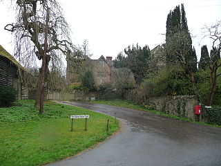
Rodd, Nash and Little Brampton is a civil parish in the county of Herefordshire, England, and is 18 miles (29 km) north-west from the city and county town of Hereford. The parish borders Powys in Wales at its north-west. Within the parish is the final home and studio of the 20th-century Australian artist Sydney Nolan.


